It’s a busy weekend for Catherine: she’s working hard to finish up an important art piece. And so Oliver and I were left to our own devices tonight for Thanksgiving supper.
Fortunately this also happened to be the day that the Cymbria Lions Club was holding its Hot Turkey Supper. So late this afternoon we got in the car and headed to the north shore.
Oliver got a little overwhelmed by the fact that we were seated across from strangers and, lest his anxiety boil over, we quickly switched our order from sit down to take out.
When we got out to the car, we realized that we didn’t have any cutlery, and so we stopped up the road and I bought 24 forks for 99 cents.
Which is how we came to eat our Thanksgiving supper in the parking lot of Gallant’s General Store.

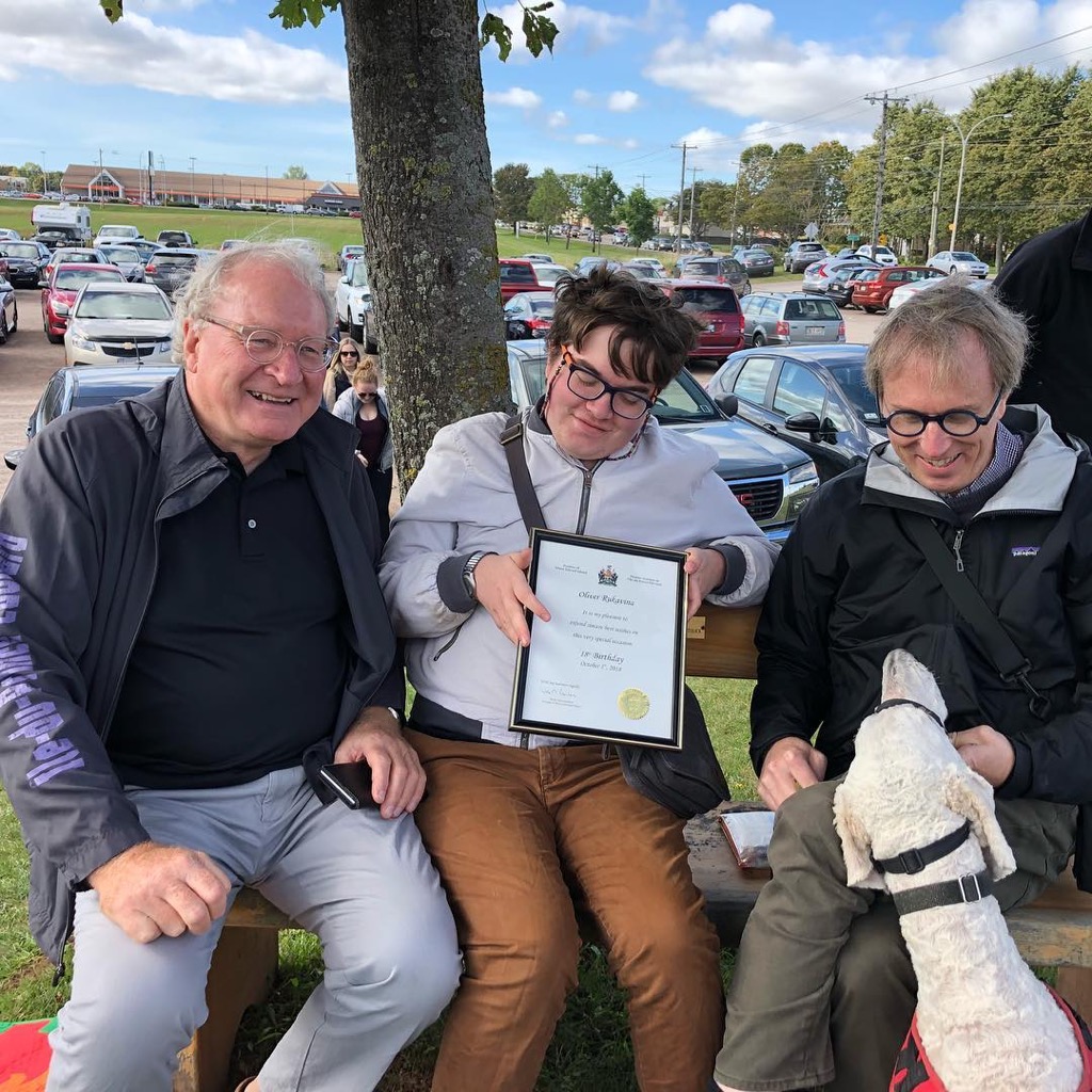
Oliver and I rendezvoused with Premier MacLauchlan yesterday morning at the Charlottetown Farmer’s Market and he kindly presented Oliver with a certificate recognizing his 18th birthday. A passing Kevin Yarr helpful snapped a photo of the occasion.
Warren Ellis at Thought Bubble:
From time to time, some of us will give up our seats and go hang out with the ghosts for a while. If you take our seats, then you know the deal – find new seats for new people to come and sit down with you. Keep growing. Keep moving forward.
He was speaking about comics, but it’s also good general advice.
Ooti Billeaud built himself a BMX ramp. City regulations required him to build a house in front of it.
Although I’ve described myself as “printer, developer, writer” for many years, I haven’t written professionally since my days as the restaurant reviewer for The Buzz, many years ago.
Until this week, when I contributed a piece to the Lady Baker’s Tea blog.
Gloria is a new song from Henry Jamison. From The Fader, Jamison writes:
I realized that I was writing a parallel story about the ways in which boys in our culture are “recruited” into a toxic fraternity, by each other, by their fathers, by video games etc. I try to sing myself and others out of a simple resistance to the nefarious male ego and into a sense of inviolate self-worth.
In Leiderschap in de nieuwe netwerksamenleving, Marco Derksen writes (machine-translated from Dutch to English):
In an era of uncertainty and rapid technological change there is a great need for leaders who, on the one hand, are not afraid to outline a vision for the long term, but on the other hand also dare to be vulnerable. By returning to previously made decisions, by admitting mistakes made and by being open to the input of otherwise-minded people. Organizing and being able to deal with diversity is perhaps the most important leadership competence in the complex world of today and tomorrow!
I couldn’t agree more: having ideas—vision—is easy; everybody’s got ideas. Humility is a rare commodity, rarer still in leaders. When you witness the two together in one person, it’s delightful to behold.
And organizing and being able to deal with diversity is so seldom discussed, a skill few have, and yet without it we’re left with an intellectual monoculture incapable of evolving.
Edward Hasbrouck has written a delightfully exhaustive review of the Gemini PDA:
A year after my initial review, and six months after I received my Gemini, here’s a detailed update on what works, what doesn’t, what Planetcom needs to do to deliver on the promise of the Gemini (and the promises made to Indiegogo backers), and — most importantly — how to decide whether you should buy a Gemini to use on your travels.
The Holy Grail for many travelers-who-work-while-traveling is a compact, always-connected device, with a big (enough) screen and a big (enough) keyboard, running open source software.
As Edward’s review makes clear, the Gemini is a device tantalizingly close to this ideal, but with some serious issues, especially software-related, that would make it difficult to rely on as the only device in your travel bag.
Earlier this year I ran into my neighbour Christina on Prince Street and she told me that she’d just walked home from Charlottetown Airport; it only took 90 minutes, she reported, and had been a lovely walk.
I joined the Passenger Advisory Panel of Charlottetown Airport this fall, and our first meeting was scheduled for yesterday at noon. Inspired by Christina, and mindful that ground transportation would be one of the topics on the agenda, I resolved to get to and from the airport using novel means.
Believe it or not, you can get to the airport by public transit, a little-known feature of the city’s transit system.
Route № 11, the Airport to Winsloe North Collector, makes 7 counter-clockwise trips in the morning from Charlottetown Mall to the airport, a trip that takes 8 minutes, and makes 4 clockwise trips in the afternoon, a trip that takes 17 minutes. Given that the Charlottetown Mall is the northern hub of the transit system, it’s thus possible, with a transfer, to get to the airport from almost anywhere in the city. At only 11 trips a day it’s not enough service to rely on there being a bus for all arrivals and departures at the airport, but it’s also not nothing.
I caught the 11:15 a.m. Route № 1 bus from the Confederation Centre of the Arts on Grafton Street, arriving at the Mall at 11:30, and then transferred to Route № 11 at 11:45 a.m., arriving at the airport just before noon (note that the bus doesn’t actually go into the airport; you need to disembark at the corner of Maple Hills and Sherwood, before the bus turns left).
Both the Route № 1 and Route № 11 buses included a cowcatcher-style bicycle rack, which allowed me to take my bicycle with me to the airport for the route back. Which is exactly what I did; here’s my route as tracked by Google Fit:
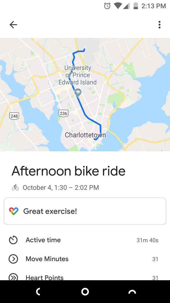
I rode out of the airport on Sherwood Road, through the roundabout and down the hill past the cemetery; when I reached the Confederation Trail I turned left and followed the trail all the way downtown, past the Charlottetown Mall, UPEI, the Experimental Farm and Joe Ghiz Park, emerging from the trail only when I got to Cumberland Street by the Maritime Electric plant. The journey was remarkably flat, with the only mildly-challenging bits being from the airport up to the roundabout, and the stretch that’s slightly uphill before UPEI. And most of the trip was on the trail, making it both car-free and scenic.
Remarkably, given that I’m not in shape, and that I faced a headwind most of the way, the journey only took 31 minutes from airport to my front door on Prince Street.
When ground transportation came up at the meeting I talked about my journey there and the plans for my journey back, and suggested that, while bus and bike might never be the predominant way of getting to and from the airport, it should at least be publicized as an option, if only to drive home the fact that the airport is among the most convenient to get to, by any means, of any airport in Canada.
This is a tale of two photos, both, in theory, with location data embedded in their EXIF metadata, but with the manifestation of that EXIF data to the Apple Photos and Preview apps only available from one.
The First Photo
The first photo, of sunrise on Prince Street, is one that I took in January 2018 on my Nextbit Robin phone. When I run exiftool on this image, I can see the GPS data:
GPS Latitude                    : 46 deg 14' 8.93" N
GPS Longitude                   : 63 deg 7' 26.80" W
GPS Position                    : 46 deg 14' 8.93" N, 63 deg 7' 26.80" W
When I load this image into GraphicConverter, I can see the GPS data:
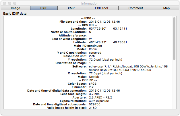
But when I use the Mac Preview app to look at the photo’s EXIF data, I don’t see anything under the “GPS” tab at all:

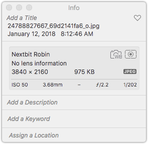
And, similarly, the location information doesn’t show up when I import the image into Apple Photos:
The Second Photo
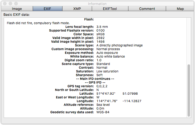
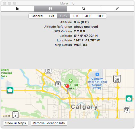
The second photo, one I took in 2014 on my Motorola phone, also shows GPS data in exiftool:
GPS Latitude                    : 51 deg 4' 47.92" N
GPS Longitude                   : 114 deg 7' 41.76" W
GPS Position                    : 51 deg 4' 47.92" N, 114 deg 7' 41.76" W
There’s GPS information in GraphicConverter:
But in this case there is also GPS data showing in Preview:
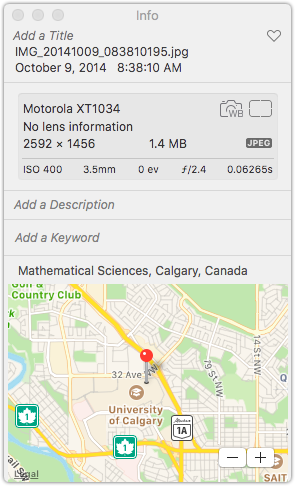
And there’s a location showing in Photos:
What’s the difference?
When I run exiftool with -v3, for extra verbosity, on the first image, I can see more details about how the GPS data is being encoded in the JPEG images.
In the first photo, the latitude is:
  | | 4)  GPSLatitude = 46 14 8.93 (46/1 14/1 893/100)
  | |     - Tag 0x0002 (24 bytes, rational64s[3])
Whereas for the second photo the latitude is expressed as:
  | | 2)  GPSLatitude = 51 4 47.92 (51/1 4/1 4792/100)
  | |     - Tag 0x0002 (24 bytes, rational64u[3])
The latitude format itself, and the tag ID, are the same, but the number format in the non-working photo is rational64s while the number format in the working photo is rational64u.
Further, if I overwrite the latitude tag in the first photo using exiftool like this:
# exiftool 24788827667_69d2141fa6_o.jpg -GPSLatitude="46 14 8.93 (46/1 14/1 893/100)"
Then the latitude changes to rational64u:
  | | 1)  GPSLatitude = 46 14 8.93 (46/1 14/1 893/100)
  | |     - Tag 0x0002 (24 bytes, rational64u[3]):
And once I do this, Preview becomes capable of reading the latitude from the file:
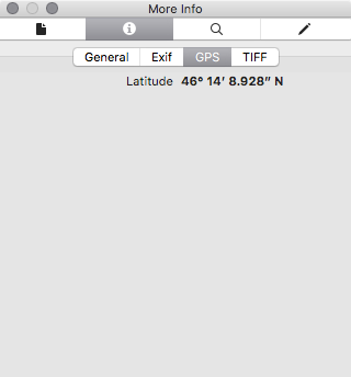
So what’s the difference between rational64u and rational64s? From here we learn:
- rational64u is an unsigned rational number, which is a pair of 32-bit unsigned integers.
- rational64s is a signed rational number, which is a pair of 32-bit signed integers.
The EXIF standard clearly says that the latitude and longitude values should be unsigned rational values; this makes common sense, as there are, in addition to the GPSLatitude and GPSLongitude values, also GPSLatitudeRef (N or S) and GPSLongitudeRef (E or W) values which obviate the need for the values to be signed.
So it would appear that while other tools–Flickr, Google Photos, exiftool, GraphicConverter–can read latitude and longitude values expressed, contrary to the standard, as rational64s, Apple tools cannot.
I took a look at a cross-section of my Flickr photos, recently repatriated to my local machine: of 13,542 photos I sampled, 6,612 photos had location data in them according to exiftool; of those, 2,572 photos (mis-)encoded the latitude as a rational64s and 4,040 encoded the latitude as a rational64u.
Of the photos with the latitude expressed as rational64s, 2,271 (88%) were from my Nextbit Robin Android phone; interestingly, there are also 377 photos where the latitude from a Nextbit Robin photo is (properly) rational64u, so I wonder if something changed in the EXIF-encoding library on the device at some point.
How to fix this?
The exiftool utility cannot only read EXIF from files, but, as witnessed above, it can also write EXIF data into files. So I wrote a shell script, fixlocation.sh, to do this:
#!/bin/bash

LATITUDE=`exiftool -s3 -c "%+.6f" -GPSLatitude $1`
LONGITUDE=`exiftool -s3 -c "%+.6f" -GPSLongitude $1`

exiftool -overwrite_original -GPSLatitude=$LATITUDE -GPSLongitude=$LONGITUDE $1
I can run this on a directory of “broken” images with:
find ./ -name "*.jpg" -exec fixlocation.sh {} \;
The result is files that Apple applications like Preview and Photos can properly interpret the locations of (while not compromising the ability of other applications to do the same).
 I am
I am