I took my parents out to see Public Enemies tonight (capsule review: avoid at all costs; a dreadful, unfocused movie the only redeeming feature of which is the typeface used for the credits). Because it was opening night I thought buying tickets online in advance would be a good idea, and as we were going to the SilverCity in Burlington, this led me to the Cineplex website for ordering.

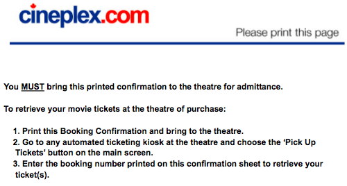
Other than being forced to become a “member” of Cineplex in order just to buy tickets, the purchase process went smoothly. The confirmation screen contained this strong directive:

Detail from Cineplex website confirmation screen after ordering tickets

You might think, from this message, what with all its MUST emphasis, that I needed to print the form out and enter my “booking number” to be able to pick up my tickets. Lacking a printer with which to do this, I ended up creating a PDF of the confirmation, transferring it to my mobile phone, and then ensuring that my mobile phone had enough juice to stay alive until we got to the theater.

When we arrived at the theater I went straight to the ticket pick-up machine, clicked on the “Pick Up Tickets” option, and was presented with the option of simply swiping my credit card to pick up the tickets. I did this, the tickets spit out, and I was on my way in about 8 seconds.

I wish they would align the instructions on their ticket-buying website with the reality of their ticket picking-up system: it would save a lot of needless confirmation form printing and hassle.

🗓️
Design  •  Technology

I had the pleasure of a brief chat with Steve Coast, OpenStreetMap progenitor, at reboot11 last week. Steve is a kind and voluble man, and I learned a lot about the skills you need to propose a crazy idea (“let’s make an open home-brew street map of the world!”) and have people follow you.

Now that vast tracts of the world are actually in OpenStreetMap, Steve suggested that the next level of data gathering might be collecting points for street addresses. This isn’t exactly at a “we’ve 100% decided how to do this” state in the OpenStreetMap universe, but there’s a generally accepted standard that people are using and the map is rendering, so that’s good enough to plunge in. So I did. Here’s how.

First, I headed out into the field with my GPS-equipped Nokia N95 mobile phone running the free WhereAmI application that allows GPS waypoints to be annotated (note that, because of nature of the N95, you likely have to sign this application before installing on your mobile).

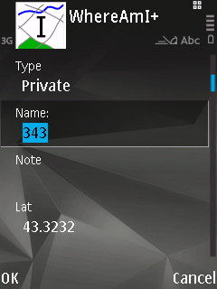
Once the GPS had found enough satellites to find its location I started walking down the street. With the Annotate tab selected in WhereAmI I pressed the centre button on the N95’s joystick when I was walking by the centre-point of each house, and added the house number as the “Name” of the annotation:
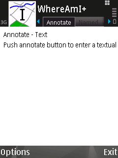
WhereAmI running on a Nokia N95 WhereAmI running on a Nokia N95

One way up the street I did this on foot; the other way I did it on a bicycle (the street’s not very busy, so it was easy to amble). When I was finished, the WhereAmI Named tab had annotations for every house number on the street:
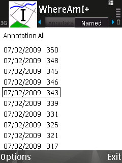
WhereAmI running on a Nokia N95

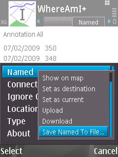
When I got back home I selected Options \| Named \| Save Named To File… in WhereAmI, and this exported all of my annotations as a GPX file to the E: drive of the phone:
WhereAmI running on a Nokia N95

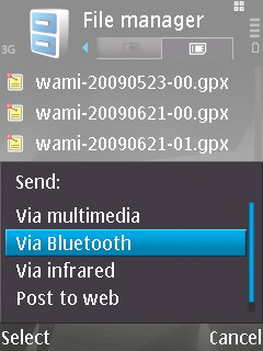
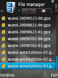
Next I started up the built-in File Manager application on the phone, navigated to the E: drive (or “memory card”), found the exported file — called wami-annotations-03.gpx — and sent it to my Mac laptop by Bluetooth:
WhereAmI running on a Nokia N95 WhereAmI running on a Nokia N95

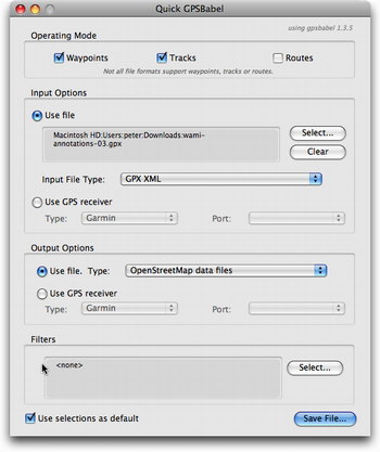
With the annotations file on my laptop, I was now ready to add the addresses to OpenStreetMap. Because of a peculiarity with OpenStreetMap importing — it won’t import a GPX file that consists entirely of waypoint and no tracks — I first had to use GPSBabel to convert the GPX file into a native OSM-format file. I selected “GPX XML” as the Input File Type and “OpenStreetMap data files” as the output file type:
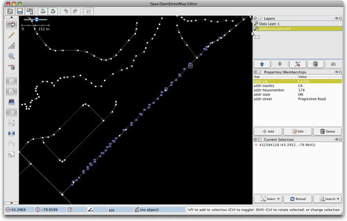
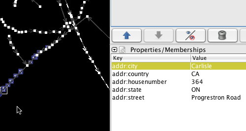
With the OSM-formatted file now in hand I fired up JOSM, the desktop OpenStreetMap editor, downloaded the existing map data for my neighbourhood, and then loaded (simply with File \| Open) the OSM file with my annotations: this loaded my house number points into the map, and I was then able to edit each one, placing it to the right or left of the street and adding metadata to each point, specifically:

  • addr:housenumber - for the house number, i.e. 343
  • addr:street - for the street name, i.e. Progreston Road
  • addr:city - for the city name, i.e. Carlisle
  • addr:state - for the state abbreviation, i.e. ON
  • addr:country - for the country abbreviation, i.e. CA

More details on the standards to use are on the OpenStreetMap wiki. The result was a map that looked like this:
JOSM screen shot JOSM screen shot

Finally, I uploaded my changes to OpenStreetMap — File \| Upload to OSM — and then went to the web-based Potlatch editor where I was able to see the satellite layer under my newly-loaded points and fine-tune the position of each housenumber so that the point fell over the house itself:
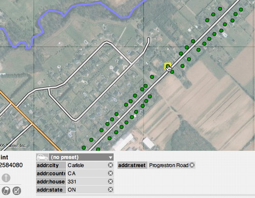
The result should is that now, a few hours later now that the map tiles have rendered, you see house numbers on the street my parents live on in Ontario:
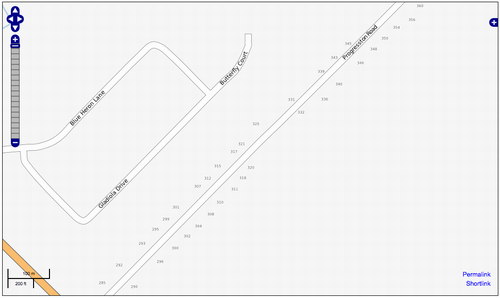
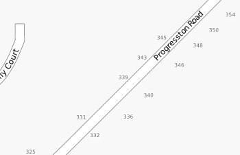
OpenStreetMap screen shot OpenStreetMap screen shot

It’s not hard to imagine a modified OpenStreetMap-house numbering-optimized version of the WhereAmI application that would smooth over some of the steps in this process, but even with the standard setup I used it wasn’t all that difficult, and the entire process, including field time, was less than an hour.

🗓️

🗓️
Malmö  •  Sweden  •  Video

I test-drove the Nihola three-wheeled bicycle at the Fridhems Cykel shop in Malmö.

🗓️

All the Swedes I’ve talked to refer to the # sign as square. Like “to get your balance you press star 1 2 0 square and then call.”

🗓️

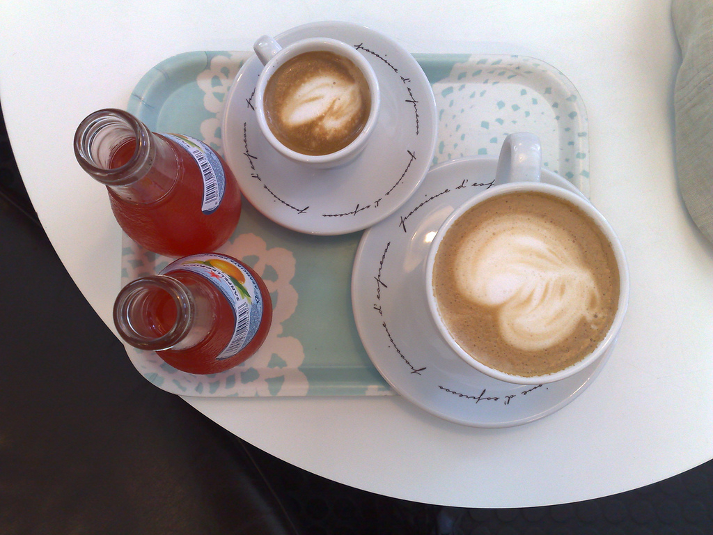
At Folk å Rock in downtown Malmö:

Coffee and Drinks in Malmö
🗓️
Malmö  •  Restaurants  •  Sweden
Audio file

Can you help me identify this music, snapped in a clothing store in downtown Malmö?

🗓️
062720092671
🗓️
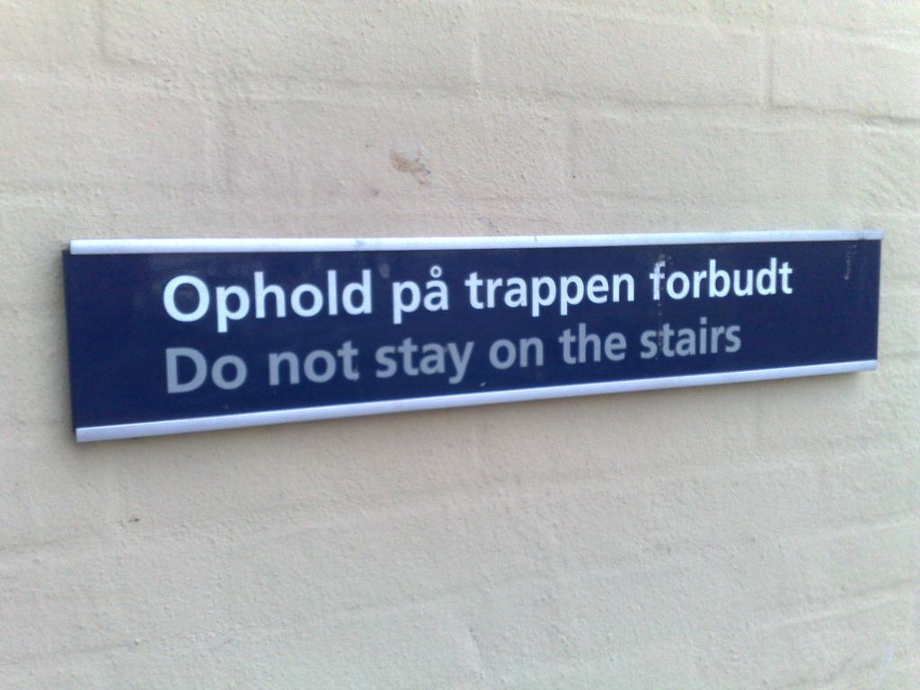
Denmark  •  Signage

🗓️
Copenhagen  •  Reboot

A random assortment of experiences at day two of this year’s reboot conference:

  • Building spaces with pen, paper and curiosity was a fantastic workshop talk by Ole Qvist-Sørensen from Bigger Picture: participatory and revelatory. If you’re looking for a novel take on helping groups work, look here.
  • While I was fiddling with pen and paper, Mark Wubben was upstairs talking about ubicomp, and he included a slide about The Talking Bus. And I wasn’t there to bask in the glory of the story.
  • The Place to Work saw thirty people squeezed into a hallway talking about working in coworking spaces, shared offices and cafés. The most interesting part was the go-around-the-room where everyone said a little about their own working situation. I sat beside Mikkel Hippe Brun, who rolls with his own battery-operated telephone-network connected wireless router.
  • David Sjunnesson, from 1scale1, who I’ve been meeting every morning on the train in from Malmö, was the one to get me over my Arduino inhibitions: I spent 80 minutes cramped into a room with 30 other eager geeks (including Catherine) at the Full Body Arduino workshop. David and his crew were excellent tutors, and when I made my Mac make the Arduino blink its LED (to my surprise) I felt God-like.
  • Bruce Sterling, who lost me at the LIFT conference several years ago, pulled me back in with a surgically-crafted poke in the eye with a stick as the closing talk. Throw away your socks with holes, get a new bed. Brilliant observations from a position hovering a mile above our enlightened self-involvement.
  • The Baking Bread project never did see us bake bread, but we did make a fetching solar oven that, with some fine-tuning over yesterday, got up to 136 degrees C this afternoon and made Guy Dickinson a mildly-steaming-hot cup of strong tea. Thanks to Peter Madsen-Mygdal for the raw materials, the wrangling and the enthusiasm.
  • I met several people who found my reboot by bicycle guide — prepared a couple of years ago — useful. That felt good.
  • Spent a great dinner over great Thai food talking with Olle and Luisa and Christian Dalager about all sorts of crazy ideas (“social drawing-sharing website,” “RSS feed of our bank transactions,” “capture the flag with RFID,” etc.) Christian’s a kindred spirit and our ideas and projects overlap a lot, so I’m certain we’ll end up working together.
  • Ended the night in the meat-packing district at the after-party. More loungey than Vega (where previous years ended), and a nice feel to it (it was in parking lot, so I spent a good part of the evening leaning on a transport truck’s tires). Had a good chat with João Santos, and many laughs and good-byes with many others.
  • Finished at the top of the game, as my old basketball coach always advised, and caught the midnight train with the Malmö crew.

It’s 2:02 a.m. as I finish this up; should be asleep, but there’s a lot to process and this is one way that helps. This was reboot number five for me, and reboot number one for Catherine (more about that when I’ve talked to her more about it); it’s a special place with special people and I’m thankful I somehow found my way here.

🗓️
Conferences  •  Copenhagen  •  Reboot  •  Travel

About This Blog

Photo of Peter RukavinaI am . I am a writer, letterpress printer, and a curious person.

To learn more about me, read my /now, look at my bio, listen to audio I’ve posted, read presentations and speeches I’ve written, see things I’ve favourited elsewhere, or get in touch (peter@rukavina.net is the quickest way).

I have been writing here since May 1999: you can explore the 25+ years of blog posts in the archive.

You can subscribe to an RSS feed of posts, an RSS feed of comments, an RSS feed of favourites elsewhere, or a podcast RSS feed that just contains audio posts. You can also receive a daily digests of posts by email. I also publish an OPML blogroll.

Instagram • YouTube • Vimeo • ORCID • OpenStreetMap • Internet Archive • PEI.art • Drupal • Github.