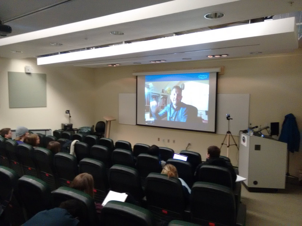
Did you know there’s a “Capital Area Transit Coordinating Committee” here in the Charlottetown area? It’s made up of representatives of the municipalities of Cornwall, Charlottetown and Stratford as well as T3 Transit (the transit operator). They meet regularly to, well, coordinate transit in the capital area. And this morning I had the pleasure of speaking to them about my efforts as a volunteer to get transit data into the GTFS format so that it can be made available both as open data and in venues like Google Transit.

The were a welcoming group, enthusiastic about what I had to show; I left the meeting with their collective support, and with an agreement from Cornwall and Stratford to allow their schedule information to become part of the effort. 

🗓️
Public Transit  •  Charlottetown  •  Cornwall  •  Stratford

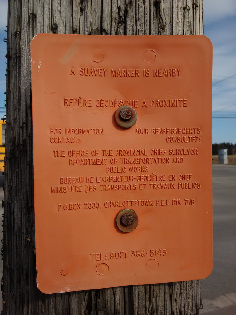
These signs, found on utility poles across Prince Edward Island, are so wonderful. They’re designed to weather the elements, to be obvious, and to never wear out.

A Survey Marker is Nearby

There are 4,746 survey monuments in total on Prince Edward Island  The Province has a page that describes their role:

Prince Edward Island’s survey control network is made up of about 4000 stations placed in strategic locations throughout the province. Each station typically consists of an inscribed brass cap placed on top of a concrete pillar buried to ground level with a sign post located about 1 metre away. This network of stations provides security of land tenure for all Islanders. For more than 30 years, land surveyors have referenced their surveys to these stations to ensure that property boundary markers found or placed are accurately recorded on a plane mapping surface and can be relocated with great certainty should these marks become lost or disturbed.

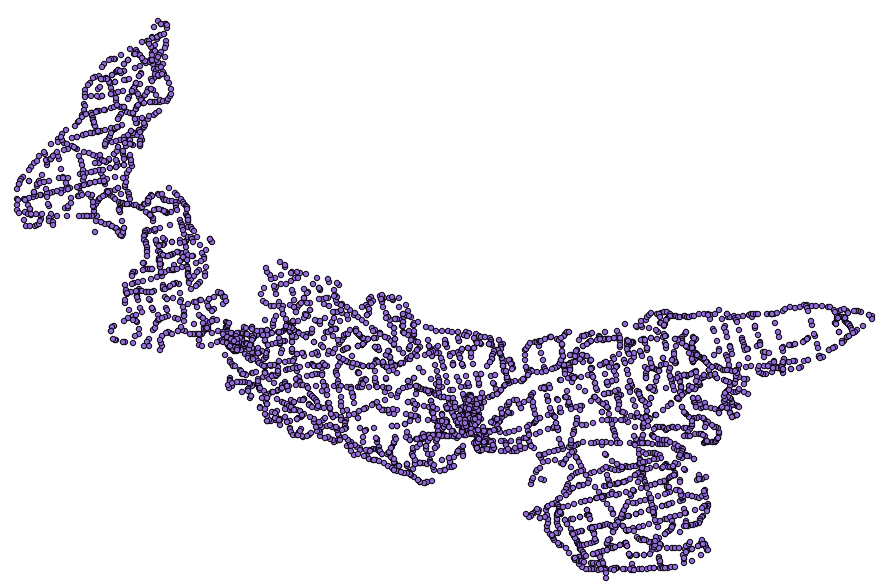
You can download a GIS file of all of them if you’re interested. You don’t even need a coastline file to view the monuments, as they describe the Island pretty much by their collective footprint:

Survey Monument Map of PEI

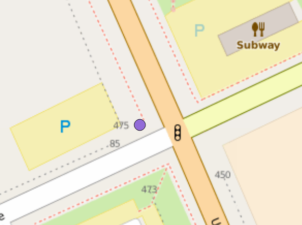
And, sure enough, right on the map where the sign was found, at the corner of University Ave. and Belvedere, there’s a marker:

Marker at University and Belvedere

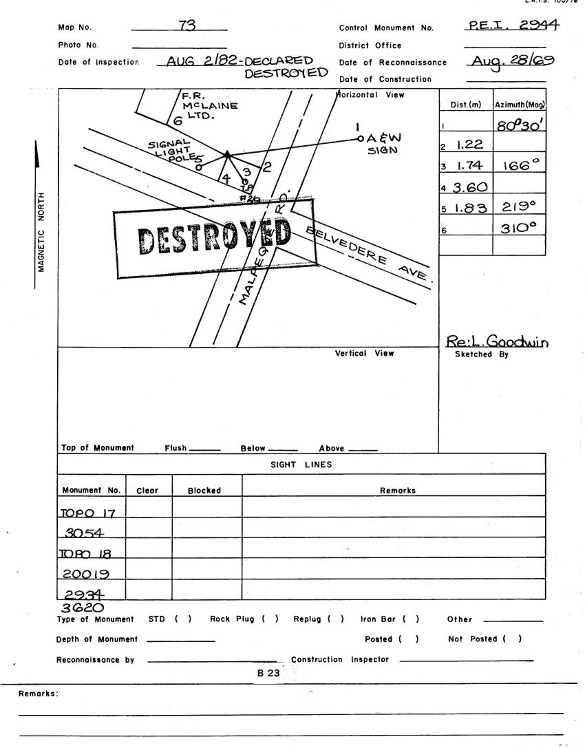
Turns out that it’s monument number 2944, which has a web page all its own. That page includes a sketch of the monument’s location, and that sketch is stamped with a big DESTROYED:

Marker 2944 Destroyed

So while the signs might be wonderful, they are also, it seems, sometimes inaccurate. 

The printing on the sketches is wonderful too, by the way: it’s almost worthwhile enough to consider becoming trained as a surveyor simply for the printing improvement it would bring.

Postscript: when you call the number on the orange survey monument sign, you are calling the Chief Surveyor themselves. This is Prince Edward Island, after all.

🗓️

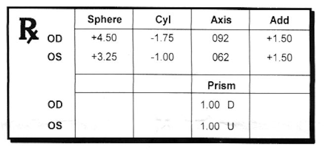
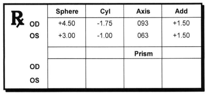
Here’s my latest eyeglasses prescription, based on an eye exam this morning at Charlottetown Vision Care:

Glasses Prescription

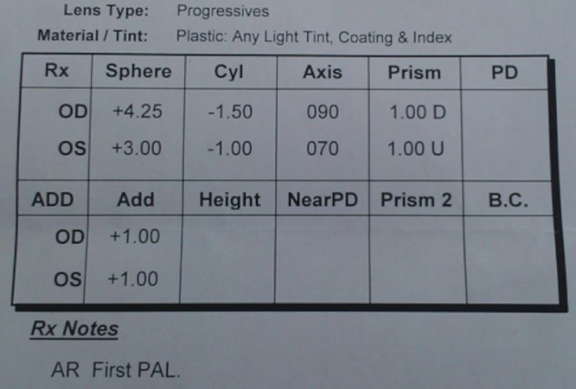
Here’s my prescription from 2014, one I never had filled (progressive lens are expensive!):

2014 Eyeglasses

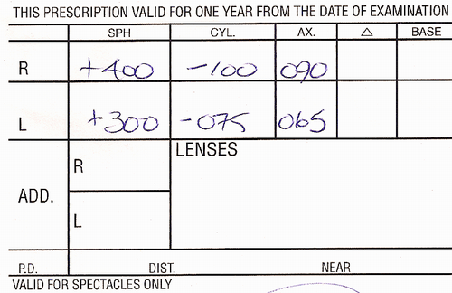
And the prescription from 2012, which I’m still wearing:

2012 Glasses Prescription

And the prescription from 2008, the one that stood me in good stead when I found myself stepping on my glasses in Ontario

After skipping a cycle, I’m off to get the new prescription filled this week, as the “which looks clearer, this… or this…” tests I did with Dr. Judson today showed a marked improvement over what I’m wearing now. I’m also going to get a pair of “computer” glasses, optimized for desk work, to avoid the neck strain I’ve been having since I started wearing bifocals.

🗓️

I took the bus up to Charlottetown Vision Care this afternoon for my biennial eye exam. Afterwards, finding myself uptown I decided to pop in at the PEI Home and School Federation office and, after that, decided to take the shortcut through the fence to Wendy’s for a quick bite before heading back downtown.

For the first time ever I ordered the Broccoli Cheese Baked Potato, a menu item I’d never had before. I’m not sure why I did this; perhaps it was a drive to expand my horizons. Upon further analysis, post-eating, I feel my horizons should stay where they are, Wendy’s-wise, as this was, in essence, a baked potato slathered in molten Cheese Whiz

It also, I found upon return to the office, is a menu item of 430 calories:

Broccoli Cheese Baked Potato Nutrition Information from Wendy's

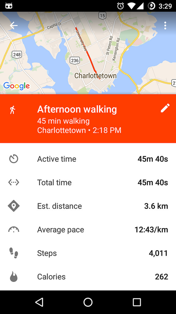
As I headed out the Wendy’s parking lot for the walk back downtown, I started recording my trip in Google Fit. When I reached downtown I ended the activity, and found that a walk from Wendy’s to downtown Charlottetown consumes, by Google Fit’s rough figuring, 262 calories. Or only 65% of the Broccoli Cheese Baked Potato. And even that cannot erase the memory of swimming through Cheese Whiz valley.

Walking from Wendy's to Downtown

Walk and learn.

🗓️
Walking  •  Wendy's  •  Nutrition

🗓️

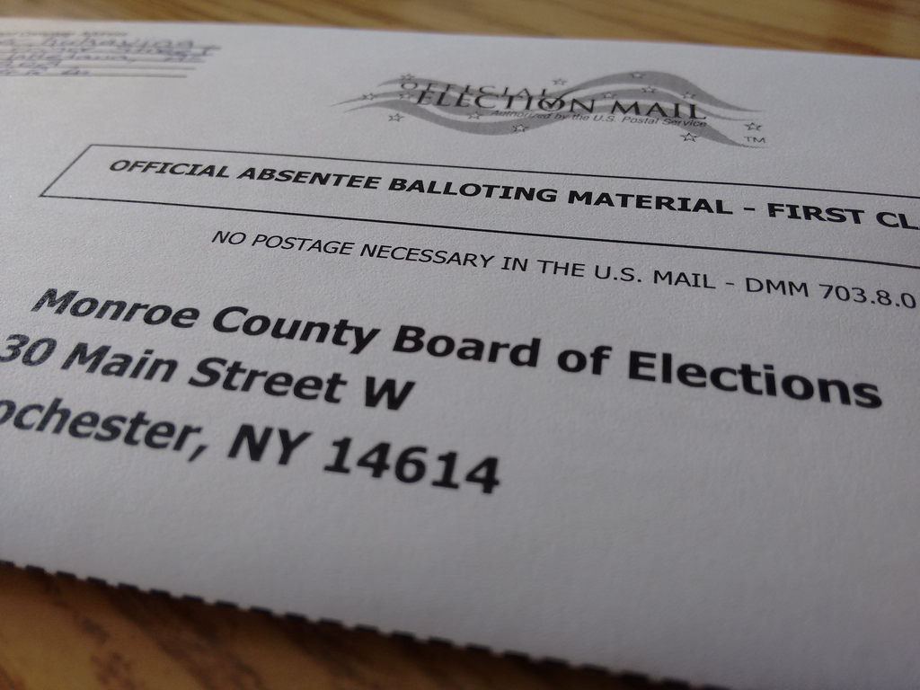
I received an email from the Monroe County Board of Elections earlier this week that my ballot for the April 19, 2016 Presidential Primary was available for download. I logged in – using credentials I’d established in the last election cycle – and downloaded both the ballot and the two envelopes (one to be placed inside the other) needed to return it by post. I’m off to the post office at lunch to mail it off.

My Absentee Ballot Envelope of the New York State Primary

🗓️

Today was my final lecture of four in the Philosophy 105 course I’ve been guest-teaching this winter (see reports from lectures one, two and three). I’ve taken the students on a diversion from the regular text and the regular path through the “philosophy of technology, values and science” so today was an opportunity to try to knit the various tangents I’d gone on together. As my overarching goal for my four lectures was to drop into the world of “open” – source, data, government, society – as a philosophical approach to technology, using my own experiences as a jumping off point, I opted to use OpenStreetMap, the open project I’ve spent the most time lurking in, as the focus for today. And so we opened with The Map:

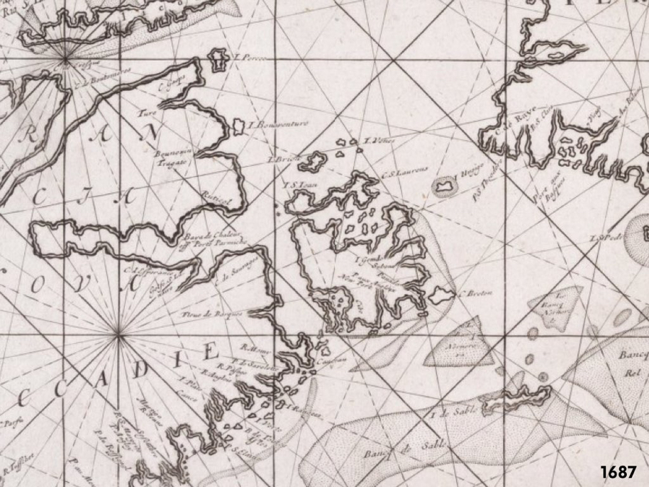
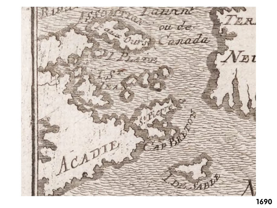
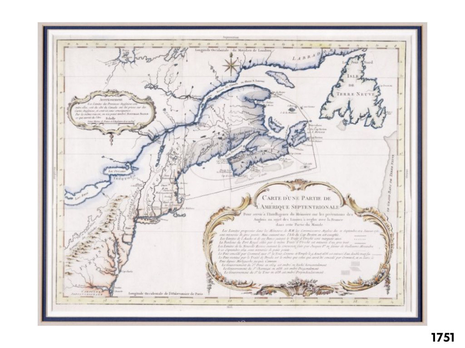
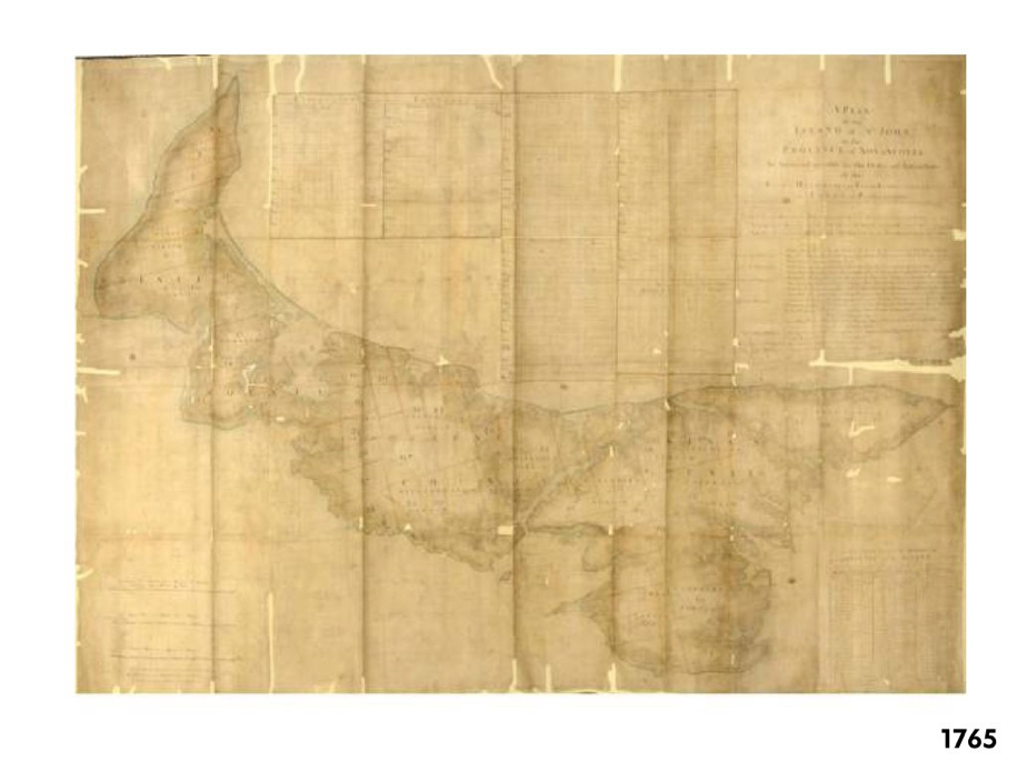
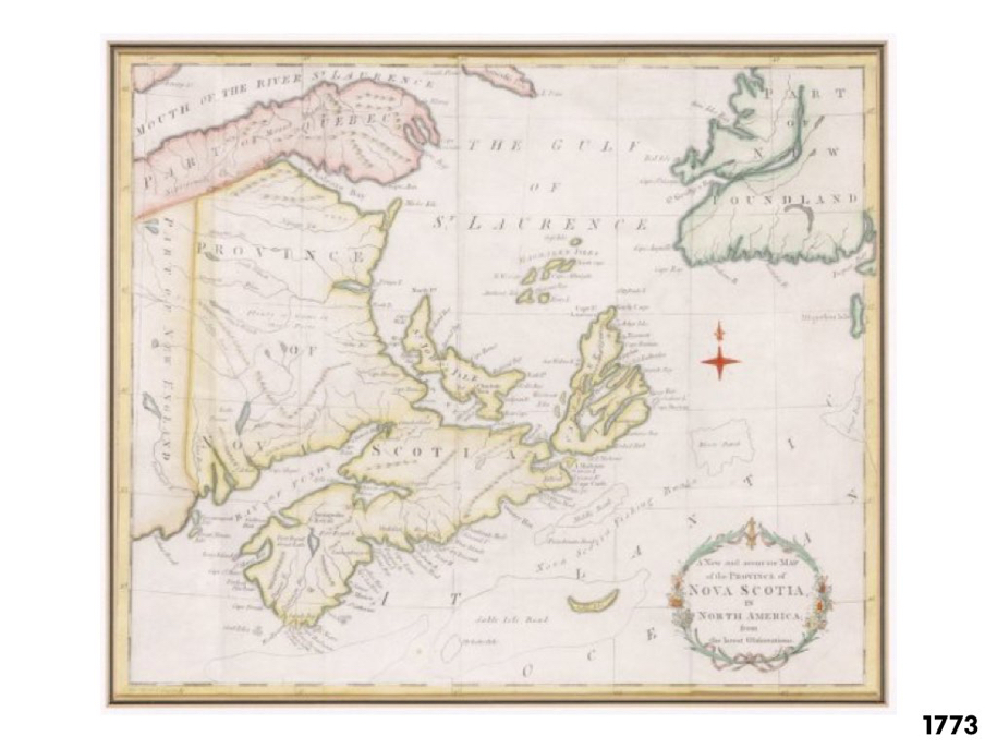
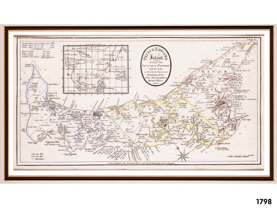
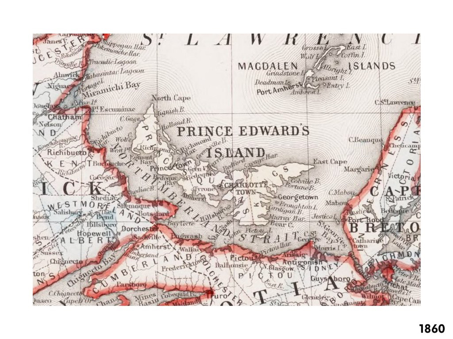
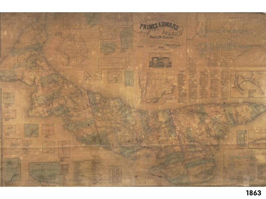
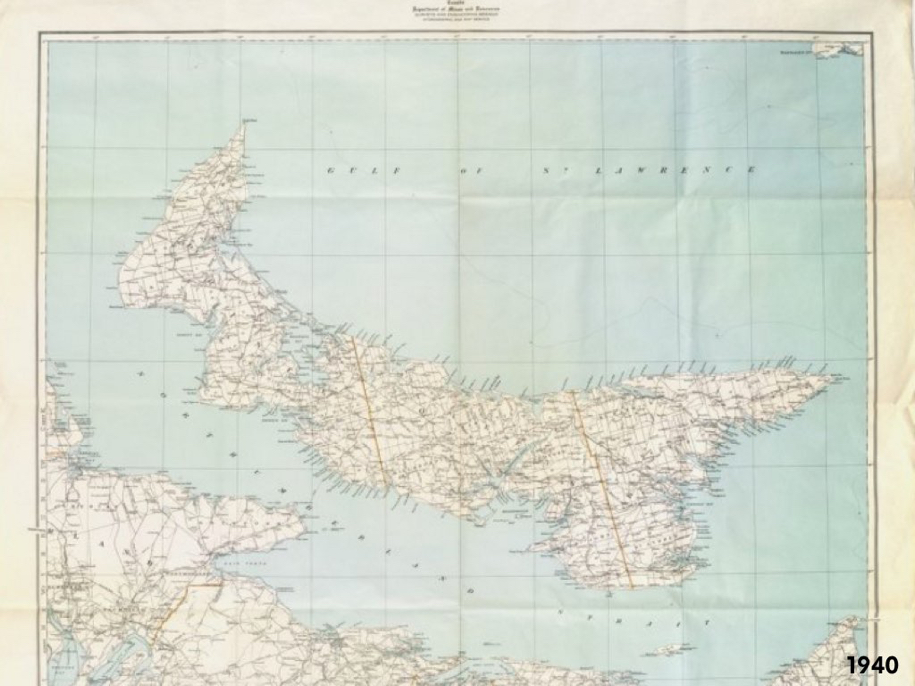
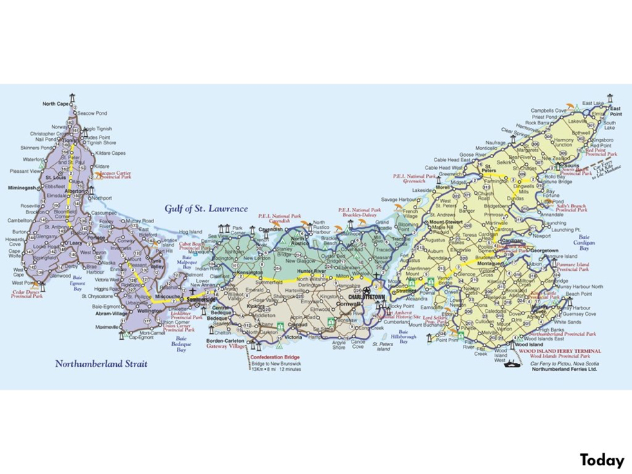
I then led the students through a visual history of maps of Prince Edward Island – helpfully mined from IslandImagined.ca – from 1666 to the current day:
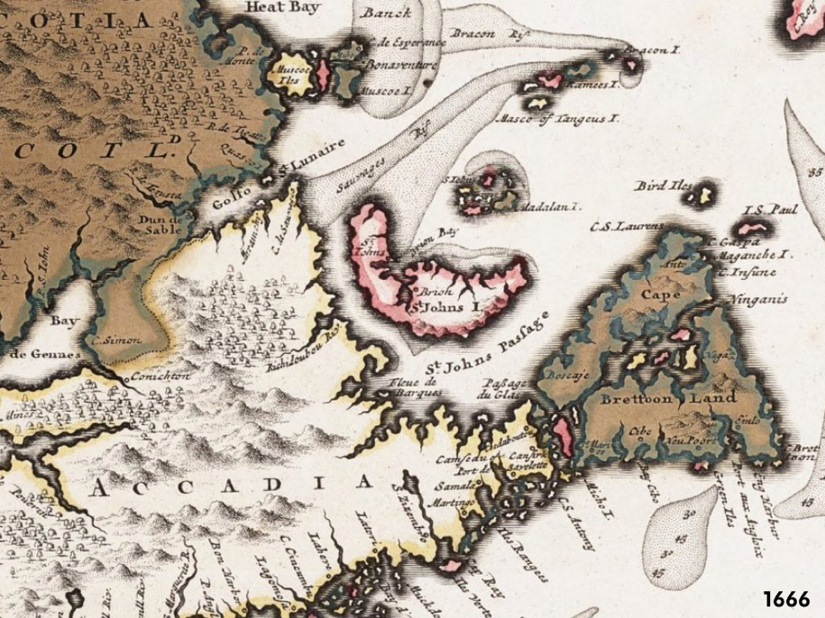
PEI Map, 1666

PEI Map 1687

PEI Map 1690

PEI Map 1751

PEI Map 1765

PEI Map 1773

PEI Map 1798

PEI Map 1860

PEI Map 1863

PEI Map 1940

PEI Map Today

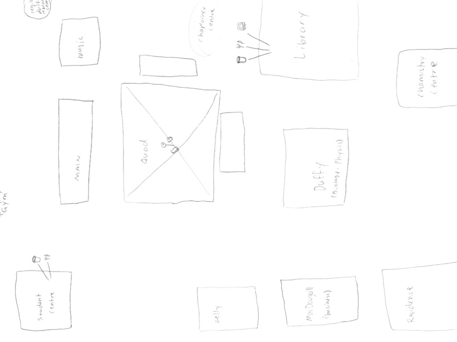
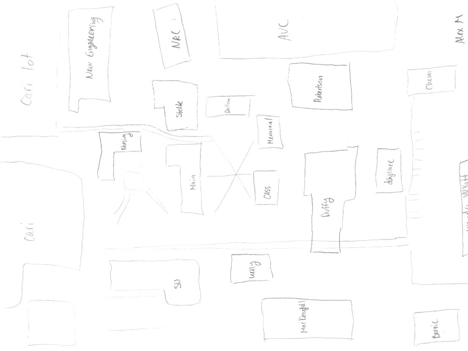
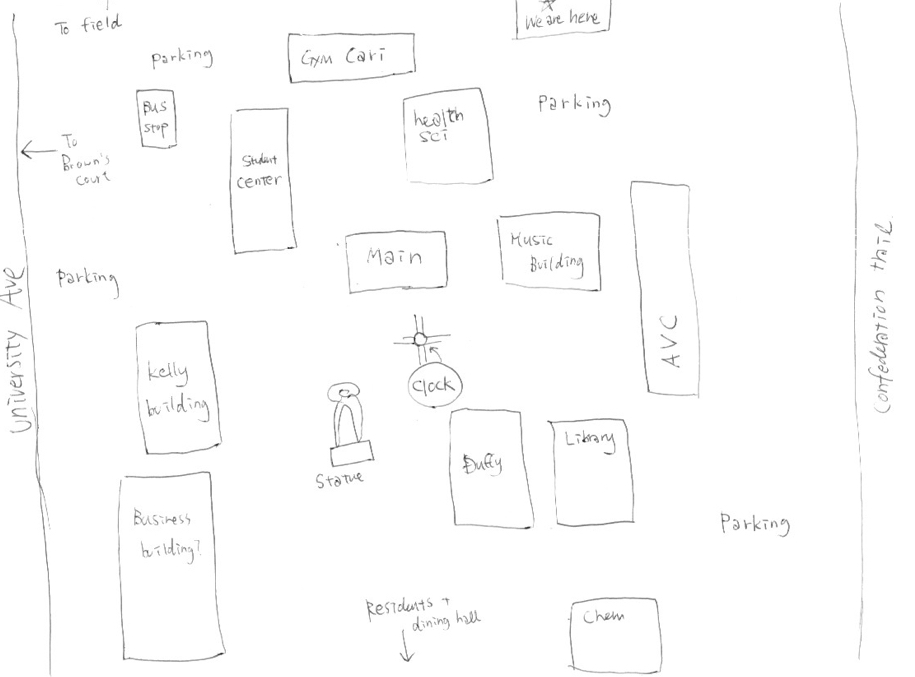
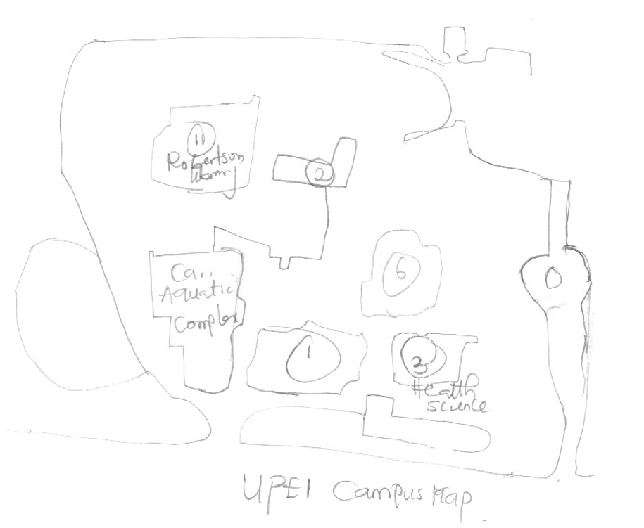
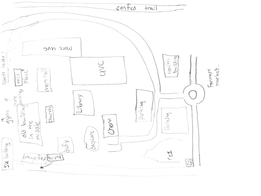
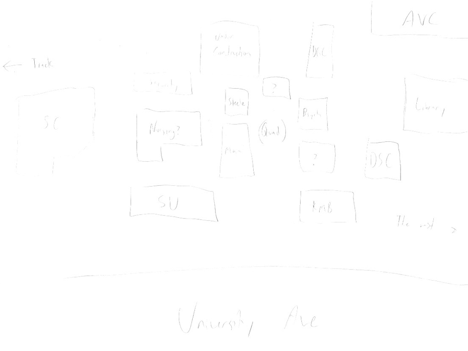
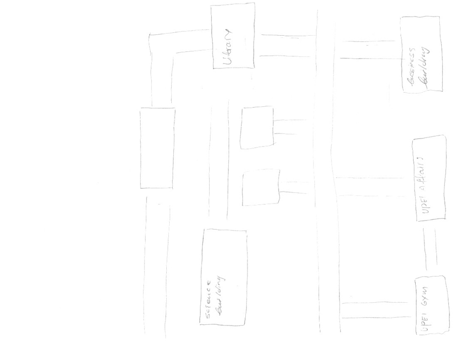
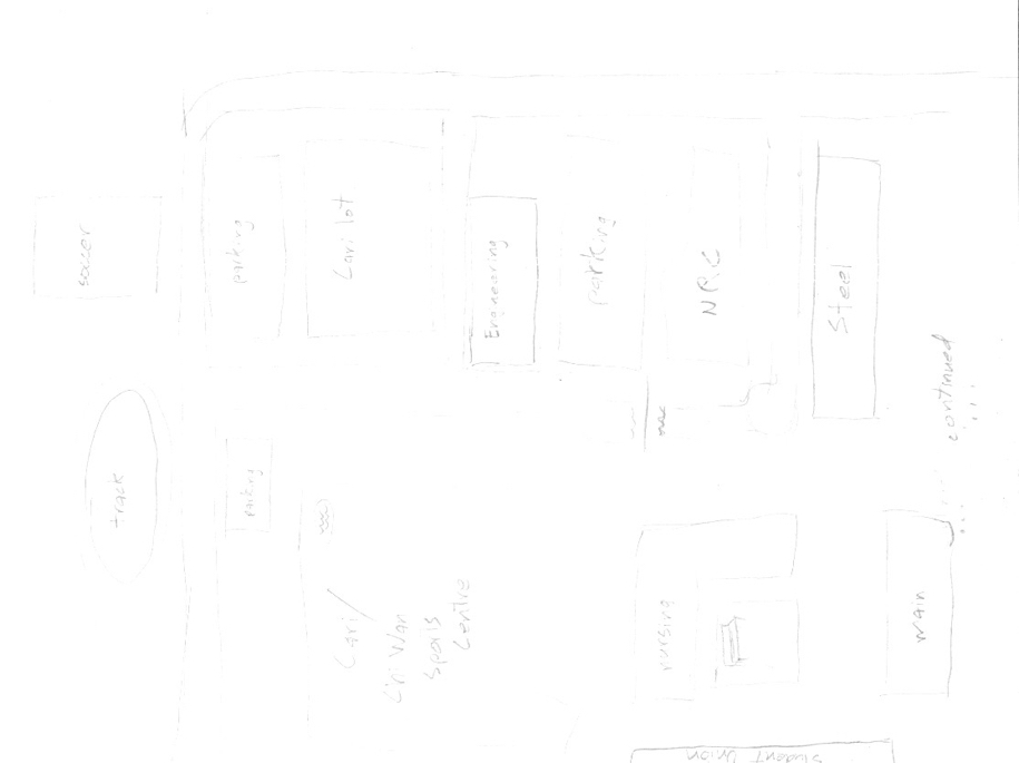
I wanted to reinforce that maps exist in a cultural context and a technology context: evolutions in our ability to measure, to communicate and to print all influence the maps we can produce, and the maps we can produce influence our mental model of where we live. In this spirit, I then presented the students with a quick challenge: take 5 minutes, a sheet of card stock and a pencil, and make a map of the University of PEI campus, suitable for handing to a new student who needs to get their bearings.
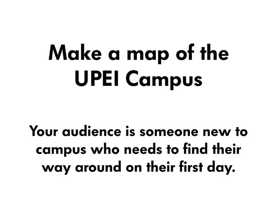
Make a Map!

The results of this exercise – I gave them about 10 minutes to finish – were very interesting: 10 students prepared 10 very different maps, with different levels of detail, perspectives, orientations, levels of accuracy, style. I posted all of the maps on the whiteboard at the front of the classroom and asked them all to come up and take a look at them, and to compare and contrast their own maps to others. I didn’t need to say any more: the results proved the point that maps have politics, maps have limitations, maps represent the world view of the creator and the tools available to them.
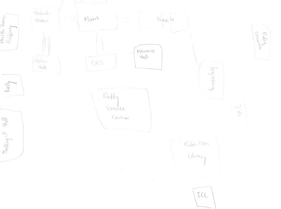
Campus Map 1

Campus Map 2

Campus Map 3

Campus Map 4

Campus Map 5

Campus Map 6

Campus Map 7

Campus Map 8

Campus Map 9

Campus Map 10

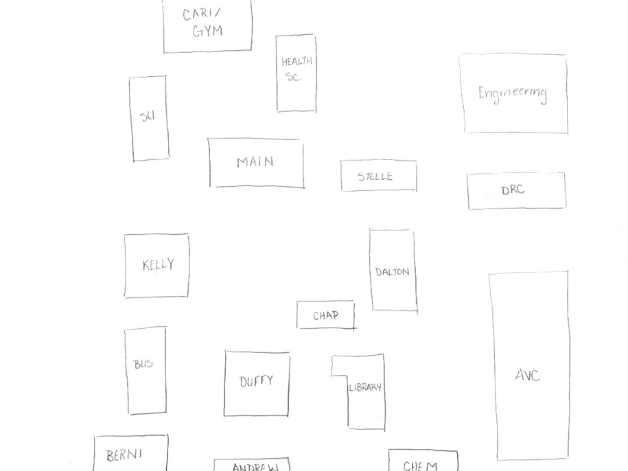
I threw my own version of the map into the ring for comparison (I created it at the same time as the students were creating theirs, and that in itself was a learning experience for me):
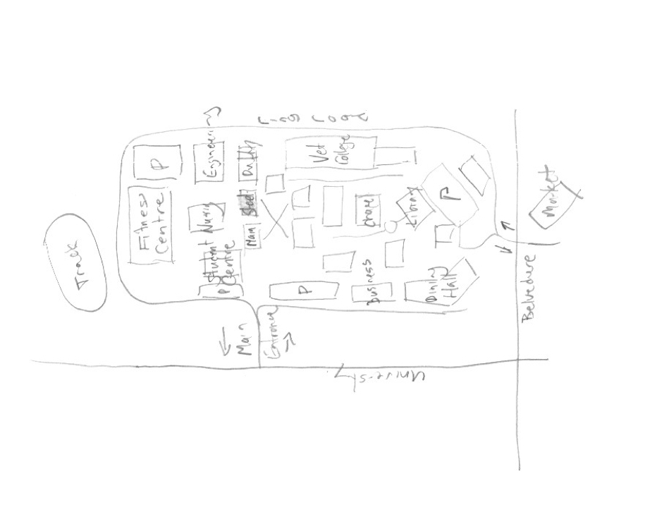
My Campus Map

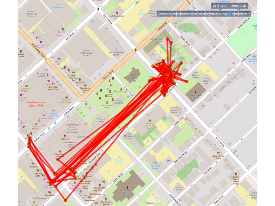
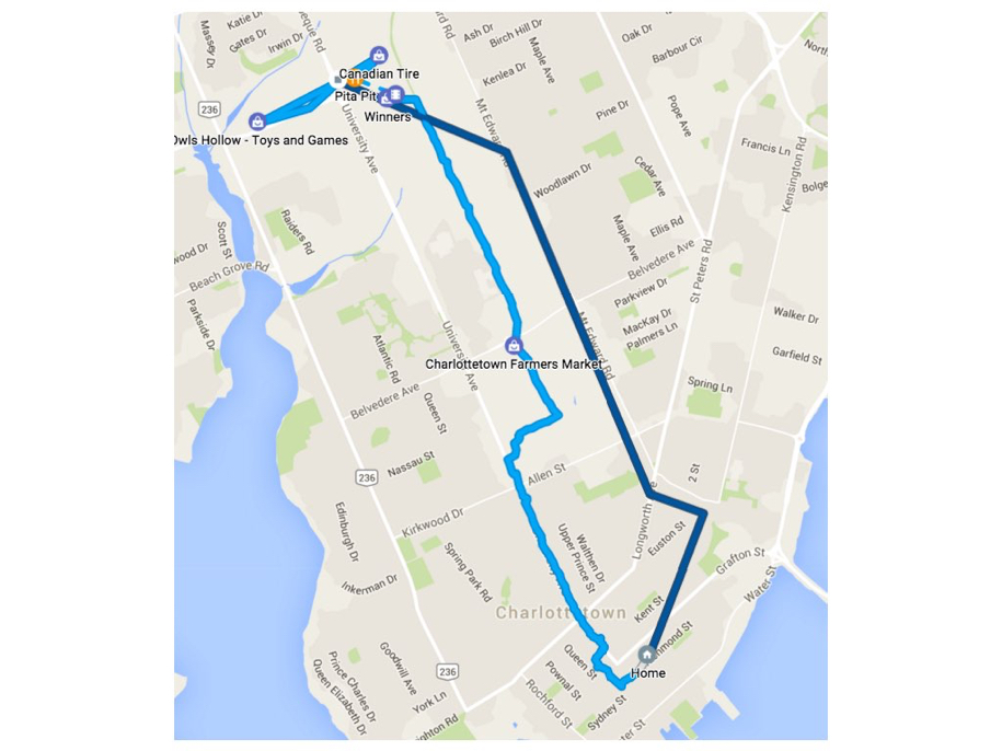
With the scene set, I then walked the students through a series of slides that illustrated how I leave a “digital breadcrumb” wherever I go, and how the collection of those breadcrumbs together tells a set of stories, and leaves a digital fingerprint of my passing:
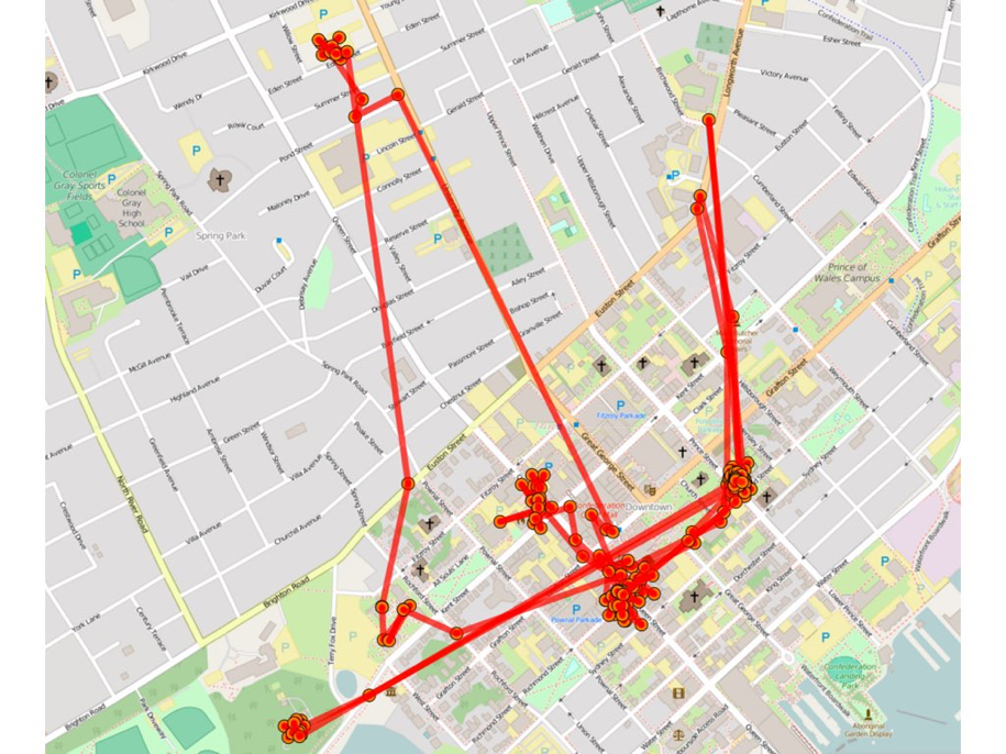
My DIgital Breadcrumbs

My Breadcrumbs Number Two

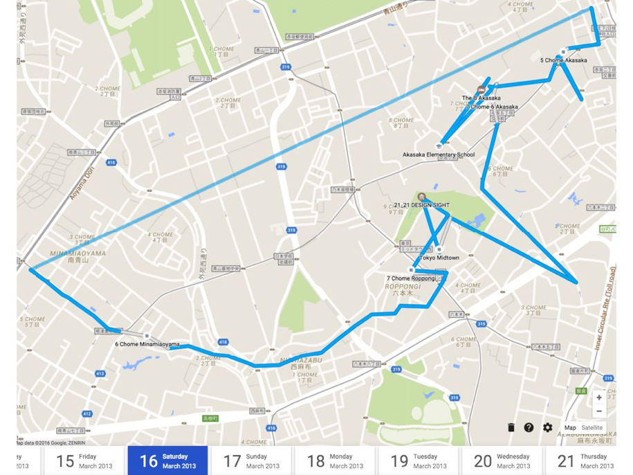
I then showed how the same data, from the same phone, also shared with Google, and thus merged with what Google knows about the world, can result in more meaningful (but also, possibly, more creepy) maps, like this map of my walk to Birchwood with Oliver this morning:
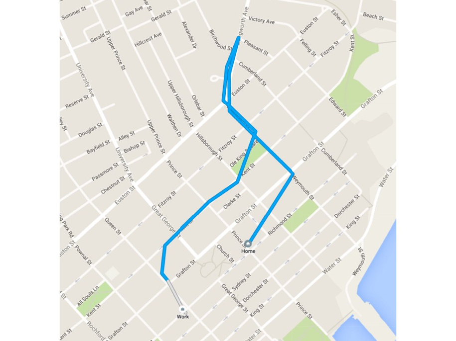
Google Locaiton History

Another Google Map

Japan Map

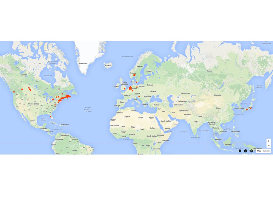
My Google Location History

With the notion of “meaningful breadcrumbs” established, I then asked the students if they could identify this:
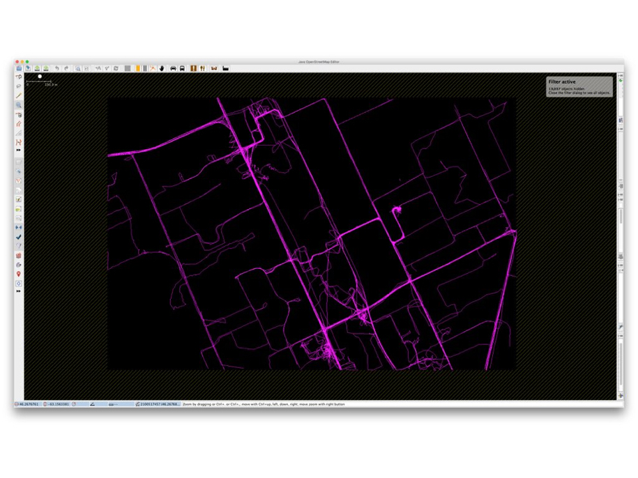
Geotraces from OpenStreetMap of UPEI

When they couldn’t guess, I added a hint:
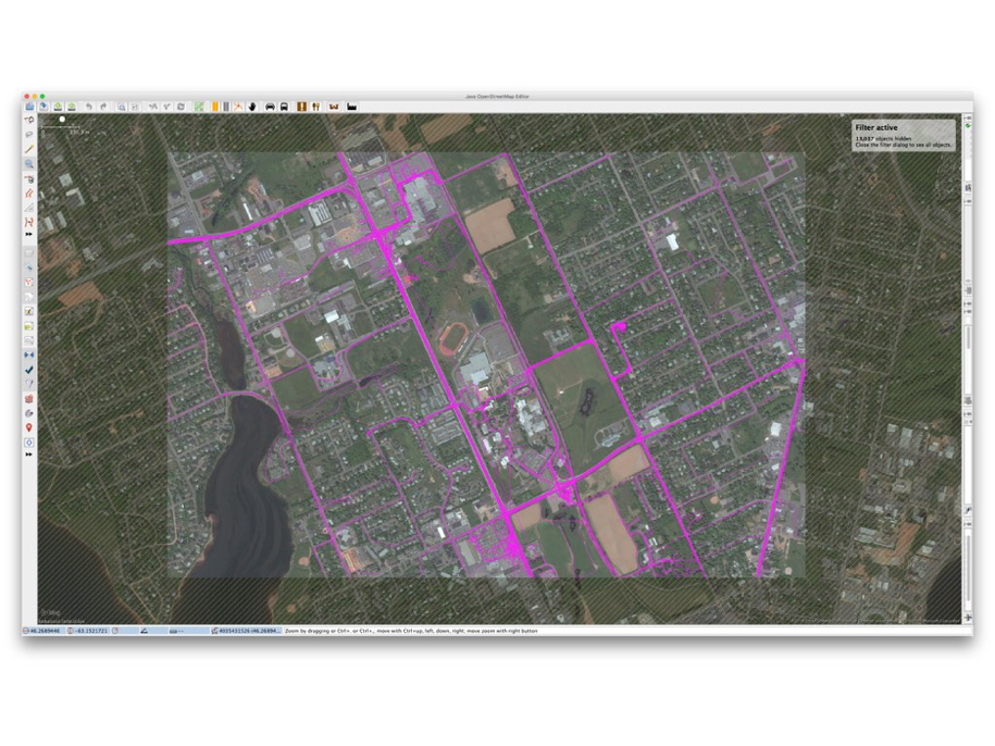
OpenStreetMap Geotraces + Bing Satellite

The running track was the clue that was needed to identify the location as the University of PEI itself, and I explain that the purple traces were the collected GPS traces of OpenStreetMap contributors, traces that, in enough volume like this, carve a sort of de facto map of the city.

Next, to introduce OpenStreetMap, I showed an introduction to the project by its founder Steve Coast:

By way of introducing the underlying technical philosophy of OpenStreetMap, I discussed how, at its core, it’s about points, lines and areas, like this:
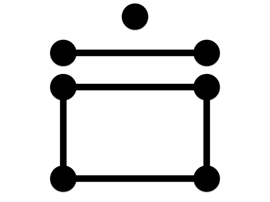
OSM Fundamentals: Points, Lines, Areas

Using those primitive elements, OpenStreetMap allows these GPS traces:
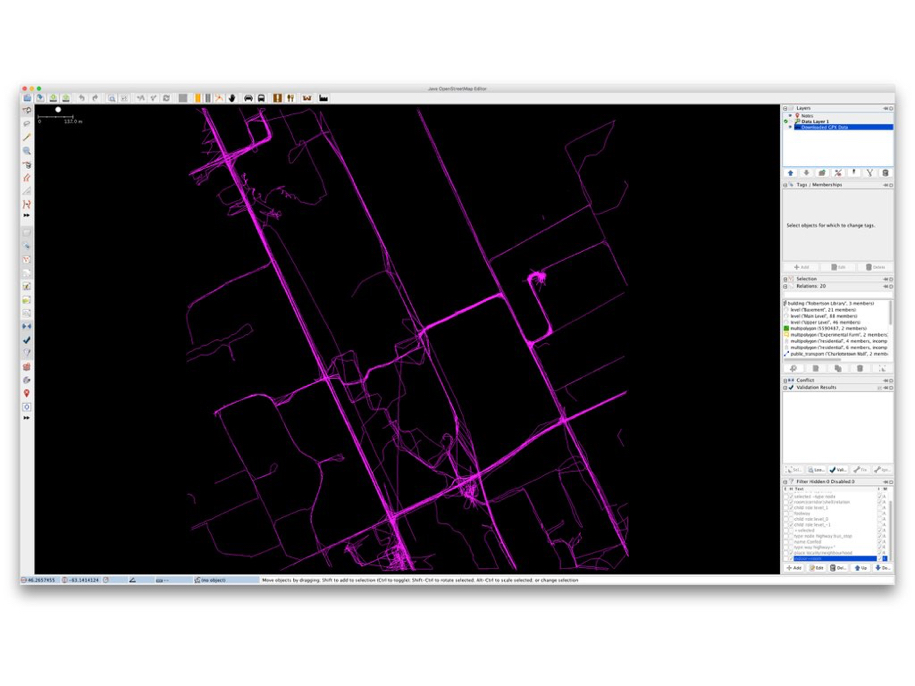
GPS Traces

combined with satellite maps with a license that allows for tracing:
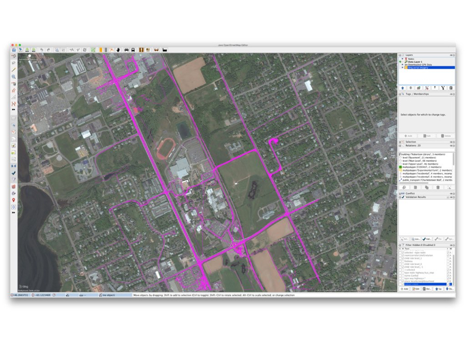
Traces and Bing Map

to be used to create features, and then to tag those features with metadata – this is a road, this is a path, this is a building, etc. – to create the raw materials for a map:
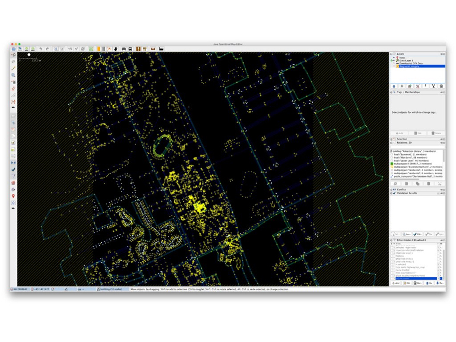
OpenStreetMap of UPEI in JOSM

A map that, when a set of rendering rules are applied to it – make residential roads white, major roads orange, grass green, etc. – results in a human-readable map like this:
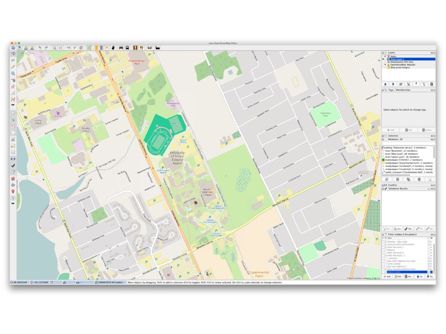
OpenStreetMap of the UPEI Campus

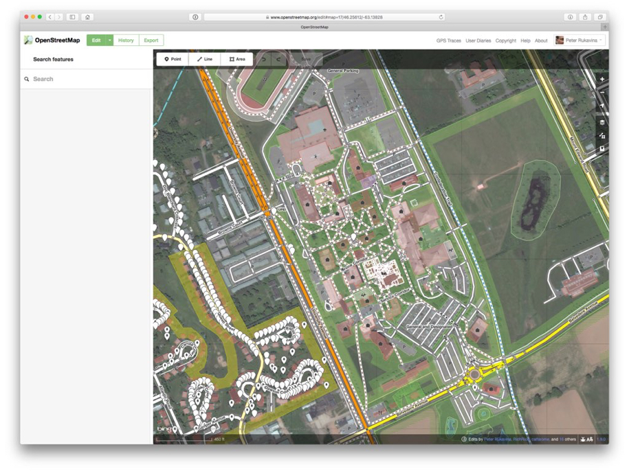
And that this is something that can be done not only with purpose-built standalone software, but in a web browser, by anyone, just by clicking “Edit”:
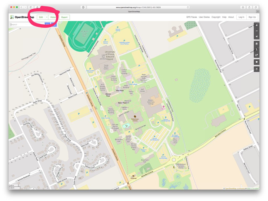
OpenStreetMap Edit Button

Editing OpenStreetMap

I demonstrated how the map itself a collaborative, open project, but also how the standards that drive them map – how to tag a coffee shop, how to identify a bicycle path – are developed collaboratively and in the open too, in the OpenStreetMap wiki:
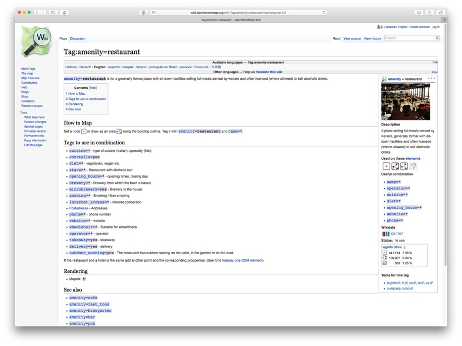
OpenStreetMap Wiki Page Example

With this basic understanding of the mechanics of OpenStreetMap in place, I showed the OpenStreetMap 10th Anniversary visualization video to give them a sense of the scale of the mapping community:

To illustrate that the project isn’t just about making slippy maps for the browser that all look the same, I showed them some examples of different manifestations of OpenStreetMap data, like walking directions:
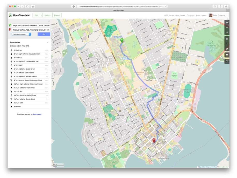
OpenStreetMap Walking Directions

And commercial use of the map data by Foursquare:
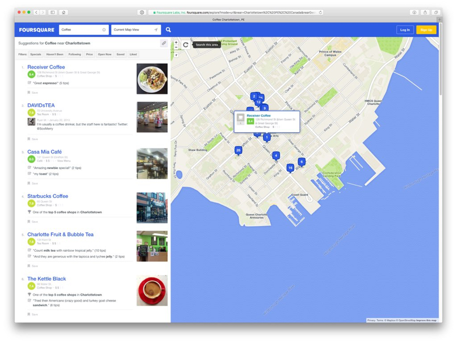
Foursquare Maps

Baby Onesie’s imprinted with the map area of your choice:
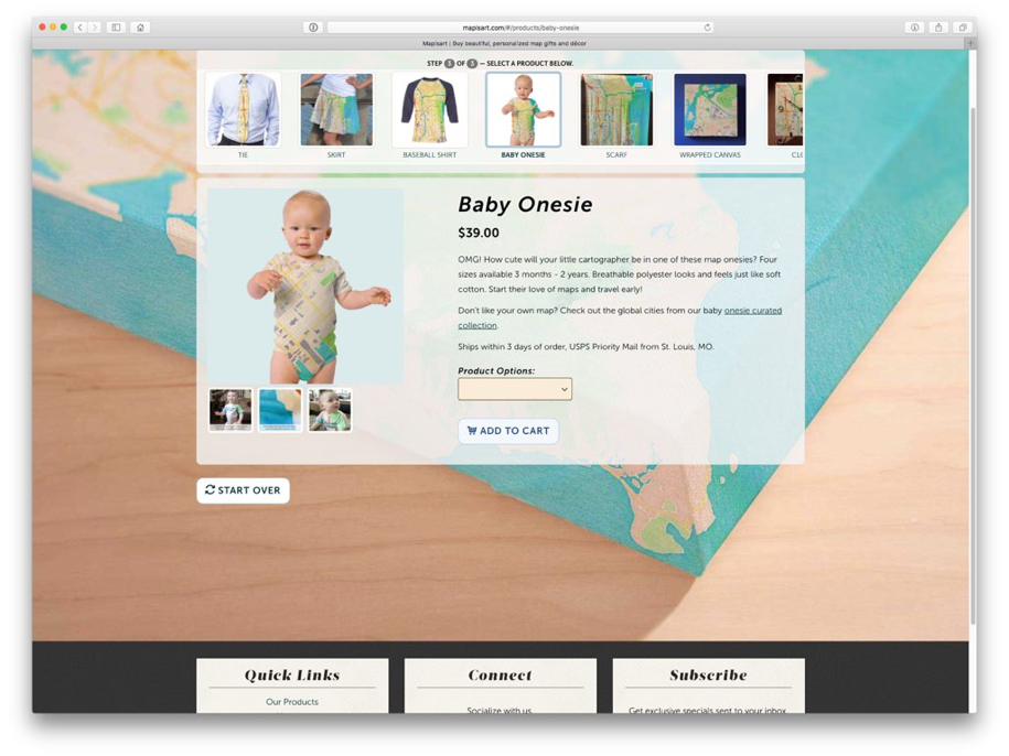
OpenStreetMap on a Baby Onesie

And the Humanitarian OpenStreetMap Team:

As a final exercise, with all of the above in mind, I asked them to return to the challenge of mapping the University of PEI campus, but this time as a collaborative project, using the whiteboard and the markers I’d given them at the start of the first lecture a week ago:

Make a Map Together!

They gamely rose to this challenge:

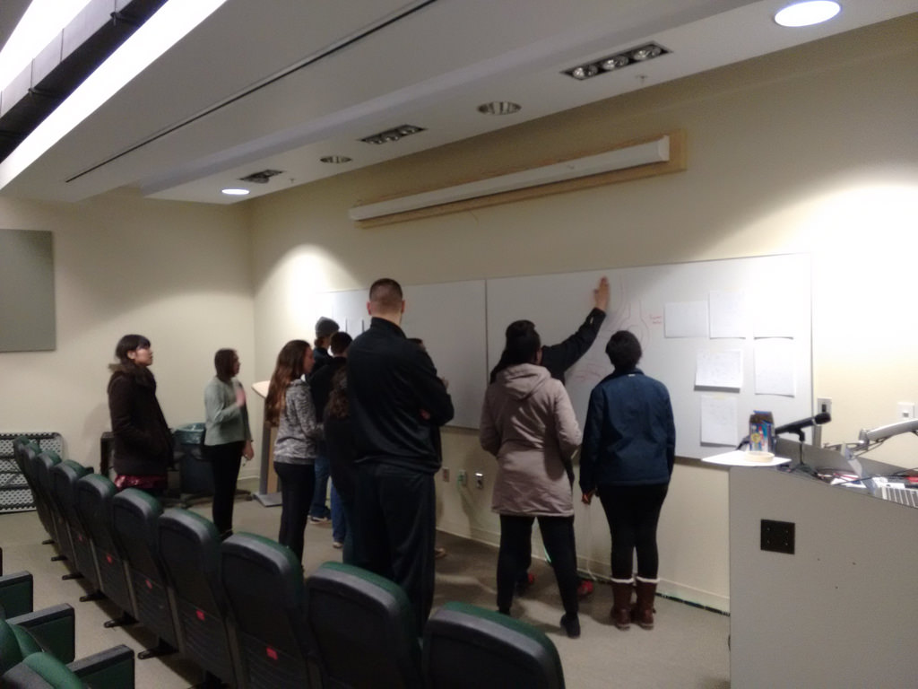
Philosophy 105 Students Mapping the Campus

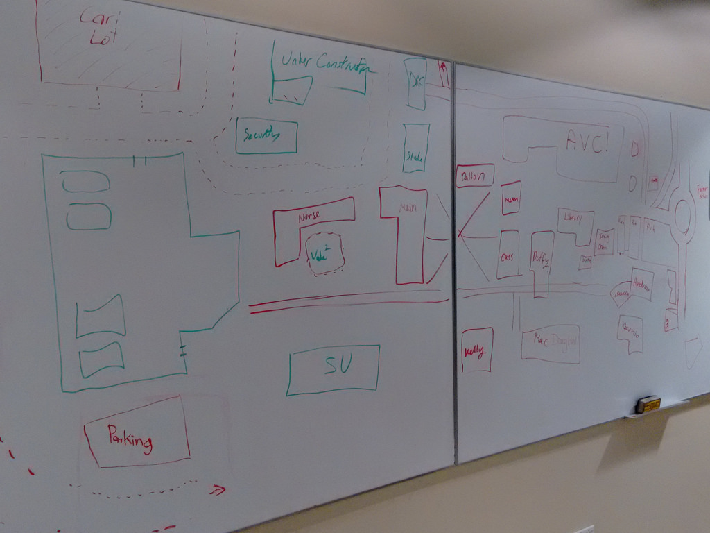
Some students held back – it was a cramped area to work together in, especially for students not used to doing so – but two groups emerged naturally that worked together on opposite ends of the campus. They achieved a surprising amount of detail and accuracy for a 10 minute whiteboard exercise:
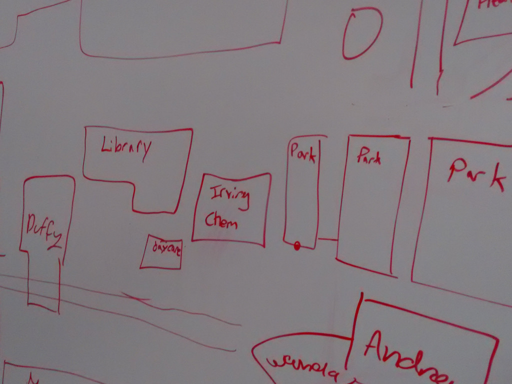
UPEI Campus Map

UPEI Campus Map

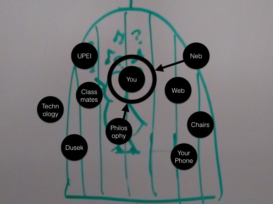
As a final effort to knit four lectures and a lot of seemingly disconnected material together, I talked about how what united the notions of “university as a technology,” open data and open mapping was the idea of agency: agency as an actor in their education, agency over developing shared conceptions of the physical world through maps, agency over the data about them and from them that is used to shape policy.

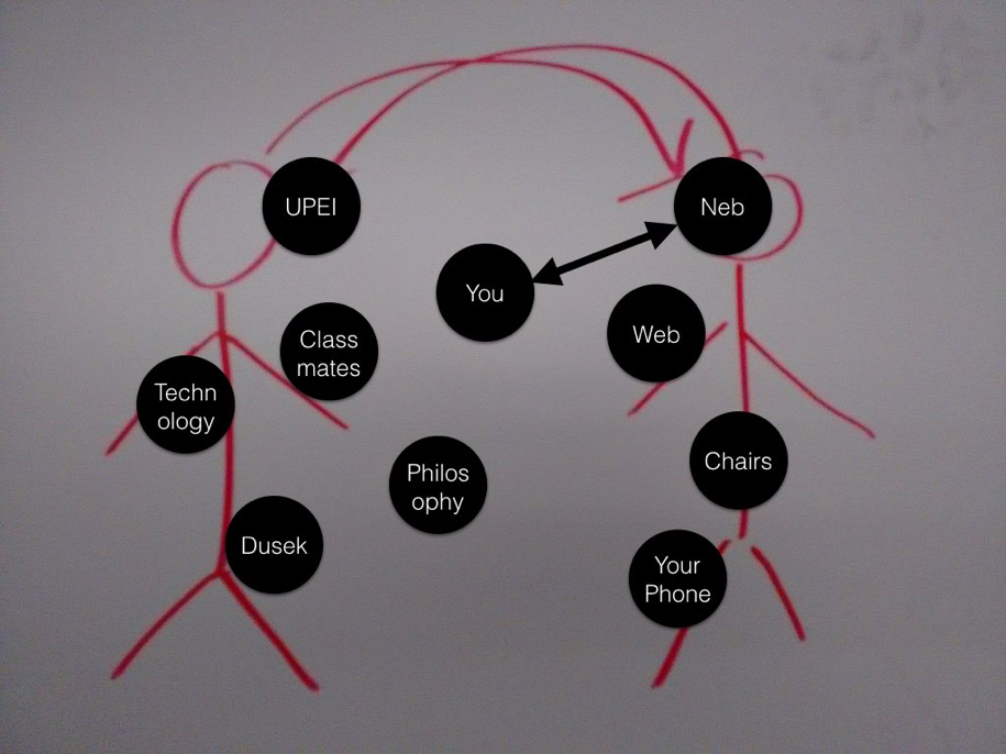
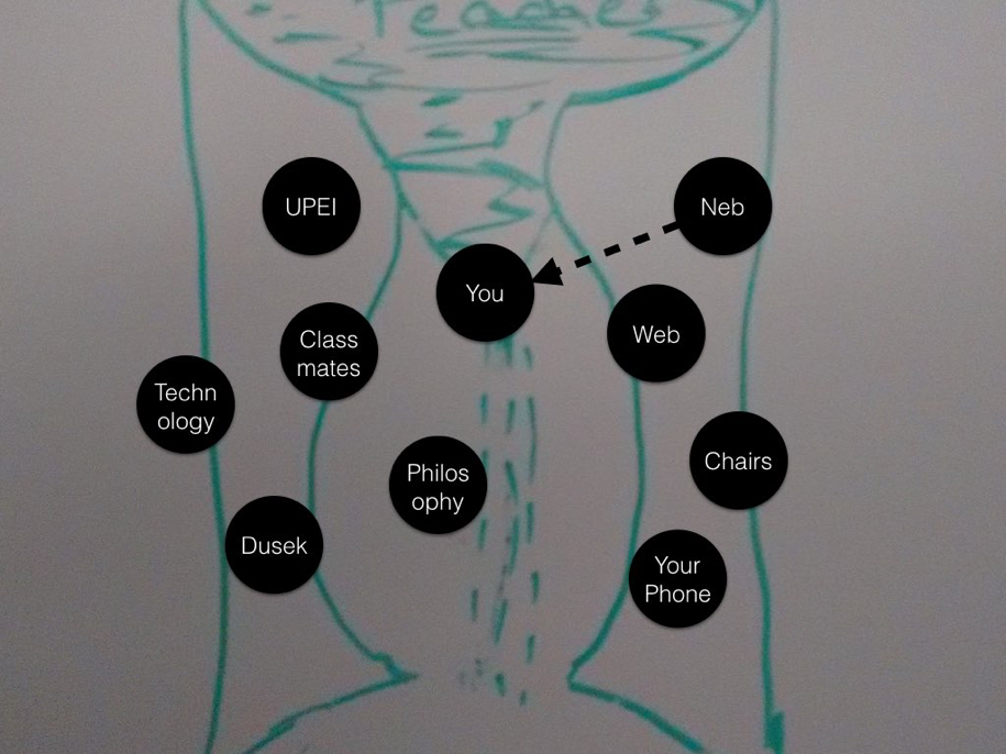
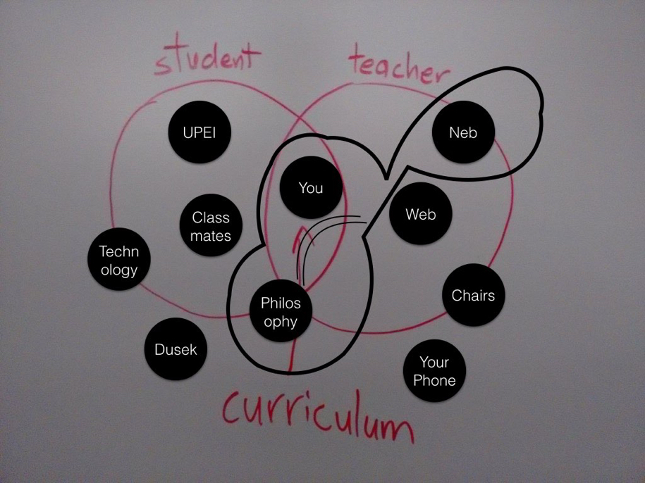
I referred back to the visualization of their own university education to date that I’d asked them to prepare in my first lecture by way of talking about different models – different conceptions of agency – in their education:
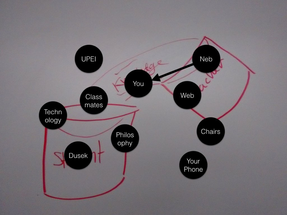
Agency 1

Agency 2

Agency 4

Agency 5

Agency 3

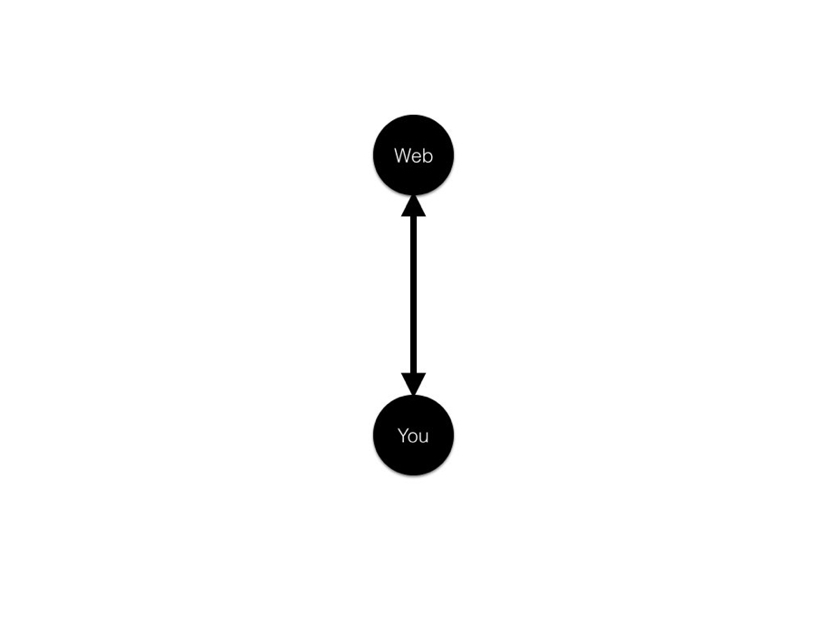
I illustrated several models of the relationship of the individual actor to the web. As a consumer:
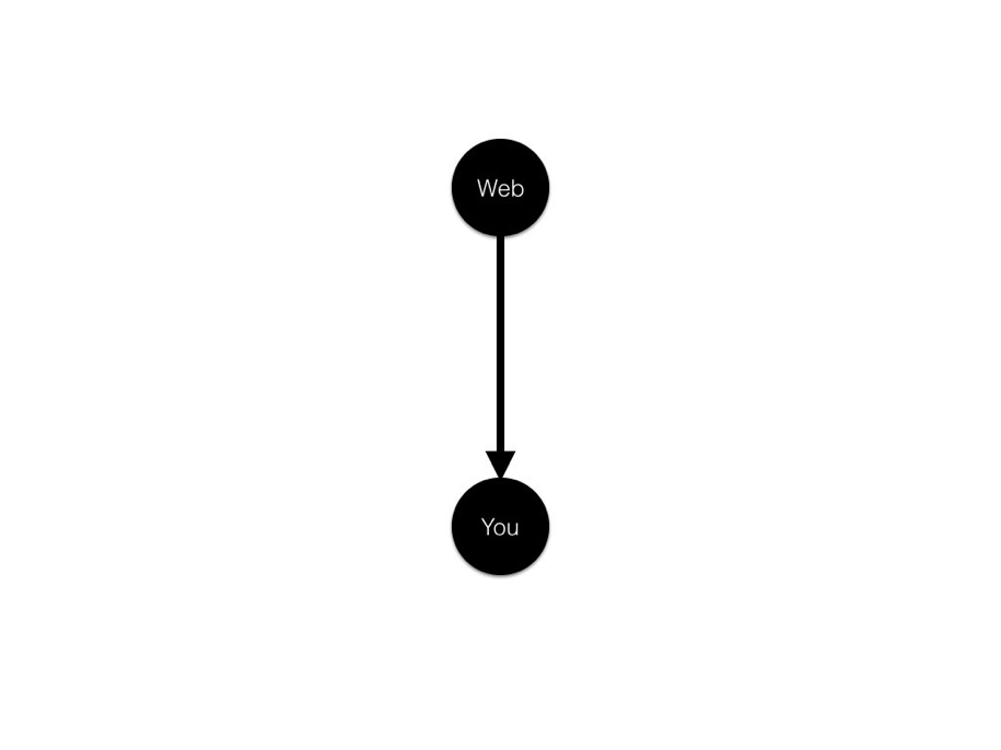
Consumer of the Web

Consumer of and contributor:

Consumer and Producer

And, perhaps most accurately, consumer of, contributor to, collaborator around, conduit through, as actor in a complex system that they are affecting and that is affecting them:
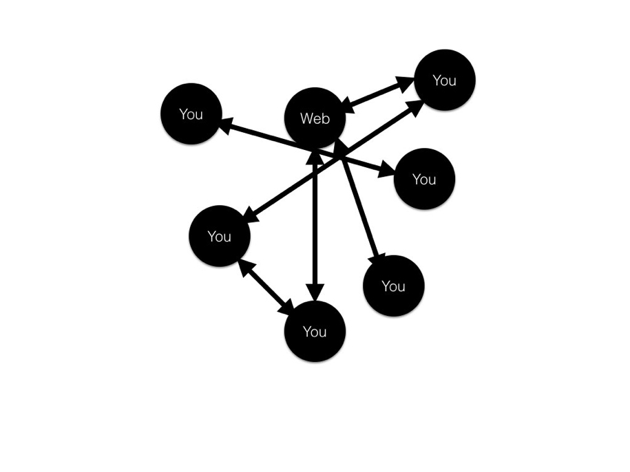
Complex Web

And with that, we were done. 

I asked the students if they had any feedback on our time together, and they said I was welcome back, which was about as high a compliment as I can imagine. I asked them for a class picture, and they generously obliged:
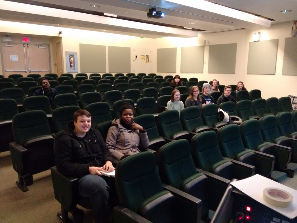
IMG_20160302_143631

I’ll likely have more to write about this experience in a university classroom once I’ve had a chance to ruminate on it for a while. I do come away with both a renewed appreciate for the challenges of the teaching profession but also an awareness that, when a plan comes together and learning is oozing out of the room, there is no better high.

🗓️

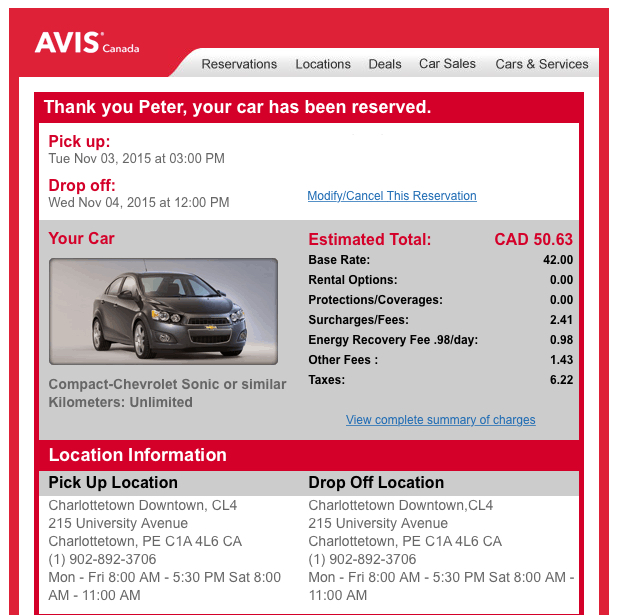
As our 2000 VW Jetta enters its later years, it’s become our habit, when driving off the Island, to rent a car. In the off-season this is always surprisingly inexpensive, a certainly much less expensive than, say, the cost of picking up the engine that’s unexpectedly fallen out of the Jetta in the Cobequid Pass.

Renting a car in downtown Charlottetown has always been easy because the Avis-Budget location is just a few blocks away from both my home and my office, so it’s been easy to walk to pick up the car (once I left the office at 4:50, reserved a car from my mobile phone while walking to pick it up, and arrived just a minute before their office closed for the day).

I was dismayed, then, to see the downtown Charlottetown Avis-Budget location at the corner of Grafton and University close down; I was afraid I’d have to resort to taking a cab out to the airport to pick up a car (or at least to walking out the Avenue to Enterprise).

It turns out, though, that Avis and Budget haven’t moved out of downtown Charlottetown, they just moved offices: their new location is at 6 Prince Street, inside Founders’ Hall, a location that happens to be even closer to our house.

So we’re back in action. Now we just need somewhere to go.

Avis Rental

🗓️

For yesterday’s session of Philosophy 105 – the third of four I’m facilitating this winter – I wanted to bring my longtime friend and colleague Ton Zijlstra into the classroom to broaden our discussion of open data.

I’d introduced the topic last week with an exploration of a local wind energy data project I’d undertaken; Ton has thought longer and harder about the fundamentals of open data, and has worked broadly in Europe with politicians and bureaucrats on the topic, and I knew it would be valuable for the students to hear from him (and I was curious to check in too!).

One of the frustrating realities of the architecture of University of Prince Edward Island classrooms – and, I imagine, most university classrooms anywhere – is that they were built with a particular “professor at the front, talking behind a podium or in front of the whiteboard” model of education in mind. While there’s been a lot of work in recent years to extend this into the digital realm – all classrooms, it seems, have a screen projector and a PC and perhaps some sort of audio-visual system – the classrooms don’t have cameras, for example, making it hard to include others in the conversation by Skype. To say nothing of being difficult to use when students aren’t sitting down and the professor isn’t speaking at them. They are not, in other words, laboratories for collaboration.

I set out to solve that issue, in an ad hoc fashion, for Monday’s session, to enable Ton to drop into the classroom.

To start, I purchased a Logitech C930E wide-angle webcam (discussed in more detail here): the camera has a 90 degree field of view (in other words, its “eye” can take in 90 degrees of space in front of it), making it well-suited to capturing a wide swath of the classroom.

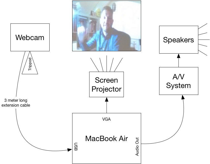
Here’s how I wired everything together:

Skype Classroom Setup at UPEI

The webcam connected to my MacBook Air by USB. It worked both as a camera, mounted on a tripod, pointing back at the classroom, but also as a microphone, picking up both my voice and the students’ (it appeared to work very well for this, and there were no problems with Ton hearing us). I used a 3 m extension cord to extend the range of the webcam, but turned out not to need it because I ended up positioning the camera on an angle to avoid having the light from the bright screen projector interfere with it.

For audio out in the classroom I connected the male 3.5 mm audio cable that emerged from the classroom’s A/V cabinet into the audio out port of my Mac and then adjusted the volume on the podium controls (it was turned down all the way when I started, which made me think it wasn’t working, but it was). The speaker system in the classroom was excellent, and everyone could hear well.

To project my MacBook Air’s screen – and Ton – onto the screen in the classroom, I connected the male VGA cable in the podium to a Thunderbolt-to-VGA adapter plugged into my computer. The Dell screen projector in the classroom automatically detected the signal and there was, unusually for such situations, no need to fiddle around with this: it just worked.

When it was all set up and running, it looked like this:

Ton Zijlstra via Skype in my Philosophy 105 Classroom

You can see the podium on the right, with the webcam on the tripod in front of it. The webcam was about 1.5 m in front of the front row of the seating and it took in everyone you can see in the photo in its view, meaning that Ton could see me (in the front row) and all the students.

Skype worked well, relatively speaking. Over 45 minutes of talking with Ton there were 3 or 4 times when audio and/or video dropped out, generally only for 10 to 15 seconds. We never lost the connection completely; it always recovered on its own. Otherwise it was like Ton was right next door: we could see and hear him, he could see and hear us, and we could forget about the technology and just have a chat.

🗓️
University of PEI  •  Skype  •  Webcam  •  Philosophy 105

On the way to work this morning I called into CBC Island Morning’s post-show-on-Tuesday community call-in to encourage PEI Home and School Federation member associations to use their March meetings to discuss provincial policy resolutions. When I arrived at the office an hour later, after a meeting, there was an email from personable Island Morning host Matt Rainnie asking me if I’d be able to come into the studio to tape a full-on interview about the topic. I quickly agreed, as I’m always eager to talk about home and school, and I’ve a deep belief in the power of our policy resolutions process.

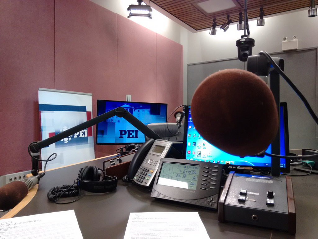
Time was of the essence, so an hour later I was on the bus to the nearby CBC Prince Edward Island studios, and 15 minutes later I was sitting in the radio studio in front of a microphone:

On the Mic at Island Morning

Usually at this point in the being-interviewed-on-the-radio process I’m terrified enough of what’s to come – what if I lose my mind? what if I forget how to speak? what if I call the Premier an idiot by mistake? – that I’ve little time for anything other than worry.

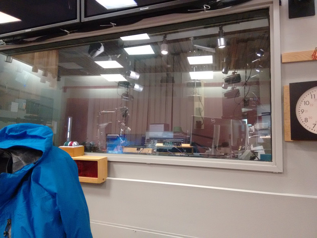
But in this case I was well-versed in the material, and I had a few spare minutes to gather myself as Matt stepped out to grab me a glass of water and to fetch Richie Bolger to run the board. So I had a chance to snap a couple of “behind the mic” pictures. 

Here, for example, is what Matt and Mitch see when they’re looking at Richie (except that Richie would be there, behind the glass):

The CBC Radio One Booth

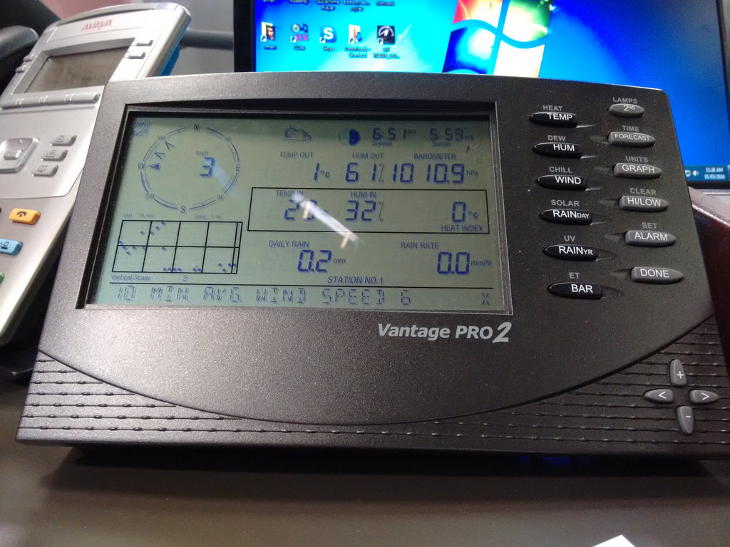
Here’s the display that Mitch and Matt consult when they want to give up to the minute weather conditions from their Vantage Pro 2 weather station:

Island Morning Weather Station

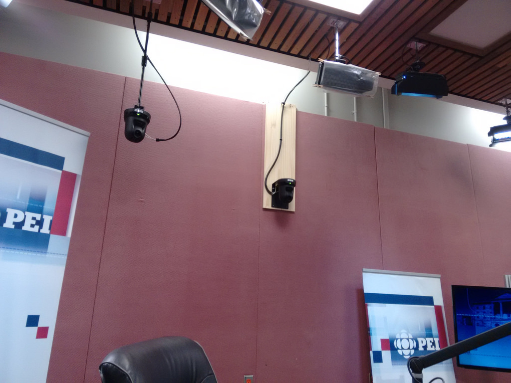
And here’s just a couple of the multiple cameras that facilitate the live broadcast of the show on CBC Television:

Island Morning on TV: Cameras

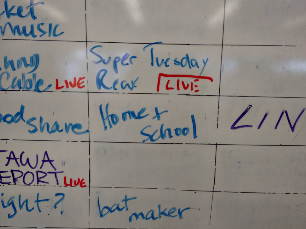
The interview went well, I think – I didn’t lose my mind, forget how to speak, or mistakenly call the Premier an idiot – and on my way out the door I snapped a photo of the rundown whiteboard in the bullpen where the segment was tentatively  slotted for tomorrow morning after 7:00 a.m., right after “Super Tuesday Reax” and before “Bat Maker”:

Home & School Slot on the Island Morning Rundown

Do tune in, why don’t you!

🗓️

About This Blog

Photo of Peter RukavinaI am . I am a writer, letterpress printer, and a curious person.

To learn more about me, read my /now, look at my bio, listen to audio I’ve posted, read presentations and speeches I’ve written, see things I’ve favourited elsewhere, or get in touch (peter@rukavina.net is the quickest way).

I have been writing here since May 1999: you can explore the 25+ years of blog posts in the archive.

You can subscribe to an RSS feed of posts, an RSS feed of comments, an RSS feed of favourites elsewhere, or a podcast RSS feed that just contains audio posts. You can also receive a daily digests of posts by email. I also publish an OPML blogroll.

InstagramYouTubeVimeoORCIDOpenStreetMapInternet ArchivePEI.artDrupalGithub.