
In 1967 the National Film Board of Canada released Summerhill, a film about the British school of the same name. I first saw the film in 1985 when my education professor showed it to our class at Trent University. Summerhill is and remains a fascinating school, organized, quite unlike any other, along truly democratic principles. I wanted to see the film again, and so I went looking for it on the NFB website where it was nowhere in evidence.
I knew the film existed because there’s a cataloging record for it (and, of course, because I’d seen it with my own eyes 30 years ago). So why wasn’t it to be found on the NFB website?
It turns out that the NFB has two websites, the “regular” one at NFB.ca and the one they call the “institutional” site at ONF-NFB.gc.ca. The former presents only a subset fo the NFB’s holdings whereas the institutional site has a more complete record, with its own search function.
Searching that site led me to the record of the film, described there as follows:
A visit to a school without fixed rules, where students study as they wish, and are their own masters. A co-educational English boarding school, Summerhill was founded by Alexander Neill a half-century ago. In the film he explains his objectives, and from the activities of the children at work and play can be seen how his methods work. School, he says, should put preparation for life ahead of learning.
Following the “To Order” link on that page led me to yet another NFB website, with the option to buy for private use, for classroom use or for public presentation.
I put a copy – for “classroom use” – in my shopping cart and began the checkout process. At which point I was required to “create an account in a few simple and secure steps.”
It turns out that one of those steps is “wait around for us to approve the account you’ve created.” I waited around. And eventually the email arrived confirming my account.
At which point I had to start the process of finding and purchasing the film all over again.
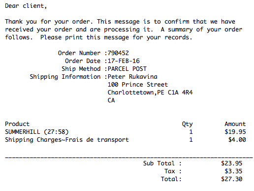
I stuck with it, sure in the knowledge that the end was near, and it turned out that the rest of the checkout purchase, while endowed with user experience with a 1985 EDI system, went relatively smoothly, and after a barrage of pointing and clicking and typing, I was checked out and done:
I’m excited to be able to see the film again; I’ll let you know when it arrives.
Last month I mentioned that I’d signed up to print Shakespeare’s Sonnet № 55.
Somebody beat me to the punch, and I was asked for a second choice. I selected Sonnet № 99 and this time I was successful. I’m on the list.
I now have until September to set and print.
The forward violet thus did I chide:
Sweet thief, whence didst thou steal thy sweet that smells,
If not from my love’s breath? Thy purple pride
Which on thy soft cheek for complexion dwells
In my love’s veins thou hast too grossly dyed.
The lily I condemned for thy hand,
And buds of marjoram had stol’n thy hair:
The roses fearfully on thorns did stand,
One blushing shame, another white despair;
A third, nor red nor white, had stol’n of both
And to his robbery had annex’d thy breath;
But, for his theft, in pride of all his growth
A vengeful canker eat him up to death.
More flowers I noted, yet I none could see
But sweet or color it had stol’n from thee.
My brother Mike and his partner Karen live in a 6th floor condo in Burlington that faces west. I snapped this photo of their sunset tonight.

I lollygagged a bit too long en route from New Hampshire to Logan Airport — lingered over coffee, found just the right architecture book for Oliver, made an impromptu Chipotle stop for supper – and then got jammed in traffic on the I-95 North between Rte. 3 and the Expressway.
Just as things were leveling out, I got lost trying trying to find the airport gas station (how much do the car rental companies pay them to hide it so effectively?). Thank goodness for the Marriott shuttle driver who let me follow his draft back to the airport.
I had to return my rental car to Hertz with an empty tank; I breezed into Terminal B with mere minutes to spare.
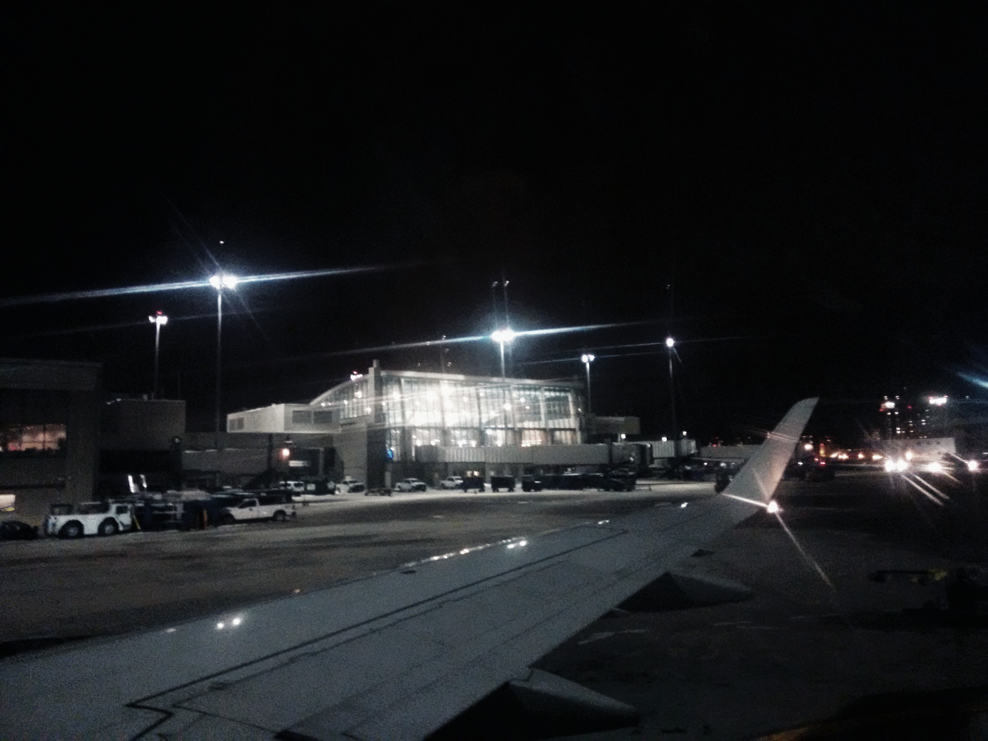
The Air Canada plane to Toronto boarded almost on time, and boarding went quickly. So I thought I was back in the time groove.
And then the captain came on the horn to announce a “full ground stop” in Toronto: we’re stuck on the tarmac, waiting for news from windy YYZ.
It’s warm. We have movies to watch — Burnt right now — and pretzels to eat. It’s like a mini-tube-shaped vacation. I can even, if I contort just right, pick up the airport WiFi (which is how I’m posting this).
What an exciting day!
Toadstool Books is a three-location independent bookseller that, for my money, is among the best-organized, best-merchandised in the world.
I’ve been to the Peterborough, NH location many times — it’s quite near my regular motel in the town — and a few times to the Keene, NH store, which sprawls through the heart of the Colony Mill Marketplace.
Today is my first time in the Milford, NH location, though: I’ve popped in en route to Boston Logan Airport and Milford is about half way.
Like the Peterborough shop, this one has an affiliated coffee shop; as I type, I’m enjoying a café latte expertly prepared by the barista cum dishwasher who recommended it as a compromise drink (as they are out of decaf beans). It’s perfectly fine.
If you ever happen to find yourself here, be sure to also stop in to Mì Jalisco, the Mexican restaurant in the plaza next door: their food is very, very good.
I’m off to browse now, before getting in the Prius C and heading out on the highway.
Twelve winters ago my friend Sherin and I ventured into Manchester, NH to experience Presidential Primary night at candidate John Kerry’s headquarters in the Holiday Inn.
Tonight, three general election cycles later, we repeated the trip, armed with a sheaf of candidate rally Eventbrite tickets, to see what we could see.
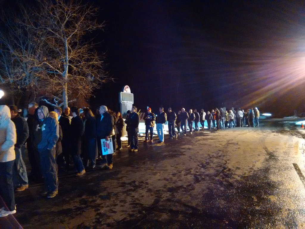
We started out the night driving to The Executive Court Banquet Facility – “one of New Hampshire’s premier destinations for the perfect wedding reception, corporate event or private party” and a handy four minutes drive from Manchester Airport – for the Donald Trump rally.
As soon as we turned the corner on Mammoth Road (yes) we realized that this would be easier said than done: there wasn’t a parking space within a mile, and there was a long, long, long lineup, snaking all the way around the front of the building, hundreds of people long. As the largest room in the facility holds only 500 people, this appears to have been a classic “book a small room and it will look crazy full” move. It worked.
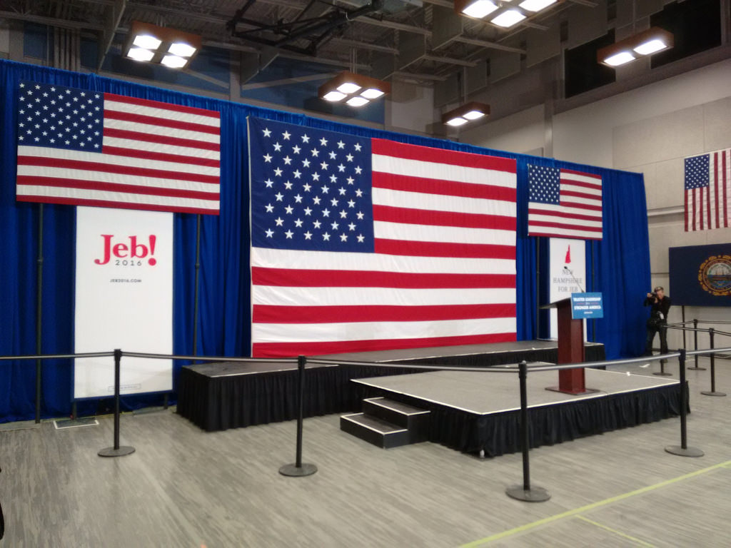
We gave up our Trump dreams and headed north to the Jeb Bush rally at Manchester Community College.
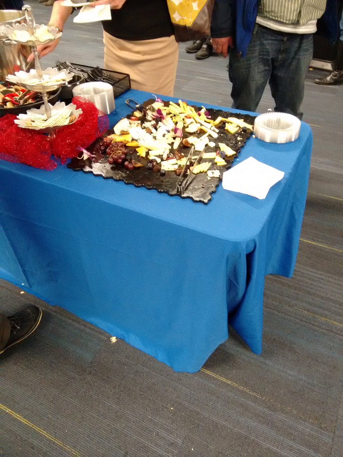
This was a decidedly more sedate affair, where the media appeared to outnumber civilians. The “registration” process was lax (we could have easily skirted it). We were given as many Jeb! stickers as we could take. There was a palpable complete lack of energy.
There was, however, a cash bar and free buffet of cheese & crackers and nachos with a very nice hot spinach-artichoke dip:
Sherin is very skilled at talking to complete strangers, and so struck up a conversation with a police officer guarding the non-hordes. He was a very nice fellow; we chatted about the Primary, and what it had been like to work the events, and when things would wind down (he said Thursday, after the morning TV programs pull up stakes back to New York).
Without much anything happened at Bush HQ, and with the Hillary Clinton campaign handy by, we set off there next.
Our GPS took us on a circuitous route to Southern New Hampshire University in nearby Hooksett. When we were about half a mile out we hit a traffic jam of cars lined up to get into the parking lot; to find a space to park we had to go to the back of the back back lot and then loop back a good distance to the field house where the rally was being held.
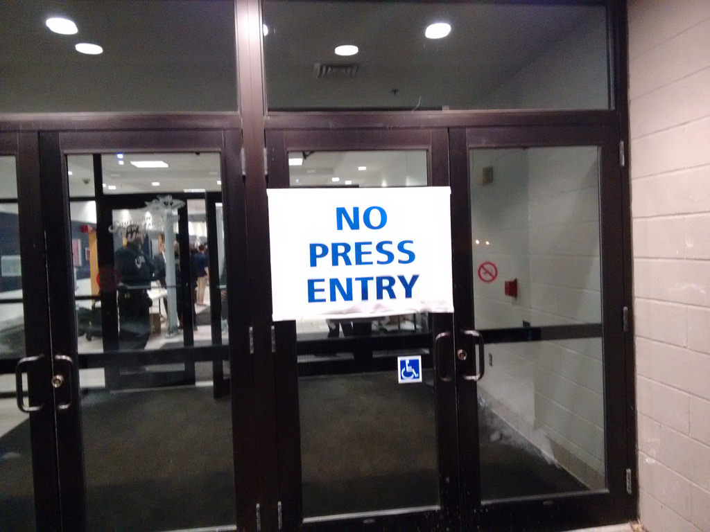
We found our way and arrived at the door, conveniently marked “No Press Entry,” where we were greeted by armed, bullet-proof-vest-wearing Secret Service agents.
We had to empty our pockets of keys and phones and change and then walk through airport-style metal detectors before we were admitted.
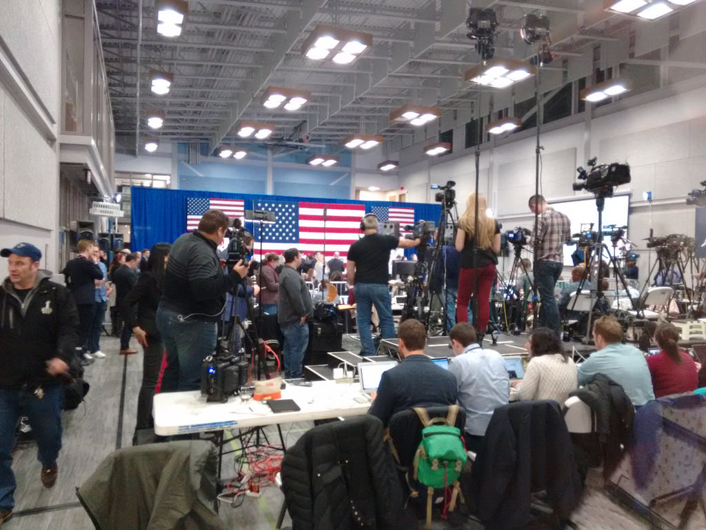
The Clinton rally, like the Bush rally, had a strong media contingent:
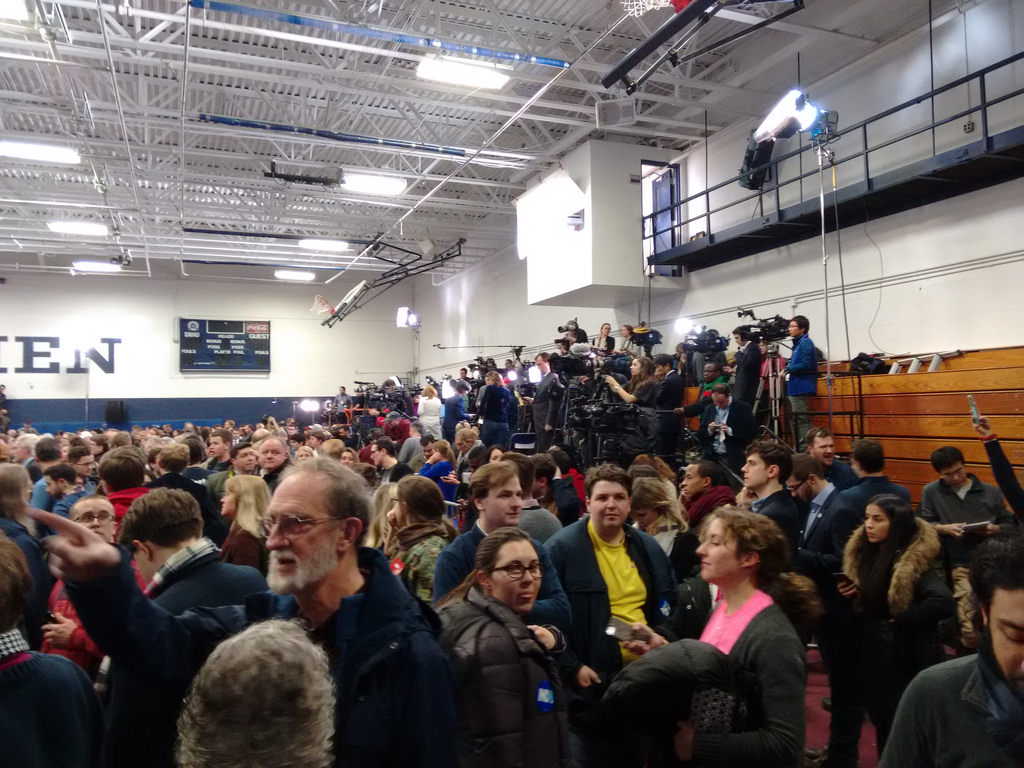
But there was also a much, much bigger crowd of supporters:
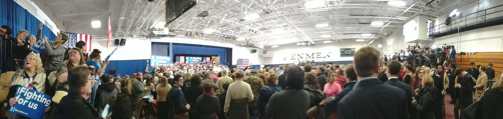
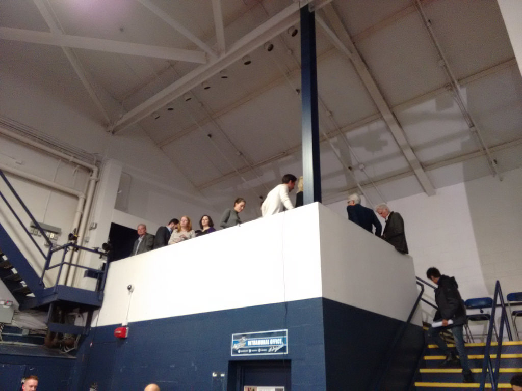
There was very loud pep-rally-type music – Taylor Swift, Pharrell and the like. And a VIP balcony populated by people like Ted Danson:
There was, however, no buffet.
As it happened, we timed our arrival perfectly, as about 20 minutes later Hillary Clinton, along with President Clinton and Chelsea, made their way to the podium, where Hillary delivery a spirited speech, part concession to Bernie Sanders and part “on to South Carolina and victory we go!”
The contrast between Bush and Clinton rallies was remarkable, given that they are running for the same position, are both running well-funded campaigns, and were holding rallies only a few miles from each other.
As I write this near midnight, Clinton’s result is 2nd place, with 38% of the Democratic vote and 79,005 votes in total.
By contrast, Bush is in 4th place, with 11% of the Republican vote and 25,859 votes in total, or roughly 1/3 of what Clinton received (albeit in a separate but parallel contest).
Neither may actually have The Big Mo, but Clinton was certainly better at acting like she does.
We timed our exit from the Clinton rally almost as perfectly, darting out before the big crowds. We were on the road a few minutes later, and back to newly-calm Peterborough, NH an hour later. Come morning, life here will return to normal.
Election day is 270 days away.
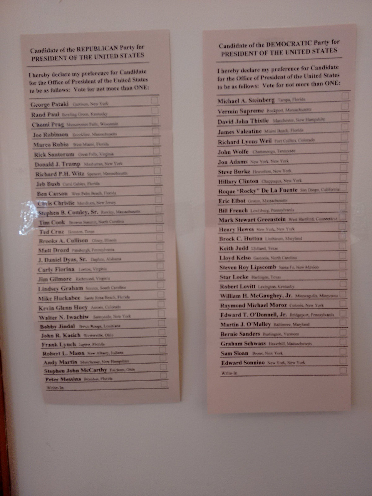
We here a lot about the big-name candidates running for President, but almost nothing about the rest. Here are the two sample ballots posted on the wall of the Dublin, NH polling station listing the choices that Republican and Democratic voters have in this Primary. Notice how you’re allowed to simply write in a name of your choice!
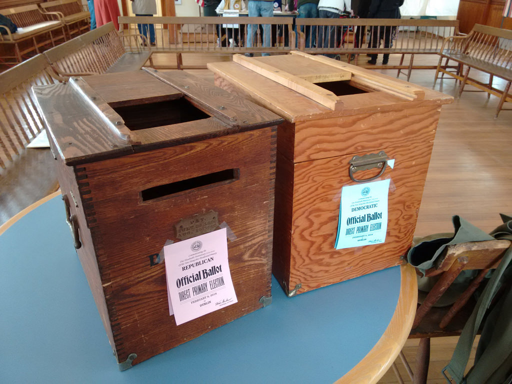
I went across the street to Dublin Town Hall to watch my friend Sherin vote in the Presidential Primary. There are two ballot boxes, one for the red Republican ballots, one for the blue Democratic ballots. The older of the two was first used in the 1890s.
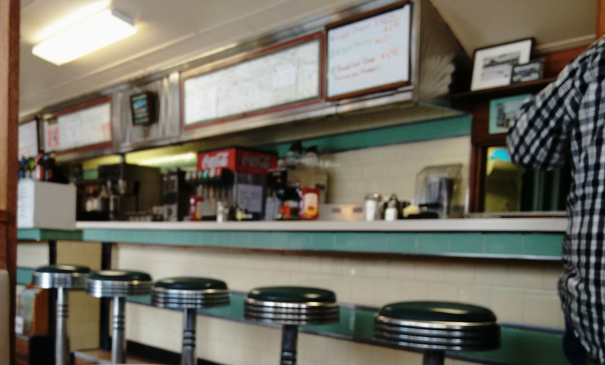
I’m starting Primary Day at the Peterborough Dinner, a ubiquitous stop on the Presidential campaign trail. Mostly deserted today, as the campaigning is all but over.

About This Blog
 I am Peter Rukavina and this is my blog. I am a writer, letterpress printer, and a curious person.
To learn more about me, read my /now, look at my bio, listen to audio I’ve posted, read presentations and speeches I’ve written, or get in touch (peter@rukavina.net is the quickest way).
I have been writing here since May 1999: you can explore the 25+ years of blog posts in the archive.
You can subscribe to an RSS feed of posts, an RSS feed of comments, or a podcast RSS feed that just contains audio posts. You can also receive a daily digests of posts by email.