Mark McQuaid passed along a pointer to Free Beer for Geeks, a WIRED story about an open source beer project in Copenhagen.
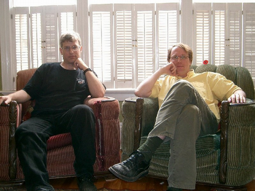
On August 6th, Derek Martin and I will transform ourselves into The Ruk City Racers to enter the Race About Charlottetown, an The Amazing Race-style event in support of the Kidney Foundation of Canada. Here’s our (totally awesome) team photo:

Do we not look trim, fit and ready to race around the city and eat worms for charity!
Word on the street is than Dan James and Nathan Frederickson are entering a team as well.
My friends Steven Garrity and Jennifer McQuaid are getting married on Friday afternoon. Today is an all-day “bachelor party” for Steven. Things began at 10:00 a.m. at Smitty’s with a hearty breakfast and are continuing as I write with 9 holes of golf out in Cornwall. Later in the afternoon there’s a rousing orgy of paintball out in York, followed by a barbecue at Dan James’s house. I was there for the breakfast, opted out of the golf module, but I’m in for violence and food.
I snapped some photos at breakfast this morning and uploaded them to Flickr with tag garritymcquaid.
We’re lucky to have a series of shows at the Confederation Centre Art Gallery this summer that relate to issues of urban spaces and social geography. Because Plazes is like a digital veneer over “real” space, it seemed like a good idea to try and bring Plazes into the conversation.
As such, I’m happy to announce that, thanks to the efforts of Shauna McCabe, Plazes creators Felix Petersen and Stephan Kellner will beam in via video for a free public session on Wednesday August 3, at 7:00 p.m. (Atlantic Daylight Time) at the Confederation Centre Art Gallery in Charlottetown. Everyone is welcome to attend in person; for virtual attendees, I’m looking into setting up a webcast (or at least a post-session podcast) and an IRC channel.
Please spread the word.
Oliver, G. and I went out to Morell this morning to the Morell branch of the Provincial Library for their book sale. While G. spent hours and hours (okay, it was only 20 minutes) porting over their wares, Oliver and I made a quick in and out and spent the rest of the time in the excellent children’s section reading Arthur and Franklin books.
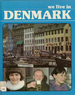
We did not come away empty handed though. For $1.00 we purchased We Live in Denmark:

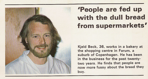
This is a book for children in a series of “We Live In…” books that includes 15 other countries. Each double-page spread focuses on one “everyday Dane” and their occupation to tell a story about Denmark. We read of Knud the pig farmer, Arne the soldier, Poul the train driver and Kasper the unemployed. My favourite, because it’s so relevant to Open Bread, is from Kjeld Beck, baker:

Speaking of Open Bread, there’s some great intelligence gathering from Olle in the discussion section over there. No loaves yet, but the horses are circling.
Rob makes a good point about technology and complexity.
 The first car I owned was a 1978 Datsun 510. Over the years it started to develop problems starting, and I traced these problems back to a problem with the teeth on the starter motor engaging with the teeth of the engine (so to speak). My solution? To replace the engine side would have required hoists and battering rams. So every three months I just replaced the starter motor.
I would drive over to the auto salvage yard, find the next Datsun 510 with a starter motor, take it off (leaving my own 510 running in the parking lot), quickly drive home, remove the faulty starter and bolt in the new one. Total cost: $35 and a couple of hours.
Cars like the 1978 Datsun 510 were simple enough that anyone, or at least anyone with a tiny bit of daring, could understand them. My confidence in this regard was greatly increased both by my father’s penchant for home car repair, and by How to Keep Your Datsun Alive, a book from John Muir Publications in the same series as the venerable How to Keep Your Volkswagen Alive. How many other auto repair books, after all, do you know that contain sentences like:
Love of life, love of things mechanical, love of things working as they should, love of our home the earth. If you care, you can do it.
My 2000 VW Jetta is beyond comprehension: open the hood and everything is cloaked inside plastic panels that scream “do not attempt to fix anything without computer assistance.” I’m not even sure if my Jetta even has a starter motor.
Another case in point: I was helping Catherine Hennessey diagnose some computer problems last week. One of her complaints was that text in her word processor kept magically disappearing. After some discussion and forensics work, we traced this back to the following key sequence: Catherine would mistakenly hit Control + A when trying to type Shift + A. As a result the entire text of her document would get selected (Control + A is a keyboard shortcut in Windows for “Select All”). Not noticing this, she would type the next letter of the word, and the word processor would then replace the entire document with that one letter.
In other words, for all intents and purposes because her finger was one key too far to the left, her entire document disappeared. As if by magic.
Catherine’s word processor (WordPerfect for Windows) can help her make tables of contents, indices and legal concordances. It has a spelling dictionary and a thesaurus and it will analyze the grammar of whatever she writes. But it can’t prevent her from easily deleting the fruits of her labours.
As with cars, word processors have become complex Swiss Army Knives. In the original old Orem, Utah, USA WordPerfect — a gentle, empty blue screen ready for typing — this never would have happened. Ye Olde WordPerfect couldn’t bake cookies, but you could change its starter motor.
I know this will make me unpopular with the Lance Armstrong set, but this whole “wristbands for X” thing is getting out of hand. In the last week I’ve seen white (poverty), pink (cancer) and yellow (strength?). And on Thursday they gave me a red one for donating plasma.

I told Oliver I wasn’t going to wear my wristband. His suggestion: use it as a key holder. Brilliant: works great, and makes it really easy to grab keys out of my pocket.
Like all other things web, it’s deceptively hard to come up with realistic numbers for “readership” or “listenership.” Web requests can come from too many places, in too many guises, to each be dependably tied to a real person.
That said, we can get a vague idea of the “listenership” of Live From the Formosa Tea House by looking at the number of times the MP3 audio files have been downloaded. This doesn’t mean they’ve been listened to, of course, but it’s better than nothing.
So here are the episode statistics, covering downloads from September 27, 2004 to the present:
- Episode One - 3,705 downloads
- Episode Two - 3,456 downloads
- Episode Three - 2,153 downloads
- Episode Four - 392 downloads
We held an impromptu “Podcasting 101” tutorial at the Queen Street Commons this afternoon. Brother Johnny, Rob Paterson, and Cynthia Dunsford were there, along with Peter West and Mark Sandiford.
We covered the same same ground I covered in this blog post, but in person: how to record audio into an iBook, the basics of editing in Sound Studio, converting to an MP3 file using iTunes.
The missing link, left uncovered, was how to take your MP3 and “turn it into a podcast.” In other words, get the MP3 on the web with a URL, and set up an RSS 2.0 feed to point at it. Unfortunately, the “free weblogging platform” marketplace — Blogger, TypePad, et al — haven’t quite caught up to podcasting yet, and so this final step isn’t easy as, say, maintaining a text-only blog.
Help is on the way, however. A good place to start is this Feedburner page that describes how you can use Feedburner to “podcastify” your TypePad or Blogger blog. This is probably exactly what Rob (TypePad user) and Cynthia (Blogger user) need.
We’re going to get together again sometime soon to cover “how to record Skype calls and turn them into a podcast.” I’ll try and give some advance notice about this so others can attend.
If you’re trying to debug problems with Java applets in Safari, you may have wondered, like me, how to see a “Java console” of the sort that’s available in Mozilla-based browsers. One way that I found, by mistake, is to Control + click on the red “X” that is displayed when a Java applet won’t run:

 I am
I am