
Johannes Kleske wrote an ode to Readwise, and, knowing Johannes to be both wise and organized, I dove in. Without bogarting his description of the app and its place in the digital ecosystem, Readwise is quickly summarized as “highlights management.”
I fed Readwise my Kindle highlights and my iBooks highlights, which amounted to a lot of highlights for someone who long ago rejected the very notion of ebooks.
The result has been a surfacing of much interesting material I’d long forgotten about, thoughts I once felt useful enough to note, now fed back to me, outside of the original flow, living to inform another day.
Like The Journal of Best Practices: A Memoir of Marriage, Asperger Syndrome, and One Man’s Quest to Be a Better Husband, a book I loved. For paragraphs like this:
But that’s clubbing. At least you can stand for hours without saying a word in a club or sneak out without being noticed. But you can’t do that at a party. At a party, you have to be present. At a party, you have to engage. Mingle. This is where my game falls apart. The social situation at a party falls way outside of my normal daily parameters. Things are not on my terms; events unfold by the terms of the gathering itself. In the midst of this, I feel that all eyes are on me—my own included—monitoring and judging my performance from start to finish. Don’t do anything wrong or unusual, because everyone will think the worst of you for the rest of your life. It’s pretty fucked-up in my opinion.
Readwise is more than simple management of highlights: it’s got some light gamification built in, some very flexible highlight-sharing tools, and has proved simply fun to use.
(Coincidentally, Ton has been experimenting with highlights management too, using an Obsidian plug-in.)
On Sunday I went wandering on the web, ambling about as I sometimes do.
“I should go to a bookbinding workshop!”, I thought to myself. “In Stockholm!”
Post-COVID thoughts were afoot!
So I Googled stockholm bookbinding school.
Top search result: The Travelling Bookbinder’s Guide to Stockholm.
Well that’s interesting.
But who’s The Travelling Bookbinder?
There’s an excellent video on The Travelling Bookbinder’s website that answers exactly that: she is Rachel Hazell.
As teacher, author and traveller, books, words and the power of imagination have always been central to Rachel’s life. She believes that everyone has a book inside them, and loves sharing the satisfying experience of creating unique artwork, in the most inspiring places.
Hazell is a part time resident of the Scottish island of Iona, and in the video there’s a quote that caught my ear:
The thing about islands is there’s less space between Heaven and Earth.
Living on an island as I do, I feel that to be intuitively true.
I emailed her to ask her more about this idea; she quickly replied, pointing me to George MacLeod, founder of the Iona Community, who, she related, she had paraphrased.
Here’s a passage, oft-quoted, from Ron Ferguson’s biography of MacLeod, George MacLeod (emphasis mine):
The cattle were certainly lowing in the ruins, but they were moved out of the choir as the rebuilding proceeded. By 1910, the Abbey church had been beautifully restored. A communion table of genuine Iona marble was placed in the sanctuary. The island continued to attract pilgrims, and students came for retreat. The first principal of St Colm’s College, Annie Hunter Small, dearly loved Iona and brought students to the island at least as early as 1913. George was to say later that Miss Small turned his attention to Iona. The Reports of the Schemes of the Church of Scotland for 1921 refers to a retreat held by divinity students the previous year.
The retreats had been started and funded in 1920 by Dr David Russell, who had enlisted the enthusiastic help of George MacLeod from the beginning. George was a popular lecturer at the annual Iona events. The potential of Iona for retreat, renewal and ministerial formation was obvious to him. The history of Iona and its special atmosphere – he described it as a ‘thin place – only a tissue paper separating earth from heaven’ – greatly appealed to him.
I went looking on YouTube to see if I could find any evidence of MacLeod discussing this, and found this excerpt of the 1960s film Sermon in Stone, narrated by MacLeod himself:
“We began to ask,” says MacLeod in the film, “could we make a permanent experiment of cooperation between Sunday and Weekday? ‘Come to Iona,’ a spirit seemed to say, ‘and do it in the large.’ Iona’s a very thin place, only a bit of tissue paper between things spiritual and things material.”
My relationship with the spiritual realm is weak, and so perhaps the tissue paper is more opaque for me than for others; but for reasons I do not completely understand, I am drawn the the notion of islands as portals between Heaven and Earth, and of MacLeod’s “thin places.”
Hazell finished her email pointing me to a review she’d posted of the book Thin Places, by Kerri ní Dochartaigh; here’s a video introduction to the book. Reading it is my next project.
I should still go to Stockholm–or better yet Iona–to take a bookbinding course, but I’m happy for the diversion that my search inspired.
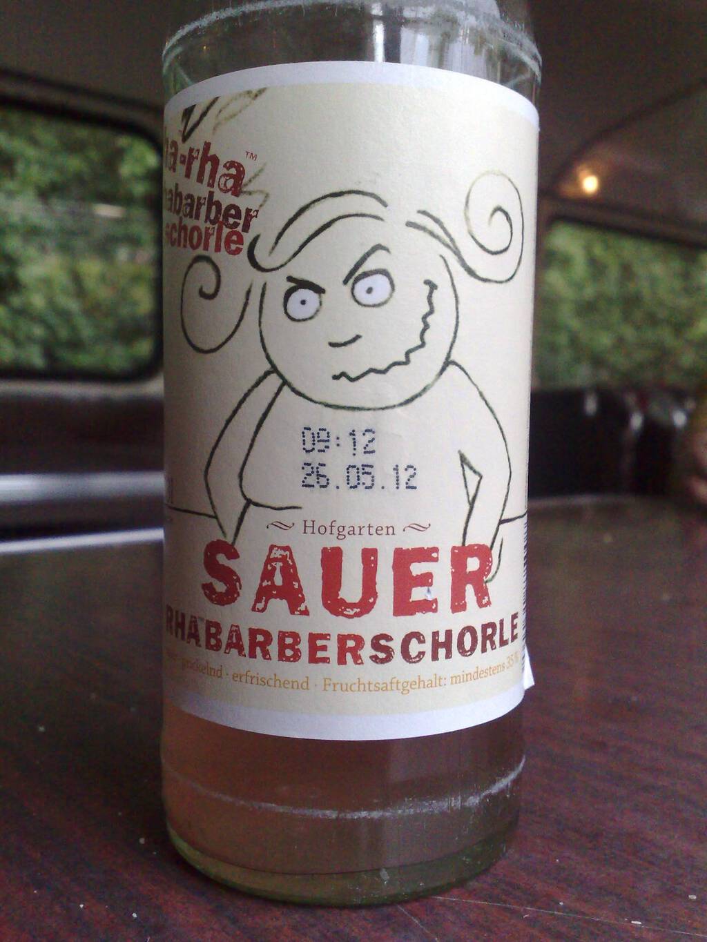
My favourite summertime drink when in Germany is Rhabarberschorle, a rhubarb spritzer. Here’s a bottle I enjoyed in 2011 in Berlin:
With rhubarb in season, I resolved to make some for myself. It’s really easy:
- Cut some rhubarb up.
- Place it in a little water in a pot and heat it on medium-high until it’s satisfyingly mushy.
- Strain the juice out into a bottle.
- Spritz up some soda water in the Sodastream and add the rhubarb juice to taste.
You can add sugar if you must, but I recommend you start without sugar, as rhubarb doesn’t really need it as much as you think it might.
Seventeen years ago today I was in Montréal, and brother Steve and I found ours way to Délices de l’île Maurice for supper.
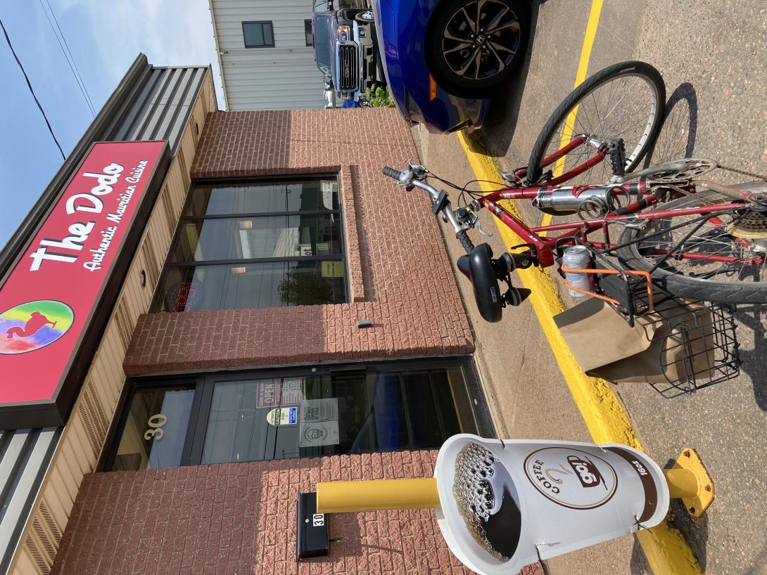
Partially due coincidence, and partially due my love of leveraging coincidence for whimsy, today for lunch I cycled out to the equine district of town to lunch at The Dodo, the Mauritian takeout joint that opened three weeks ago.
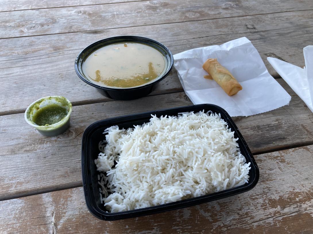
My order was ready for pickup when I arrived, and it neatly fit in my cycle carrier. I took advantage of my proximity to J. Frank MacAulay Park to scootch down Bills Lane and in the back door of the park, where I enjoyed my tasty lunch of spring roll, shrimp curry, basmati rice, and sparkling water under a gazebo beside the swale.
Lunch presented two mysteries: why The Dodo, and who was J. Frank MacAulay?
The first was easily answered in Wikipedia: the now-extinct dodo was native to Mauritius (its extinction seems to have been more due to humans introducing predators, and destroying habitat, than hunting the dodo itself).
The answer to the second question remains elusive: just who was J. Frank MacAulay (and why is there nothing in the park that bears his name to tell us)?
 ,
, 
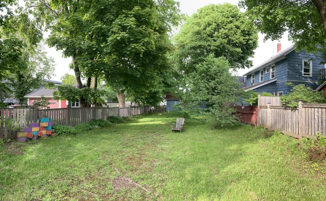
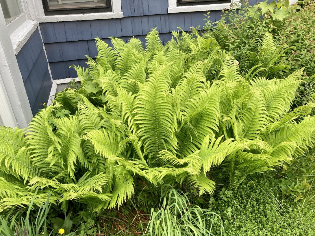
The large back garden is one of the great aspects of 100 Prince Street, and never is it more beautiful and verdant than in June.
Two years ago—can it really been have been so little and so long ago both?!—the back garden was filled with Crafting {:} a Life conversations and we were all feeling lucky to be alive.
Postscript: as proof that seasons have patterns and my perception of seasons also has patterns, I noted the same thing, almost exactly a year ago, with exactly the same post title.
Crocuses gave way to tulips. Tulips have given way to ferns.
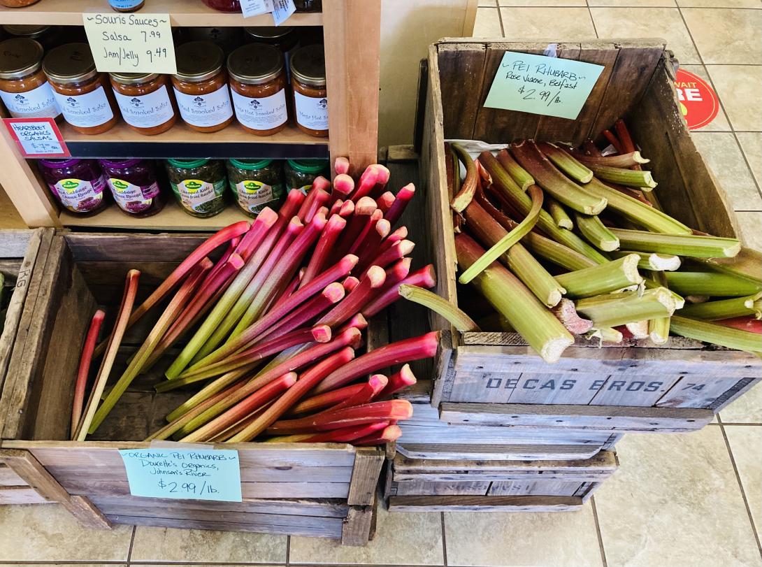
Having exhausted our supply of front yard rhubarb, we were forced into the inexorable choice between Johnston’s River rhubarb and Belfast rhubarb.
I would have loved Barenaked Ladies’ new song New Disaster based solely on its creative rhyming of prestidigitation: they’re the only band on Earth that could get away with that with such aplomb.
But it’s also a catchy track, with lyrics on the needle of the zeitgeist, and a chorus that’s infected my ears:
Here comes the new disaster
Here comes the end of days
Next up the sweet hereafter
We’ll tell you all about it at the next commercial break
Stay tuned for scary monsters
Watch out for rising tides
But first a word from sponsors
Might be a mess but it’s a hell of a good time
Perfect.
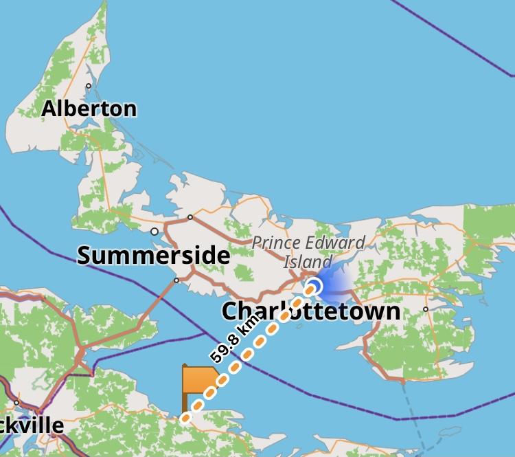
I’m certain there are many estimable women in Pugwash for whom I’m an ideal suitor. And, let’s face it, who wouldn’t want to date a gal from Pugwash. The only strike against it is that it’s 2 hours away by bridge, 3½ hours by ferry.
Unless it’s Bumble that’s doing the calculating, in which case Pugwash is a mere 59 km from my front door. Because Bumble measures as the crow, or bee, flies.
Now Bumble provides many mechanisms for nudging you to possible consorts: you can filter by age, height, politics, or religion. You can filter out smokers. Or people who do (or do not) want children. But surely one of Bumble’s most basic levers is distance, especially in the time of COVID, when our Island is even more an island than usual.
So while I’d happily pop out for coffee with someone from Park Corner (46 km), or grab a drink with a friendly face from Cable Head East (49 km), Pugwash, for the moment and perhaps forever, falls outside my range.
And it’s not just Pugwash.
Let’s say I fancied a date from Miminegash (hours of fun just saying that euphonious wonder of a name alone): it’s 110 km away, as the bee flies. That becomes 136 km and 1¾ hours when you get driving directions, but it’s on the Island.
Alas, within the same 110 km radius you’ll also find Shediac (110 km), Springhill (98 km), Truro (97 km), and Antigonish (110 km). I can attest, from my casual Bumble swiping, that these communities are filled with perfectly wonderful possible assignations, but they are, literally, an ocean (and several prohibitory public health orders) away.
Now this isn’t a real romantic problem for me: I’m remarkably happy as I am, and have come to treat Bumble, as apparently many have, as much as a sort of curious hobby as anything else. But it’s an interesting computational problem.
How could Bumble do better?
In my case, an “in my Province only” checkbox, added to the distance slider, would work well. But that’s not going to solve the problem for people, say, on Bainbridge Island, WA who would happily look for a date up the road in Suquamish, WA (14 km), but aren’t interested in a ferry-mediated courtship with any of the millions of someones in Seattle, WA (13 km).
Ultimately, travel time is what we’re really interested in when looking at potential suitors.
While the algorithmic challenge might seem to be “calculate the travel distance between me and every Bumble prospect in the world,” it’s actually much simpler than that.
First, there’s never a situation where the “as the bee flies” distance is shorter than the travel distance; indeed, it is the shortest possible distance. So the challenge is the much more reasonable “calculate the travel distance between me and every Bumble prospect inside this radius.”
Second, the world is, relatively speaking, immutable, so as Bumble learns the travel time from Charlottetown to Pugwash, and Charlottetown to Miminegash, and Charlottetown to Shediac, it can build a model of the “reasonable travel” landscape, and save computing in real time on every go.
And, finally, there are only a limited number of places on Earth where this matters at all: islands far enough practically disconnected from mainland populations and, perhaps, people living on opposite sides of mountains.
And that’s why this is a problem unlikely to ever be addressed: the dozen or two single Prince Edward Islanders are far enough down the analytics report at Bumble HQ to be practically invisible.
So the lonely hearted of the Island will simply have to get used to swiping left on the forbidden fruit of the mainland.
About This Blog
 I am Peter Rukavina and this is my blog. I am a writer, letterpress printer, and a curious person.
To learn more about me, read my /now, look at my bio, listen to audio I’ve posted, read presentations and speeches I’ve written, see things I’ve favourited elsewhere, or get in touch (peter@rukavina.net is the quickest way).
I have been writing here since May 1999: you can explore the 25+ years of blog posts in the archive.
![]() You can subscribe to an RSS feed of posts, an RSS feed of comments, an RSS feed of favourites elsewhere, or a podcast RSS feed that just contains audio posts. You can also receive a daily digests of posts by email. I also publish an OPML blogroll.
You can subscribe to an RSS feed of posts, an RSS feed of comments, an RSS feed of favourites elsewhere, or a podcast RSS feed that just contains audio posts. You can also receive a daily digests of posts by email. I also publish an OPML blogroll.
Instagram • YouTube • Vimeo • ORCID • OpenStreetMap • Internet Archive • PEI.art • Drupal • Github.