I viscerally remember the 1979 NBC show Supertrain: more so than any TV show or movie I’d seen before, it showed a tantalizing vision of the future that I could get behind. A train with a swimming pool: imagine.
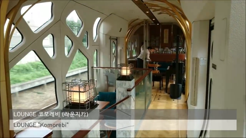
Nothing in the real world had ever come close to Supertrain until I saw this tour of the E001系, an amazing Japanese luxury train that features two-level suites, fireplaces, and an observation car that puts VIA Rail’s dome car to shame.
 ,
, 
From David Noel’s Friday’s Five newsletter, a pointer to a video love letter to Berlin by Bob Mould.
We spent most of August 2011 living in Berlin; the way I’ve long-described that amount of time was that in the middle of the month it was far enough both from arriving and departing that it felt like we were really there.
I’ve been back to Berlin several times since then, but only for short 2 or 3 days jaunts; they’ve been lovely trips, but they haven’t had the magic of 2011.
Somewhere in the back of my mind I think I’ve decided the one day someday I will actually live in Berlin. I don’t know when this will be. But I hope it comes true. In the meantime, we will continue to flirt.
If you’ve been following along with my documentation of Crapaud and its roundness, might want to visit the updated Did Crapaud incorporate “in order to purchase a short piece of fire hose?” (Or, How Crapaud came to be Round). I’ve added some materials I came across a couple of days ago in the folder related to the 1950 plebiscite in the collection of the Public Archives.
The Province of PEI has a Civic Address Communities data layer in its GIS Data Layers offering. Civic Address Communities are used solely as the basis for civic addressing: they aren’t real communities, neither in the sense of community identity nor incorporation; they are simply polygons on a map offering 100% coverage of the Island, something that the civic addressing system requires.
As I showed yesterday, it’s possible to “live in Crapaud,” for example, but to have a civic address in Tryon.
Here’s a quick walk-thru showing how you can use the province’s Civic Address Community GIS layer, along with the open source QGIS software, to find the smallest (and the largest) civic address community, by area.
First, download the Civic Address Communities shapefile and unzip it.
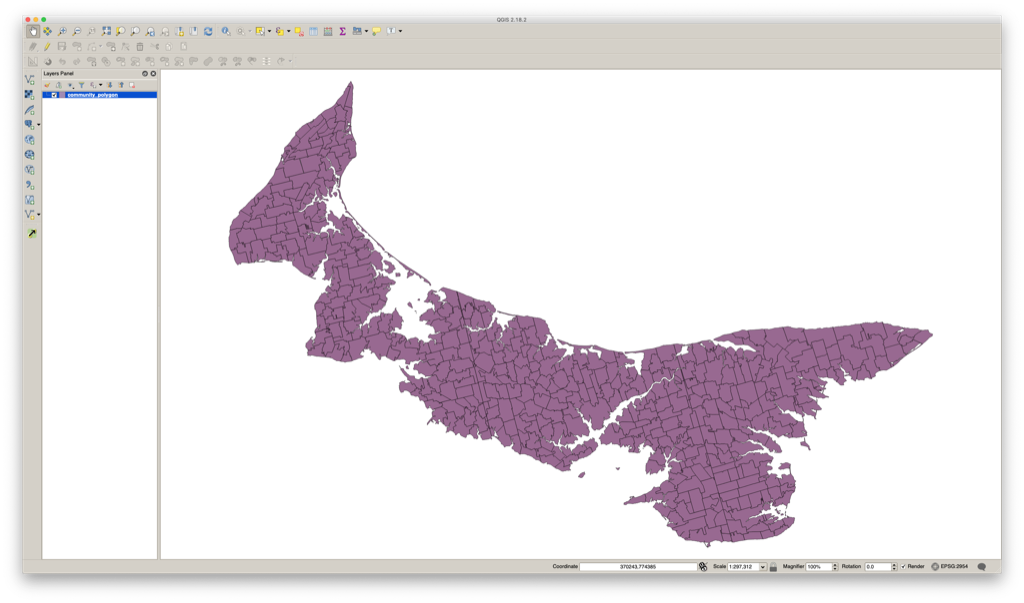
Start QGIS, and open the shapefile with Layer > Add Layer > Add Vector Layer. It will look like this:
Next, install the Group Stats plugin–Plugins > Manage and Install Plugins from the menu–and then select Vector > Group Stats > GroupStats and set it up like this:
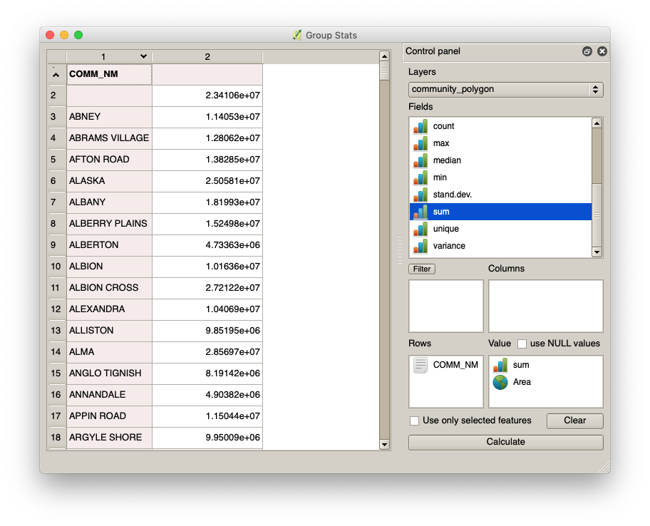
Drag COMM_NM into the Rows box, and then both sum and Area into the Value box and click Calculate and you’ll see the list of communities and the total area of each community’s polygons (in square meters).
Click on the column header for the total area to sort in ascending order of area; click again for descending order of area.
What you’ll find is that:
- The smallest Civic Address Community is Pinette, at 70,216 square meters (17 acres).
- The largest Civic Address Community is Charlottetown, 44,437,948 square meters (10,980 acres).
The case of Pinette is an interesting one: not only is it the smallest civic address community, but it also only has two civic addresses in it, the first for a house that, although its road entrance is in the Civic Address Community of Pinette, is actually physically in the Civic Address Community of Belfast, the second for Pinette Provincial Park
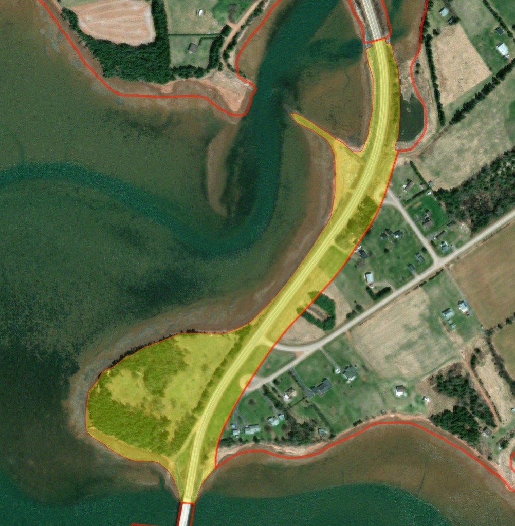
To the north of Pinette is the Civic Address Community of Mount Buchanan, to the east is Belfast and to the south is South Pinette.
South Pinette, by comparison to Pinette, is, at 2,771 acres, absolutely massive; why what is carved out as Pinette isn’t simply a part of South Pinette is a mystery apparently lost to time.
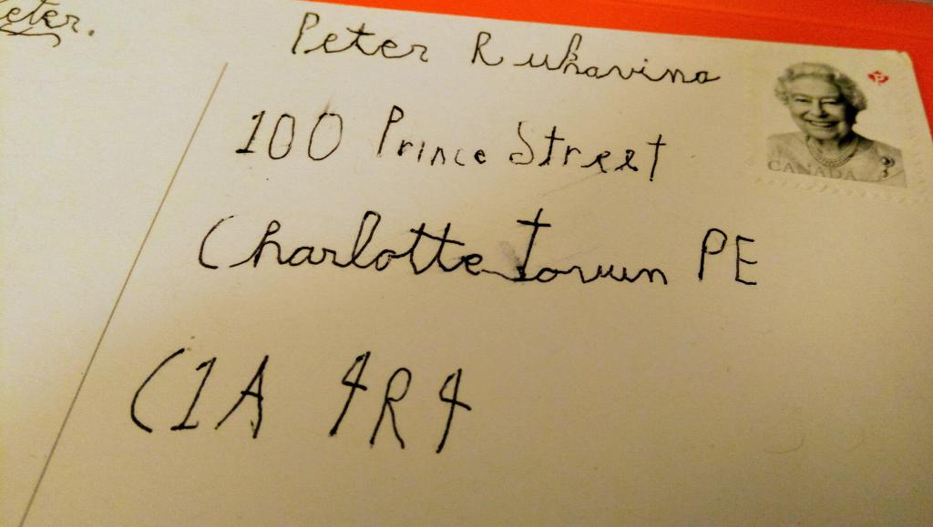
The greatest thing about mailing things to my young nephew is that he mails me back.
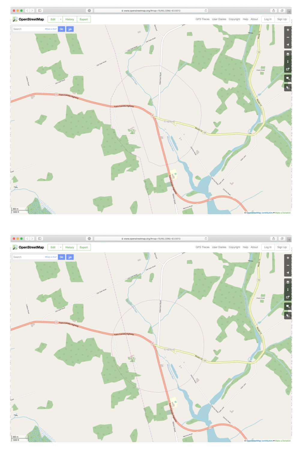
Being immersed in Crapaud’s roundness, I decided it was finally time to do something about how grossly inaccurate Crapaud’s representation in OpenStreetMap was: somehow, when boundary was imported as part of a national data set, the Crapaud boundary became a part of the Prince-Queens county line, a sort of loop-de-loop, rather than a distinct boundary.
Here’s a before-and-after animated GIF to show what I did today:
Given the atypical amount of time that I spend in Crapaud (for a non-resident), I have a particular interest in its geography–see Why is Crapaud Round? and the follow-up Did Crapaud incorporate “in order to purchase a short piece of fire hose?” (Or, How Crapaud came to be Round).
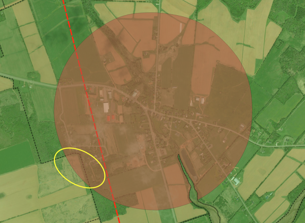
My study of Crapaud’s geography today led me to the issue of the village’s bisection by the Prince-Queens county line (the dashed red line on the map below). This means that part of Crapaud is in Prince County and part of it is in Queens County.
But it’s even more interesting than that, as in additional the boundary of the Rural Municipality of Crapaud–the circle with a radius of one-half mile from the “Crapaud corner,” shown as the brown circle on the map–there’s also the civic address community of Crapaud, a kind of parallel universe that is used by the civic addressing system (shown on the map with a black dashed line).
Oddly–though perhaps understandably given the clash of the round boundary with the non-round boundary–there’s a part of Crapaud (the municipality) that is not in Crapaud (the civic address community), but rather in Tryon, to the west.
I’ve circled this area in yellow on the map below: it’s about 11 acres in size, and this geographic dual nationality is not, I imagine, a day-to-day practical calamity as the area in question is part of one property (PID 456244) that fronts onto the Victoria Road and the Foy Road in Tryon, but has no civic addresses associated with it, as it’s not an improved property.
One wonders, however, whether the Rural Municipality of Crapaud levies taxes on its share of the property. More investigation needed.
I’m organizing an unconference for June 7 and 8, 2019 here in Charlottetown, in part to mark the 20th anniversary of this blog.
It’s called Crafting {:} a Life, and it has a website all its own.
As I wrote there:
The unconference is by invitation only; think of it more as a “party of friends and familiars with intention” and less “we need to get the word out on the socials.”
That said, if you are reading this, it’s entirely possible that you’re exactly the kind of person it would be great to have there, and I didn’t invite you either because (a) we’ve never met, (b) we have met but we’ve never exchanged email, so I had no way of getting in touch.
As such, if, after reading about the unconference’s theme and format, you think “oh my, that’s for me,” please drop me a note.
My small side-career as a professional writer continues this week with The Science of Making Nylon and the Art of Blending Tea, a post for Lady Baker’s Tea about throwing things together and seeing what happens.
Ask an Islander where you can get a cup of tea near Crapaud on a cold winter’s afternoon and I’d hazard a guess that very few would recommend Kinkora: although the two communities are near each other, they inhabit distinct regions of the psychgeographic Prince Edward Island landscape.
This is partly due history: Kinkora is historically Catholic, Crapaud historically Protestant. They’re in different counties—Kinkora in Prince and Crapaud just across the border in Queens—and in different electoral districts.
Geography does not foster close ties either: the area between them, encompassing Maple Plains and Lady Fane, has only tertiary roads running through it, and both Kinkora and Crapaud lie on major east-west routes.
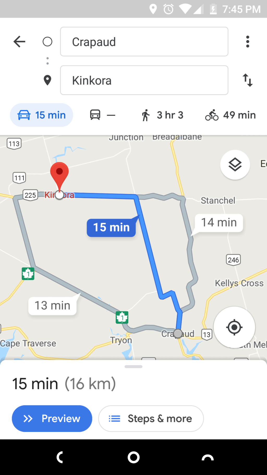
And yet you can drive between them in 15 minutes, even in winter, and the roads are well-plowed and the scenery compelling.
But ask an Islander in Crapaud running low on gas where they’d drive for a fill-up, and about half would say New Haven, about half would say Borden, and very few, unless Kinkorian themselves, would head to Kinkora (even though Borden, New Haven and Kinkora are all the same distance).
I took advantage of Kinkora’s proximity today, while Oliver was studying art in Crapaud, drove the 15 minutes northwest, and enjoyed a Caesar salad and a pot of tea in O’Shea’s Pub & Eatery.
What an interesting Island we live on.
 I am
I am