
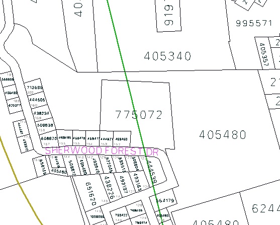
Back in April I wrote about the curious case of South Shore Villa, a community care facility in Crapaud, PEI that’s bisected by the Queens County-Prince County boundary; in this map it’s shown as property 775072, right in the middle, and the county line is shown in green:
My friend Ray was instrumental in the development of South Shore Villa back in 1990, and, knowing that I’d be in Crapaud again yesterday, I asked him if there was any obvious physical manifestation of the county line boundary on the property.
Ray told me to look for a concrete pole in the forest in front of the facility and, sure enough, that’s exactly what I found when I went looking yesterday:
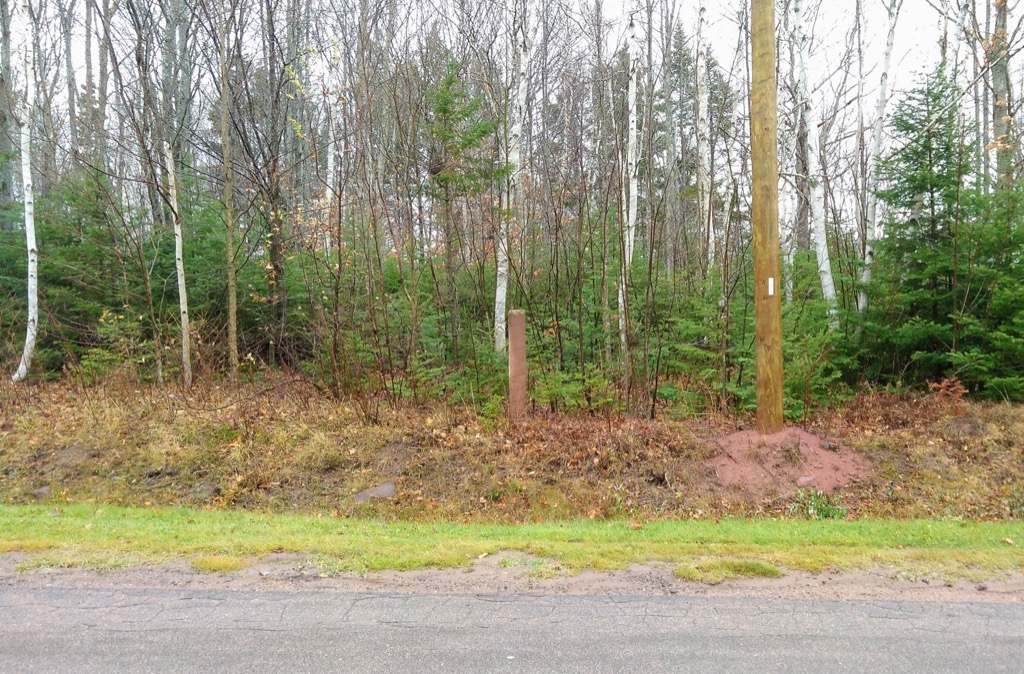
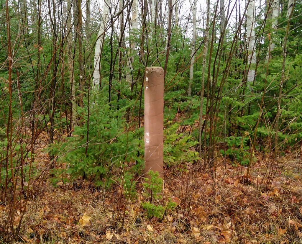
The pole was set there, Ray tells me, in the spring of 1990; it’s in remarkably good shape for a 27 year old piece of concrete.
I love marks on the earth that make the fictional non-fictional.
If you’re out and about looking for the pole, set your GPS for 46.2371944 N, 63.5054333 W and you’ll find it. Or if you’re there as you read this, you’ll know right where you are on the surface of the Earth.

Comments