When one of the installations in the Rooted in Art project went up next door, and I discovered that all of the trees in the city have an ID number, as part of an “urban tree inventory,” I got very curious about that data, and I requested a copy from the City of Charlottetown. This request was turned around quickly: I needed to sign and return a “digital data agreement,” and I received a CSV file with records on 10,000 trees shortly thereafter.
It turns out that the inventory is not of every tree in the city, only the “street trees,” as described here. One of the things I gleaned from that explainer is that we have too many maple trees. Apparently a diverse tree population doesn’t have more than 10% of the same species; the inventory counts 24% Norway maples.
To run this test myself, I imported the CSV file into a MySQL table, and ran this query:
select count(*) from `trees`.`UrbanTreeInventory` where `species` = 'Maple Norway (Acer platanoides)'
Sure enough, there are 2,384 Norway Maple trees in the inventory – 24% of the total.
There are 133 species in the inventory in all; here are the top 10, by count:
2384 Maple Norway (Acer platanoides)
1372 Spruce White (Picea glauca)
787  Linden Littleleaf (Tilia cordata)
537  Birch White (Betula papyrifera)
451  Maple Red (Acer rubrum)
374  Oak Red (Quercus rubra)
362  Ash Green (Fraxinus pennsylvanica)
220  Maple Sugar (Acer saccharum)
166  Maple Silver (Acer saccharinum)
138  Ash White (Fraxinus americana)
This comes from this MySQL query:
select species,count(*) as howmany from `trees`.`UrbanTreeInventory` group by species order by howmany DESC
The diameter of each tree is in the inventory too; there are 73 trees with a diameter of more than 100 cm. To see these I used this MySQL query:
select species,latitude,longitude,diameter from `trees`.`UrbanTreeInventory` where diameter >= 100 order by diameter DESC
I exported the result from that query as a CSV and imported it into geojson.io to see these big trees on a map:
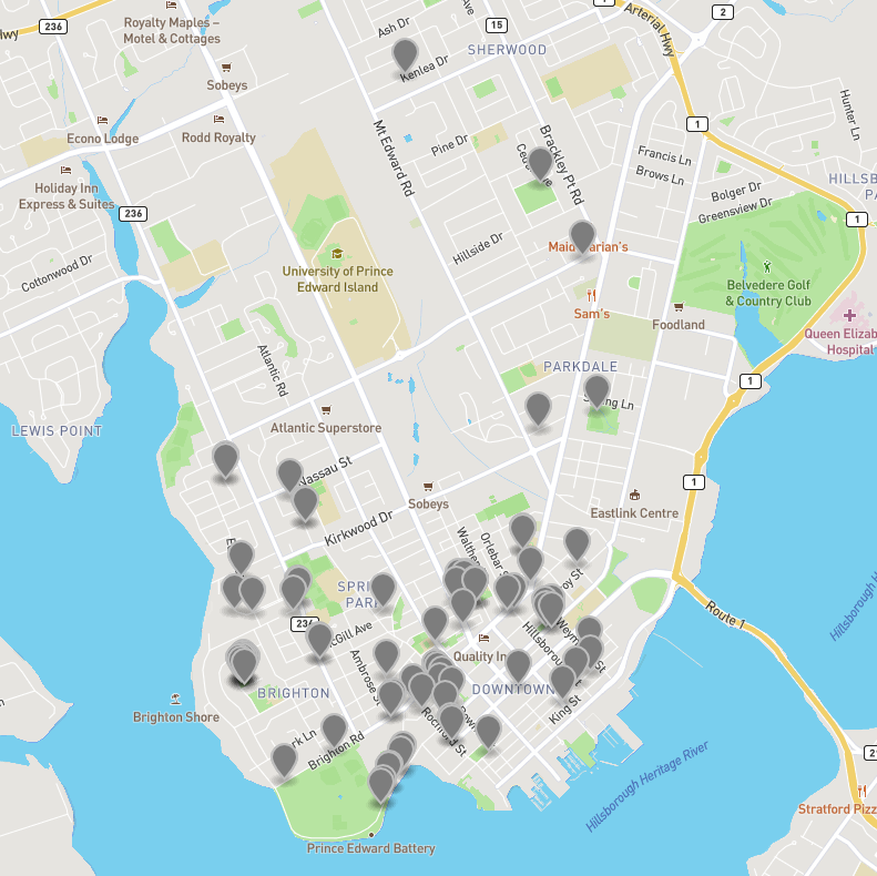
The tree with the largest diameter is 155 cm across, a silver maple in St. Clair Park in Brighton. I had to go and take a look at this tree for myself, so I stopped writing this blog post, grabbed my bicycle, and went to do some field research:
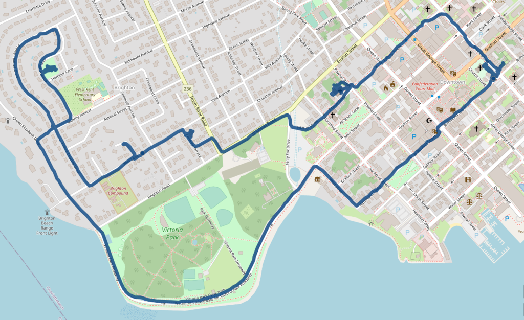
Careful map-readers will note that I made two stops along the way: first at Lady Baker’s Tea to pick up some organic Assam tea (with th bonus of a chat with friends Sandy and Katherine), second at Brighton Clover Farm to purchase some sumac and some green wheat.
Continuing on through to deepest, toniest Brighton, I came to the aforementioned St. Clair Park, upon which I’d never laid eyes; truth be told, I’d never noticed that St. Clair Avenue runs up the western side of West Kent Elementary School.
Once I arrived at the park, I took advantage of having added the large silver maple to OpenStreetMap just before I left; this allowed me to walk right up to it, phone in hand:
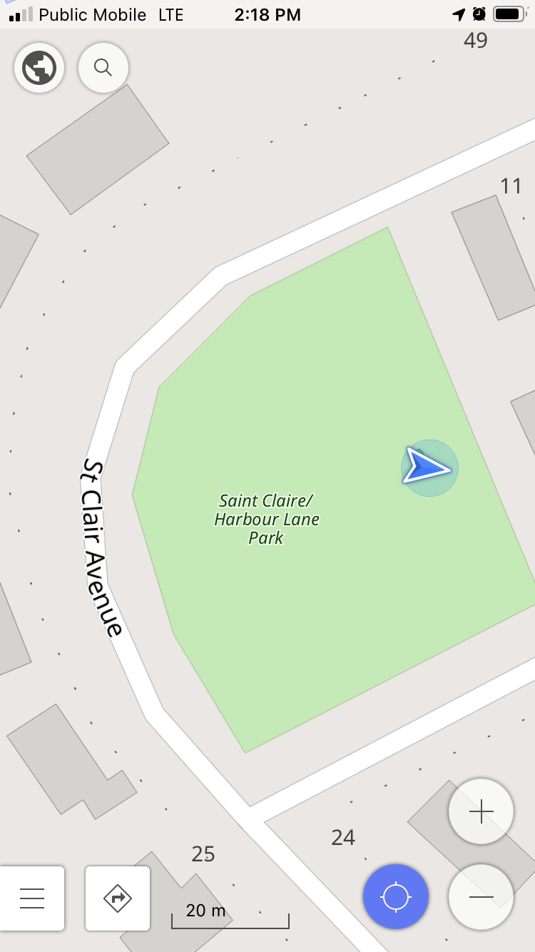
And it is, indeed, a grand tree:
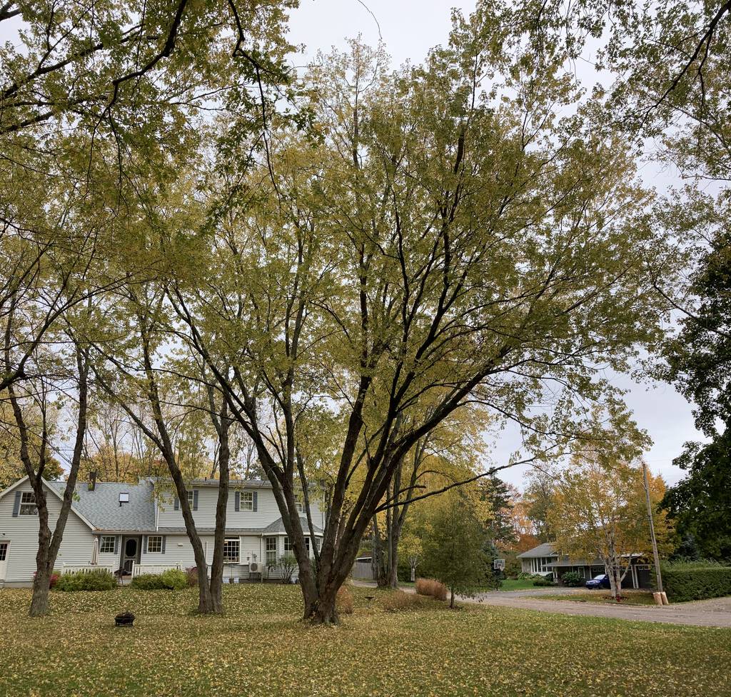
It’s 155 cm diameter can be explained, in part, by it’s hydra-headed base:
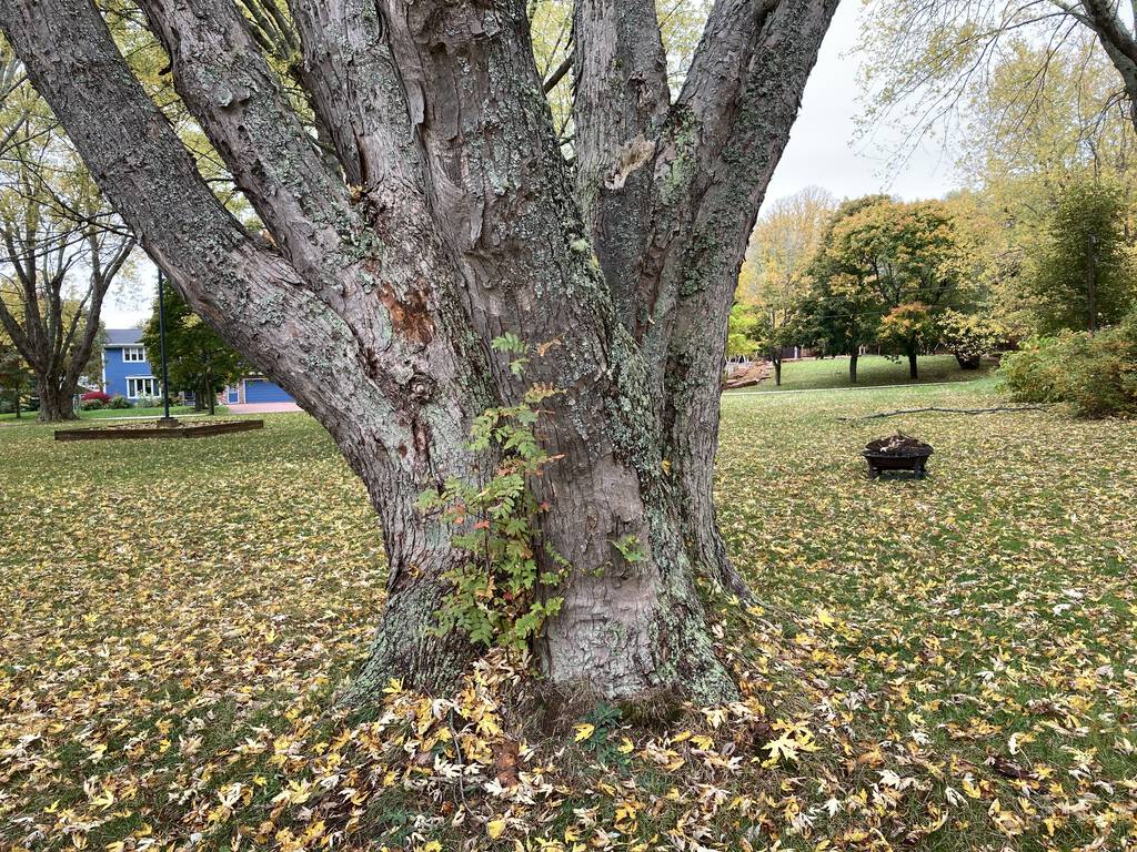
St. Clair Park turns out to be home to eight of the top-100 trees, by diameter, all of them silver maples:

While I was standing in St. Clair Park, looking at its impressive community of trees, I wanted to know more about each one, but I didn’t have ready access to the inventory database on my phone. Which has me thinking that a mobile “hey, what’s that tree?” app might need to be added to my project list.
So, what do we do about having too many maples?
Here’s what the city has to say:
- Plant fewer maple trees… but don’t stop planting them as we don’t want a big gap in the succession of the urban forest where there are no maples
- Stop planting Norway maples – they are invasive. The City has not been planting Norway maples in our Parks for over 13 years and have not been planted as street trees for a number of years
- Look for and plant alternate tree species that serve the same purpose (foliage color, shade tree, etc.) in the urban forest. More tree species means greater biodiversity and forest health
We may have too many maple trees for our own good, but those ones in St. Clair Park are awfully impressive, and I recommend you pay the park a visit while they are still in leaf; it’s a wonderful part of the urban landscape to experience in the autumn.
 I am
I am
Comments
What was in the "digital data
What was in the "digital data agreement"?
Lists of trees, and 'monumental trees' (that are regarded as special due to their age, size, or local history), are often the first open data set published by municipal governments here in Netherlands. It is sometimes joked about, and once I encountered a civil servant refusing to release the list (because his list had a field for when maintenance is needed next. It had a label 'urgent' which in tree timescales actually meant 'sometime in the next 2 years', and we were discussing publication in a period of fall storms, he feared a barrage of phone calls. Instead we changed the labels from the qualitative urgent into the quantitative 1-2 years)
But tree open data does have its own re-use niches. It's been used to plan city walk guides, and it helps gardeners: they regularly get phone calls 'can you plant a tree in my garden, like the beautiful one on the corner of X-street?', and they then used to drive there to check what tree it was. Now they just look it up.
Also LIDAR images are being used to determine height and width of tree crowns (e.g. here http://boomregister.nl/overzichtskaart-van-de-bomen-in-nederland/ )
Here’s the Digital Data
Here’s the Digital Data Agreement, in its raw form.
Under “Narrative description of the use of the Digital Data” I wrote “research and experimentation,” which was honest.
This agreement extends, obviously, from a pre-open-data era (the first question from the holder of the data, when I emailed to request it, was, gently, “what do you want this for?”). The prohibitions against share-alike and value-added derivatives, for example, stick out.
Hi Peter, if I knew you were
Hi Peter, if I knew you were in “our” park I would have invited you in for coffee! We are very, very lucky to have those beautiful trees in our backyard.
This is a most interesting
This is a most interesting blog post. Well done Peter! As a lifelong dendrophile I am quite surprised that I have never heard of this tree inventory. So much more can be done with this information starting with a creating an easy to search library of photographs of each tree to which the public can add to. It would be a valuable resource to be able to contribute and obtain research on each entry in the urban tree inventory. Additionally links to stories about how the trees came to be planted could be included such as this one: http://peihistory.blogspot.com/2015/06/a-verdure-of-living-beauty-arbor-day-in.html?m=1
I also recently discovered St
I also recently discovered St. Clair Avenue after visiting a friend who bought a house there in September. I’m not surprised at all that it is home to several trees of note - it’s got a dense ceiling which you notice immediately when coming in from the north end of the avenue.
Really great stuff, Peter. I
Really great stuff, Peter. I was involved in a large scale tree survey a few years back and we had to grapple with some rather poorly-formatted CSVs of partial street tree data to augment our own findings. It wasn't easy, though admittedly it was done when I didn't know much about spreadsheet wrangling. I wonder if the public information is in better shape now. From what you and Ton say above, and from what I've seen recently, urban tree data seems to be becoming quite common and open access.
On an unrelated note, your use of toniest made me smile; I recently stumbled across tony for the first time in another (north American) blog I read and had to look it up. Never seen it before.
What a delightful spot! I’m
What a delightful spot! I’m sitting here now, enjoying the sunshine, the breeze, the many bird calls, and this exquisite little park. Thank you for the tip Peter!
Add new comment