
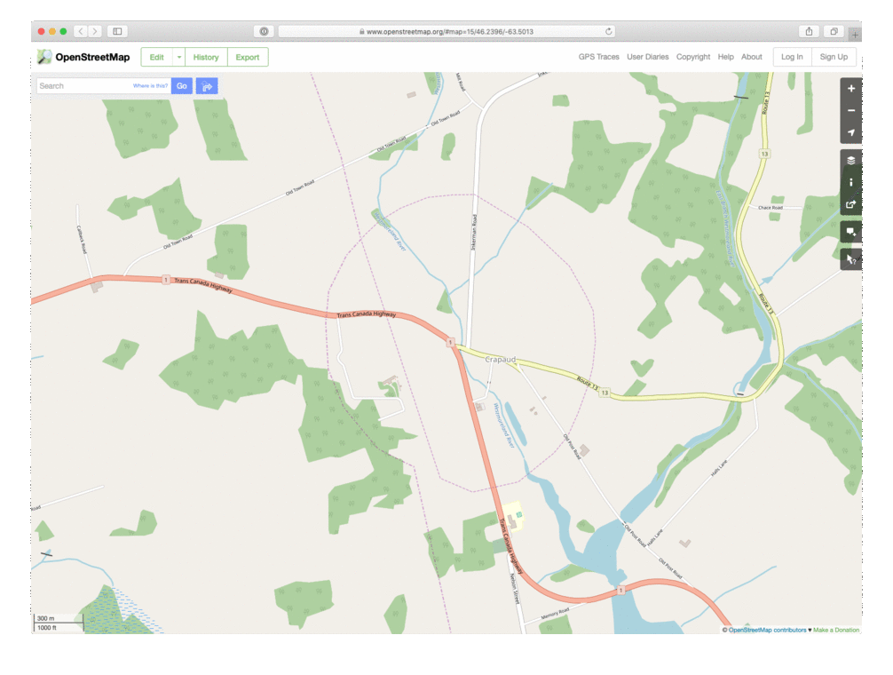
Being immersed in Crapaud’s roundness, I decided it was finally time to do something about how grossly inaccurate Crapaud’s representation in OpenStreetMap was: somehow, when boundary was imported as part of a national data set, the Crapaud boundary became a part of the Prince-Queens county line, a sort of loop-de-loop, rather than a distinct boundary.
Here’s a before-and-after animated GIF to show what I did today:
About This Blog
 I am Peter Rukavina and this is my blog. I am a writer, letterpress printer, and a curious person.
To learn more about me, read my /now, look at my bio, listen to audio I’ve posted, read presentations and speeches I’ve written, see things I’ve favourited elsewhere, or get in touch (peter@rukavina.net is the quickest way).
I have been writing here since May 1999: you can explore the 25+ years of blog posts in the archive.
![]() You can subscribe to an RSS feed of posts, an RSS feed of comments, an RSS feed of favourites elsewhere, or a podcast RSS feed that just contains audio posts. You can also receive a daily digests of posts by email. I also publish an OPML blogroll.
You can subscribe to an RSS feed of posts, an RSS feed of comments, an RSS feed of favourites elsewhere, or a podcast RSS feed that just contains audio posts. You can also receive a daily digests of posts by email. I also publish an OPML blogroll.
Instagram • YouTube • Vimeo • ORCID • OpenStreetMap • Internet Archive • PEI.art • Drupal • Github.
Comments
The link to "Crapaud’s
The link to "Crapaud’s representation in OpenStreetMap" is broken.
Thank you. Fixed.
Thank you. Fixed.
Add new comment