
I decided that it was only right, given the work I’ve been doing with OpenStreetMap on the UPEI campus, that I should revisit the neighbourhoods closer to home too. Given that my life is lived, in large part, around Queens Square in downtown Charlottetown – office on one end, home on the other – that seemed like a good place to start. So, over the last few days, I’ve been fleshing out details, to the point where things look like this now:
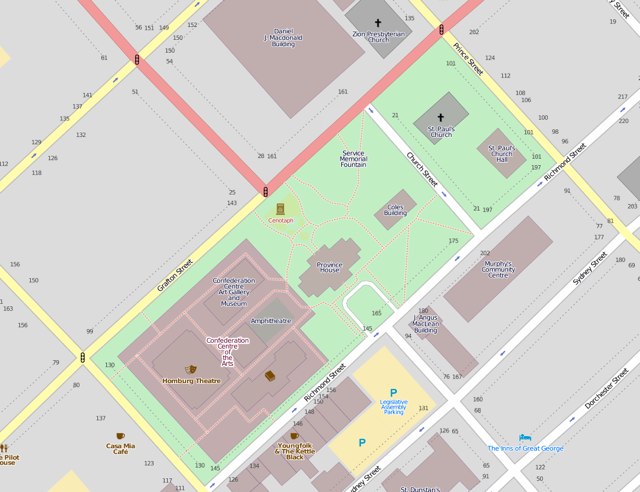
I added all the foot paths through the square, made some adjustments to the setup of the Confederation Centre of the Arts so that its footprint is clearer, and added monuments and fountains. You can take a look for yourself (and join in the effort – just click Edit) at OpenStreetMap.org.

Comments