
My colleague Matthew sent me a link to this compelling GIS application that allows exploration of the provincially-maintained roads on Prince Edward Island by annual average daily traffic:
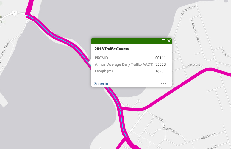
The busiest road on the Island in 2018 (the latest year for which data is presented) was the Hillsborough Bridge between Charlottetown and Stratford, with 35,053 vehicles per day:
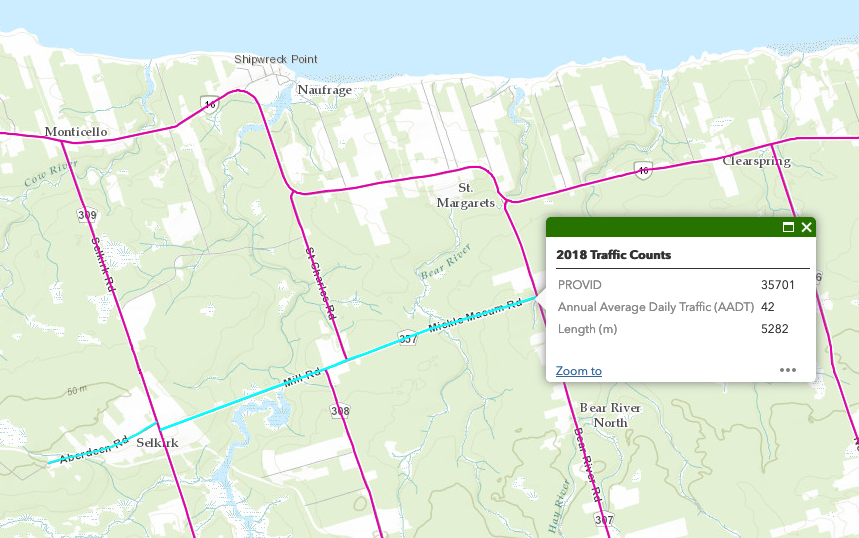
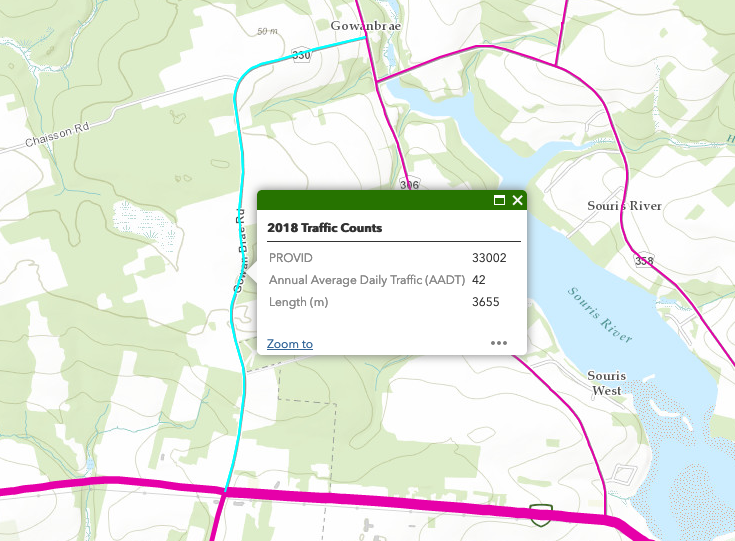
Four roads were tied for least busy, each with an average of 42 vehicles per day.
The first two comprise this stretch of road that includes the Aberdeen Rd., the Mill Rd., and the Mickle Macum Road, near Naufrage:
The third is the Gowan Brae Rd. near Souris:
A road that sees 42 vehicles a day is seeing under 2 cars an hour, on average. That’s a pretty sleepy road.
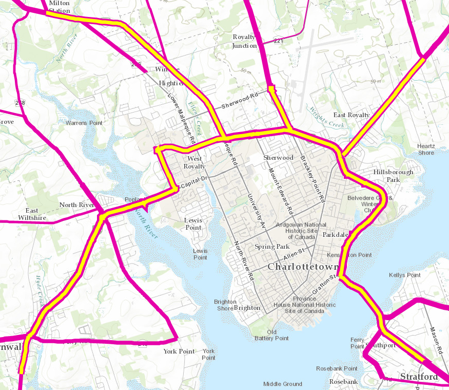
As you might expect, the collection of busiest provincial roads on the Island are those that run into and around Charlottetown: each of the roads highlighted in yellow on this map had a daily average of more than 12,000 vehicles:
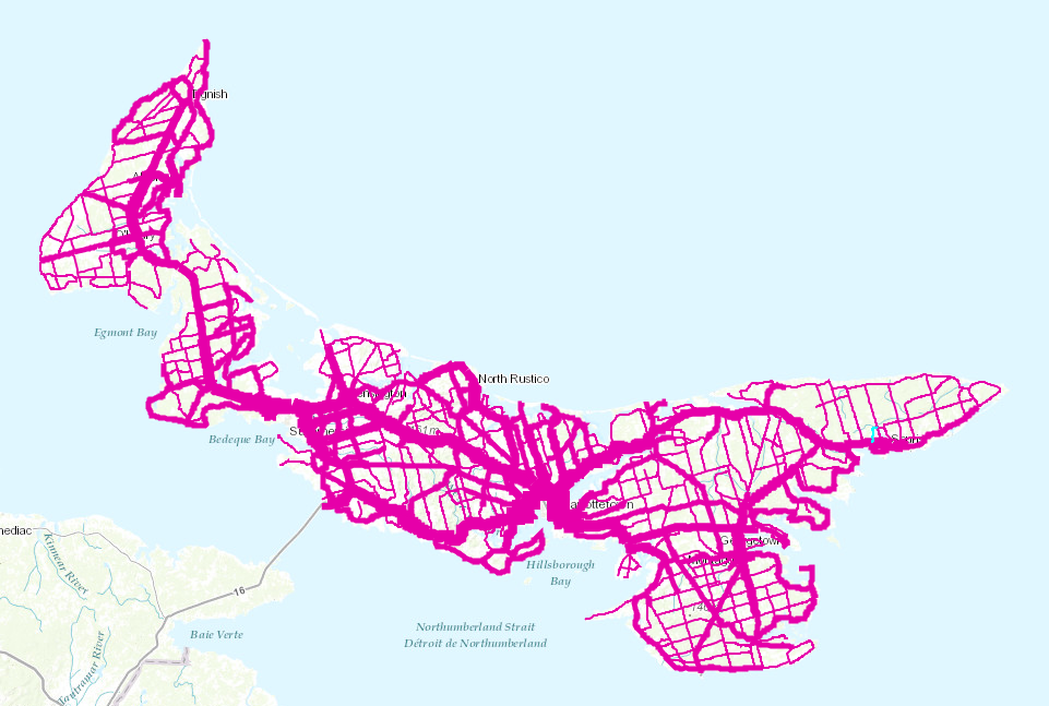
Because the application supports exporting all of the data about the roads and the traffic counts to GeoJSON, it’s possible to cook up your own visualizations too. Here are the roads in QGIS, colour-coded by traffic count (the redder the line, the more traffic):
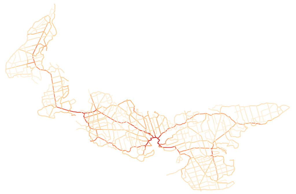
This visualization looks like a circulation system of the body. And, of course, that’s exactly what it is.
Kudos to the Department of Transportation, Infrastructure and Energy for releasing this data, and developing such a useful tool for exploring it.

Comments
How is this counted. Samples done manually? Sensors on the busier roads?