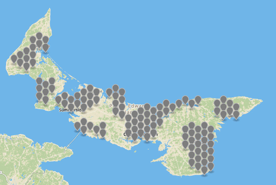
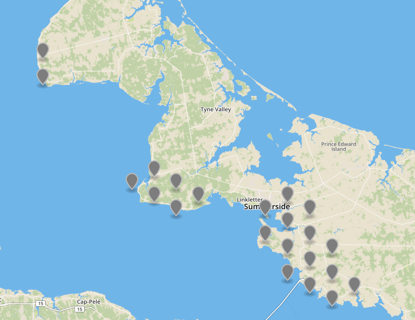
Here’s a map, using data extracted from the federal Connecting Canadians lookup tool, showing the areas of Prince Edward Island that are served either by Bell Aliant fibre or Eastlink cable Internet.

The federal tool divides the Island into 308 hexagon-shaped segments, and then overlays ISP-provided coverage area maps to show what services are offered in what segments; as such it’s a blunt instrument, but not an useless one.
If you’d like to do some additional data analysis using the information I extracted from the tool, you can use these two CSV files:
- hexagons.csv contains 308 rows, one for each hexagon, with its latitude, longitude, community name, population, dwelling count and ID.
- providers.csv contains all the information for each provider offering service in each hexagon; it’s related to the hexagons data file by hexagon ID.
So, for example, here’s a row in hexagons.csv:
PE46470633,"North Rustico",46.473231,-63.312532,501+,251-500
that defines a hexagon-shaped region around North Rustico centred on 46.473231,-63.312532, with an ID of PE46470633.
In the providers.csv file there are seven rows with this ID, showing the 7 Internet access options offered inside that hexagon:
PE46470633,Bell,5,8,"Mobile Wireless"
PE46470633,"Bell Aliant",5,1,DSL
PE46470633,Eastlink,5,2,Cable
PE46470633,Eastlink,5,8,"Mobile Wireless"
PE46470633,"Rogers Communications",5,8,"Mobile Wireless"
PE46470633,"Route 2",5,5,"Fixed Wireless"
PE46470633,"Xplornet Communications Inc",5,7,"Direct-to-Home Satellite"
If you import these data files into an SQL database, you can then do queries like:
select distinct hexagons.hexid,hexLat,hexLon
from hexagons,providers
where (hexagons.hexid = providers.hexid)
and providers.ispType in ('Fixed Wireless')
and name='Xplornet Communications Inc';
which extracts those areas where Xplornet Communications offers its fixed wireless service. You can then use that data with a web mapping tool like GeoJSON.io, to map those areas:

As I found out first-hand when preparing for the Rural Internet Access Town Hall in September, finding your way through the complex thicket of Internet access options (or lack of options) is confusing. While this tool, and the data underlying it, don’t explain the difference among providers (unlimited vs. usage-based billing, for example, can make providers that appear apples-to-apple decidedly not so), at least it provides a geographically based “Yellow Pages”-style starting point.
 I am
I am
Comments
This is very useful for our
This is very useful for our upcoming relocation. With the difficulty in finding a place to live on PEI we have had to broaden our search outside of the familiar greater Charlottetown area. Staying connected is essential for us, and this will help give us insight as to what other areas might be suitable for our family.
I'm starting a remote job
I'm starting a remote job that requires 10mbps of both down and upload speeds starting Sep 26thj
Add new comment