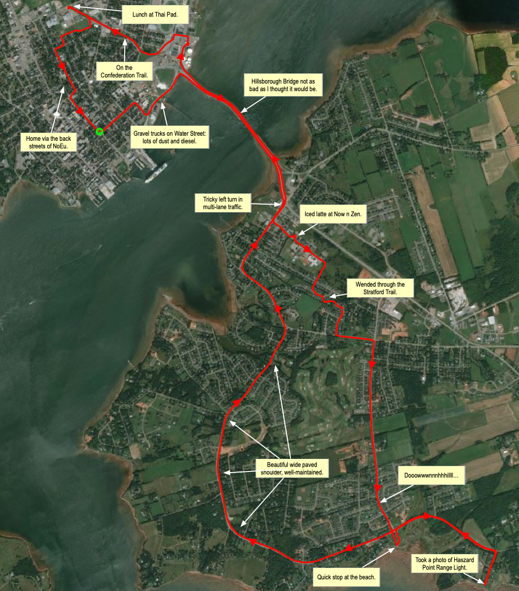
I squeezed every last drop out of my electric bicycle rental this morning before returning it, heading over the bridge to Stratford, down to the shore, back to town, out for lunch, and then home. 21 km from door to door. A beautiful, sunny day for a bicycle ride.

 I am
I am
Comments
fantastic annotated map! and
fantastic annotated map! and great story your e-assist bicycling adventues
Which tools did you use to
Which tools did you use to produce this map?
I recorded a GPX trace of my
I recorded a GPX trace of my route using the OsmAnd app on my Android phone (it’s proving an excellent alternative to Google Maps, and it has GPX-recording built in).
When I returned to my office, I transferred the GPX file to my computer and loaded it into the open source QGIS on top of the Bing satellite view.
I took a screen shot of the result and saved as a PNG and then loaded this into OmniGraffle, where I added the annotations.
Add new comment