
I have been immersed in election geography this week, and by way of procrastinating I made this visualization that connects every address on Prince Edward Island to its polling station on election day.
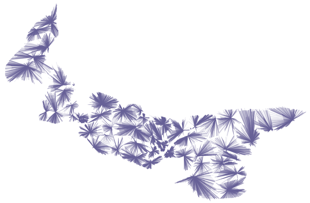
Here’s a similar visualization, but for the advance polls:

I shared the map with a friend, and they asked me if I could tell them, as the crow flies, which addresses were the greatest distance from their polling station on election day, so I made this map to illustrate this. There’s one dot on the map for each civic address on PEI; the darker the colour of orange of the dot, the greater the distance to the polling station for electors at that address.
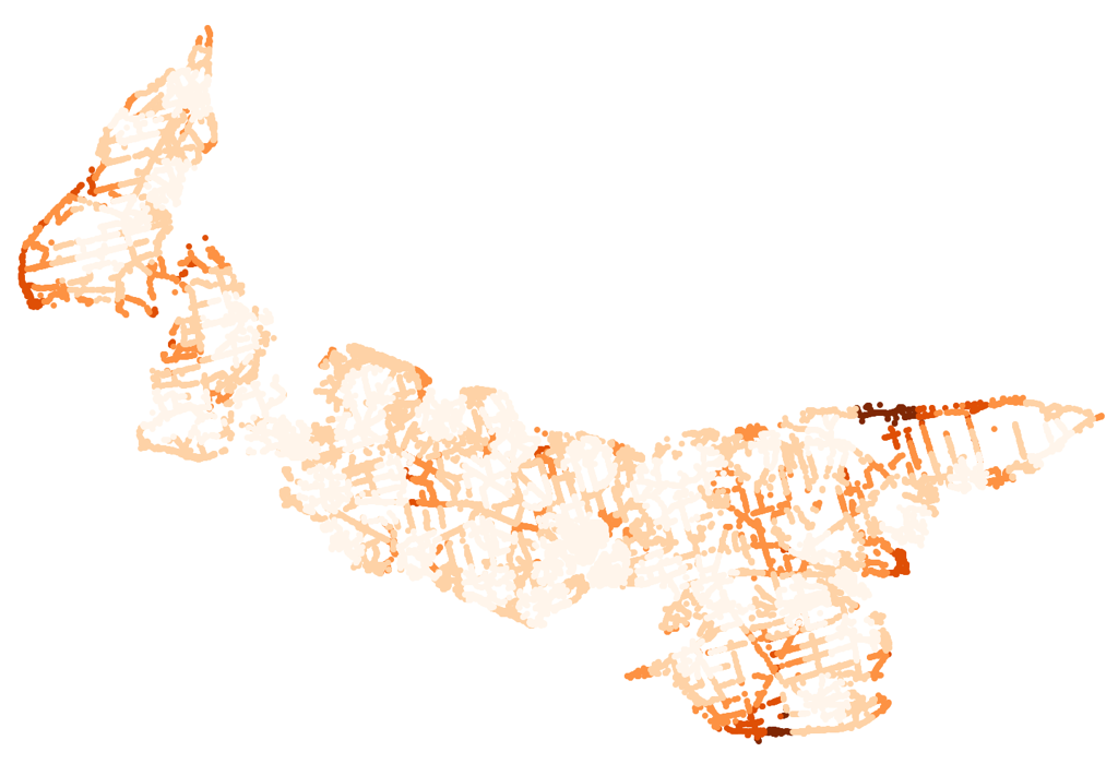
The greatest address-to-poll distances are from Goose River and Little Sands.
About This Blog
 I am Peter Rukavina and this is my blog. I am a writer, letterpress printer, and a curious person.
To learn more about me, read my /now, look at my bio, listen to audio I’ve posted, read presentations and speeches I’ve written, see things I’ve favourited elsewhere, or get in touch (peter@rukavina.net is the quickest way).
I have been writing here since May 1999: you can explore the 25+ years of blog posts in the archive.
![]() You can subscribe to an RSS feed of posts, an RSS feed of comments, an RSS feed of favourites elsewhere, or a podcast RSS feed that just contains audio posts. You can also receive a daily digests of posts by email. I also publish an OPML blogroll.
You can subscribe to an RSS feed of posts, an RSS feed of comments, an RSS feed of favourites elsewhere, or a podcast RSS feed that just contains audio posts. You can also receive a daily digests of posts by email. I also publish an OPML blogroll.
Instagram • YouTube • Vimeo • ORCID • OpenStreetMap • Internet Archive • PEI.art • Drupal • Github.
Comments
These are both fascinating
These are both fascinating and beautiful.
Add new comment