
The Province of PEI has a treasure trove of public GIS data available and using my GIS-data-grabber script you can slurp it all down easily to your local machine. Run that script and you’ll end up with a collection of ESRI shapefiles ready for exploring.
But what then?
What if you want to start using modern web-based GIS tools like OpenStreetMap and geojson.io?
Here’s what you need to do to take old-school PEI GIS data and make it web-tool-friendly (in technical terms, here’s what you do to transform the coordinate reference system of the GIS data from NAD83/PEI Stereographic to WGS84).
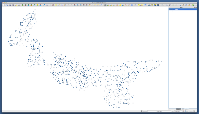
First, get the free Quantum GIS application and install it. Next, open a PEI shapefile in QGIS (Layer | Add Vector Layer). Here’s what the “bridges” shapefile looks like when I do that:
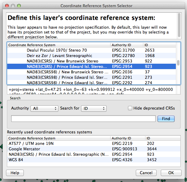
Next, right-click on the name of the layer – “bridges” in my case – in the list of layers in the sidebar and click Set layer CRS and select the coordinate reference system called NAD83(CSRS) / Prince Edward Isl. Stereographic (NAD83) and click OK:
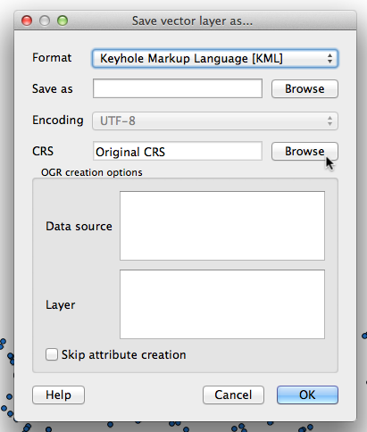
Then right-click again on the layer and select Save as… and click on the Browse button beside CRS:
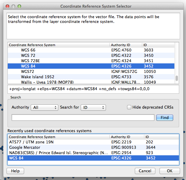
And for this export set the CRS for the layer you’re going to save to WGS 84 / EPSG:4326 and click OK:
Then just select the format you want to export as: KML for Google Maps or Google Earth, GeoJSON for geojson.io, for example. You’ll now have a transformed version of the GIS data in the WGS 84 coordinate reference system ready for use.
And here’s a KML file of the same data that you can load into Google Earth.
About This Blog
 I am Peter Rukavina and this is my blog. I am a writer, letterpress printer, and a curious person.
To learn more about me, read my /now, look at my bio, listen to audio I’ve posted, read presentations and speeches I’ve written, see things I’ve favourited elsewhere, or get in touch (peter@rukavina.net is the quickest way).
I have been writing here since May 1999: you can explore the 25+ years of blog posts in the archive.
![]() You can subscribe to an RSS feed of posts, an RSS feed of comments, an RSS feed of favourites elsewhere, or a podcast RSS feed that just contains audio posts. You can also receive a daily digests of posts by email. I also publish an OPML blogroll.
You can subscribe to an RSS feed of posts, an RSS feed of comments, an RSS feed of favourites elsewhere, or a podcast RSS feed that just contains audio posts. You can also receive a daily digests of posts by email. I also publish an OPML blogroll.
Instagram • YouTube • Vimeo • ORCID • OpenStreetMap • Internet Archive • PEI.art • Drupal • Github.
Comments
Hi PeterDoes this data set
Hi Peter
Does this data set include the most recent topology from Lindar (I think was the technology they used). I was wondering how accurate it would show the watersheds. These information should be used to prevent fish kills.
Thanks
Alan
Add new comment