
From Island Imagined, a Robertson Library map-scanning project, here’s a page from the 1903 Fire Insurance Map of Charlottetown. Our house, at 100 Prince Street, is in the bottom-left corner in the 53rd block.
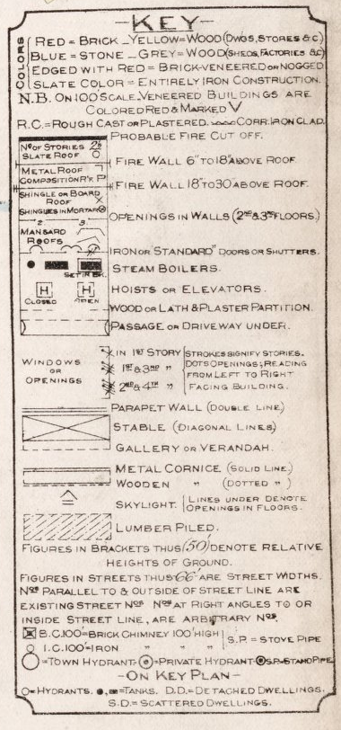
There’s city-wide map that acts as an index to the individual map pages; my favourite part of that map is the legend:
Comments
Hey, look, the fire hydrant’s still in the same place!
 I am
I am  You can subscribe to an