
I took the cleaned up list of companies receiving PNP investment (derived from the list released by the Province of PEI last week), combined it (matching on company name) with the 2008 ClosedCorporations.org corporations data, and then geocoded the corporate contact address against the PEI civic address database.
The result was a CSV file with records for 379 companies (30% of the total 1354 companies on the original list) that could be identified by latitude and longitude.
I then took this CSV file and ran it through GPSBabel to create a KML file of the 379 companies that can be loaded into Google Earth or displayed on a Google Map.
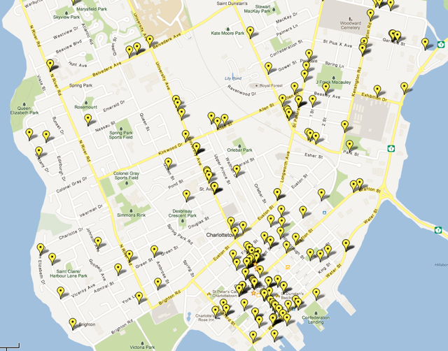
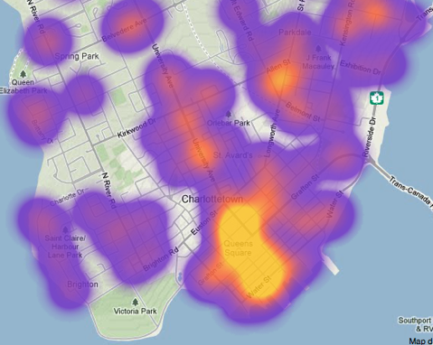
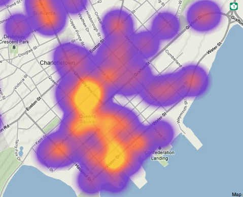
It’s only when you see the data — and remember this is only 30% of the companies, that the location data is 4 years old, and the the geocoding process is imperfect — displayed on a map that you get a true sense of how pervasive the uptake of the PNP program was; here’s a snapshot of downtown Charlottetown, for example:
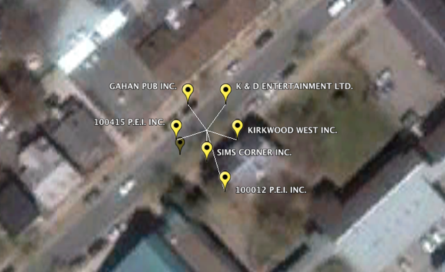
Google Earth has a much better interface for allowing multiple pins at the same location to be displayed; here’s a snapshot of a building on Water Street in Charlottetown, for example, showing 6 companies geocoded to the same location:
Companies, organizations and political parties are increasingly combining data about us gleaned from disparate sources to better target us as consumers; we have a right and a responsibility to educate ourselves about the tools of this trade, and one of the ways we can do this is to equip ourselves with information about companies by combining open data sources to see patterns and derive insights that wouldn’t otherwise be visible.
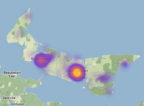
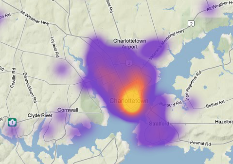
Update: here are some “heat maps” of the same data, created by uploading a slightly-modified CSV file (replacing the “name” column with the number 1, to weight each company with the same value) to myHeatMap.com. Because many rural addresses cannot be geocoded (“RR#3, Cornwall” for example), urban companies are over-represented on these heat maps (and the maps above too):
About This Blog
 I am Peter Rukavina and this is my blog. I am a writer, letterpress printer, and a curious person.
To learn more about me, read my /now, look at my bio, listen to audio I’ve posted, read presentations and speeches I’ve written, or get in touch (peter@rukavina.net is the quickest way).
I have been writing here since May 1999: you can explore the 25+ years of blog posts in the archive.
You can subscribe to an RSS feed of posts, an RSS feed of comments, or a podcast RSS feed that just contains audio posts. You can also receive a daily digests of posts by email.
Add new comment