
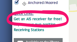
When I was crafting up the Is there a cruise ship in Charlottetown? site I inevitably came across MarineTraffic.com, a website that aggregates together ship’s position information from receiving stations around the world and displays them on a map. There wasn’t any data for the Port of Charlottetown because there was nobody in Charlottetown sending the data; but over in the left corner of the site I spotted a call to action:
I followed the link, and then followed the instructions to request a VHF receiver and antenna. And, to my surprise and delight, while I was away in Europe last month they both arrived in the mail. This morning I got things set up — really just a matter of attaching the antenna and power supply to the Ship Location Received (a SLR200N) and connecting the received to our office Internet router. And then, blamo, data started to flow to MarineTraffic.com showing all the yachts moored down at the Charlottetown Yacht Club.
Here’s what the gear looks like:
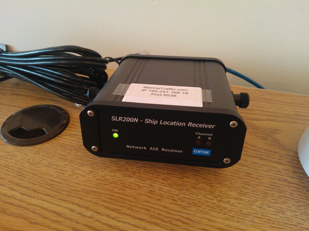

I’m Station No. 1218 at MarineTraffic.com and we’re on the air now streaming ship’s position information 24/7 for the curious.
About This Blog
 I am Peter Rukavina and this is my blog. I am a writer, letterpress printer, and a curious person.
To learn more about me, read my /now, look at my bio, listen to audio I’ve posted, read presentations and speeches I’ve written, or get in touch (peter@rukavina.net is the quickest way).
I have been writing here since May 1999: you can explore the 25+ years of blog posts in the archive.
You can subscribe to an RSS feed of posts, an RSS feed of comments, or a podcast RSS feed that just contains audio posts. You can also receive a daily digests of posts by email.
Comments
I think you’ve delighted my
I think you’ve delighted my inner nerd with this.
So now you’re an open data
So now you’re an open data source! :) Cool!
Very cool! Thank you for
Very cool! Thank you for sharing :)
Add new comment