
If you visit WhatsMyLot.com and you happen to be on Prince Edward Island with a device – a desktop, a laptop, a mobile phone, a tablet – that knows its own location, the little app you find there will tell you which of the township lots originally set out by Samuel Holland in 1765 you happen to be standing in.
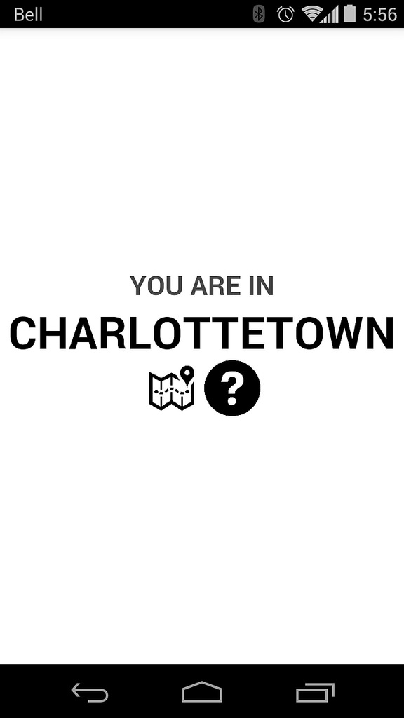
Here’s what it looks like when I call it up on my phone here in my office in Charlottetown:
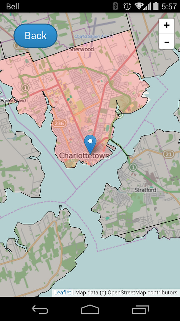
If I tap on the map icon, I see my township – Charlottetown Royalty, in this case – highlighted, and a marker showing my current location:
If you leave the app running on your device and go for a ride in the countryside, as you cross lot boundaries you’ll see the lot number update as you drive (once you’ve loaded the app, you don’t need to have Internet connectivity for it to work: all of the logic of finding your location and identifying your lot happens on the device, using JavaScript).
The app also remembers which lots you’ve visited, colouring the lots red as you visit them. Collect all 67 (plus 3 royalties), and you win the Island!
This is just an alpha release of the app, to receive feedback in advance of packaging it up for the various app stores in preparation for the 250th anniversary of Holland’s survey next year. So, please provide feedback.
About This Blog
 I am Peter Rukavina and this is my blog. I am a writer, letterpress printer, and a curious person.
To learn more about me, read my /now, look at my bio, listen to audio I’ve posted, read presentations and speeches I’ve written, see things I’ve favourited elsewhere, or get in touch (peter@rukavina.net is the quickest way).
I have been writing here since May 1999: you can explore the 25+ years of blog posts in the archive.
![]() You can subscribe to an RSS feed of posts, an RSS feed of comments, an RSS feed of favourites elsewhere, or a podcast RSS feed that just contains audio posts. You can also receive a daily digests of posts by email. I also publish an OPML blogroll.
You can subscribe to an RSS feed of posts, an RSS feed of comments, an RSS feed of favourites elsewhere, or a podcast RSS feed that just contains audio posts. You can also receive a daily digests of posts by email. I also publish an OPML blogroll.
Instagram • YouTube • Vimeo • ORCID • OpenStreetMap • Internet Archive • PEI.art • Drupal • Github.
Comments
Not that you’d need to refer
Not that you'd need to refer to them, but what do you have in the way of survey markers in Charlotte Town and PEI? I'm wondering with respect to what Holland put down his lines, or what new point or points of reference he created. Don't want to send you on a forensic expedition--just a little curious, in case you happen to know.
Add new comment