My habit regarding OpenStreetMap edits is to dive into improving the map for places that are new to me. After ignoring Colonel Gray Senior High School since we moved to Charlottetown 23 years ago, it’s now Oliver’s school, and so a big part of my life. So time for some edits.
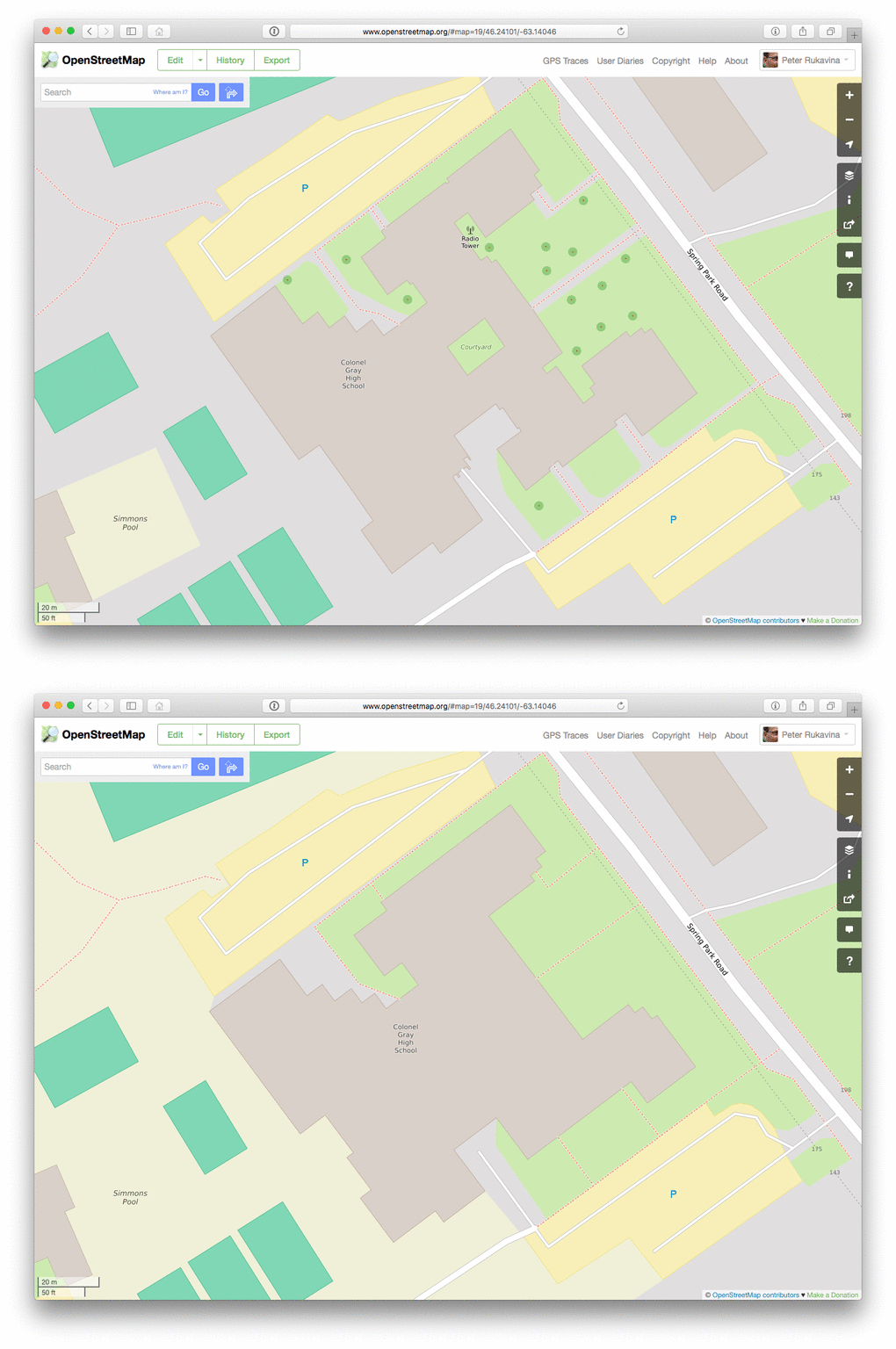
Fortunately for the casual school-mapper, there are useful PDF building plans of every school – the result of the mould-moisture reports prepared in 2011 – and so I was able to use the floor plans in the PDF to make the rendering of the school in OpenStreetMap much more geographically accurate. I didn’t give it the full OSM indoor treatment, but the footprint of the building is now much better.
Here’s an animated visualization of the “before” and the “after”. Notice I even added the trees!

 I am
I am
Add new comment