
I’ve been spending time this fall volunteering with Bryson Guptill and his team at Island Trails to improve the representation of hiking trails on Prince Edward Island in OpenStreetMap (here’s a list of relations I’ve been working on, and you can see the results of my labours in maps like this one of the Bonshaw Trails).
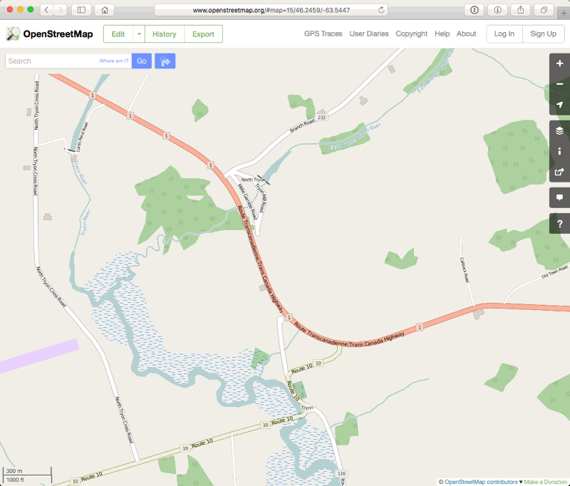
As part of this work I sought an updated map of the Confederation Trail that’s more up to date than the 2010 version on the province’s website. My man in the Department of Transportation noted, when he was preparing this for me, that OpenStreetMap didn’t include the realignment of the Tryon section of the Trans Canada Highway that was constructed over the last couple of years, and he helpfully sent along a GIS file of the change. Reasoning that this will eventually make its way to the National Road Network, which is licensed for incorporation into OpenStreetMap, I incorporated the changes into the highway.
Here’s a GIF animation showing the changes, which I’ve found helpful in visualizing what’s happened there:
About This Blog
 I am Peter Rukavina and this is my blog. I am a writer, letterpress printer, and a curious person.
To learn more about me, read my /now, look at my bio, listen to audio I’ve posted, read presentations and speeches I’ve written, see things I’ve favourited elsewhere, or get in touch (peter@rukavina.net is the quickest way).
I have been writing here since May 1999: you can explore the 25+ years of blog posts in the archive.
![]() You can subscribe to an RSS feed of posts, an RSS feed of comments, an RSS feed of favourites elsewhere, or a podcast RSS feed that just contains audio posts. You can also receive a daily digests of posts by email. I also publish an OPML blogroll.
You can subscribe to an RSS feed of posts, an RSS feed of comments, an RSS feed of favourites elsewhere, or a podcast RSS feed that just contains audio posts. You can also receive a daily digests of posts by email. I also publish an OPML blogroll.
Instagram • YouTube • Vimeo • ORCID • OpenStreetMap • Internet Archive • PEI.art • Drupal • Github.
Add new comment