
If you’re a geonerd like me, finding a whole new level of geography somewhere is like discovering gold. When I used the parishes of Prince Edward Island as an example of the map layers available from the Province of Prince Edward Island I had no idea what I had accidentally discovered: I’d assumed these were some sort of religious slice-and-dice of the province.
Talking to G. last night, though, I came to learn that the “parish” level of geography here on the Island goes back to Samuel Holland, the surveyor who originally laid out the “lots” system for Prince Edward Island. At the same time as he surveyed the lots he also created parishes, collections of lots, and gave each a name. Here’s a map from the National Archives that illustrates this:
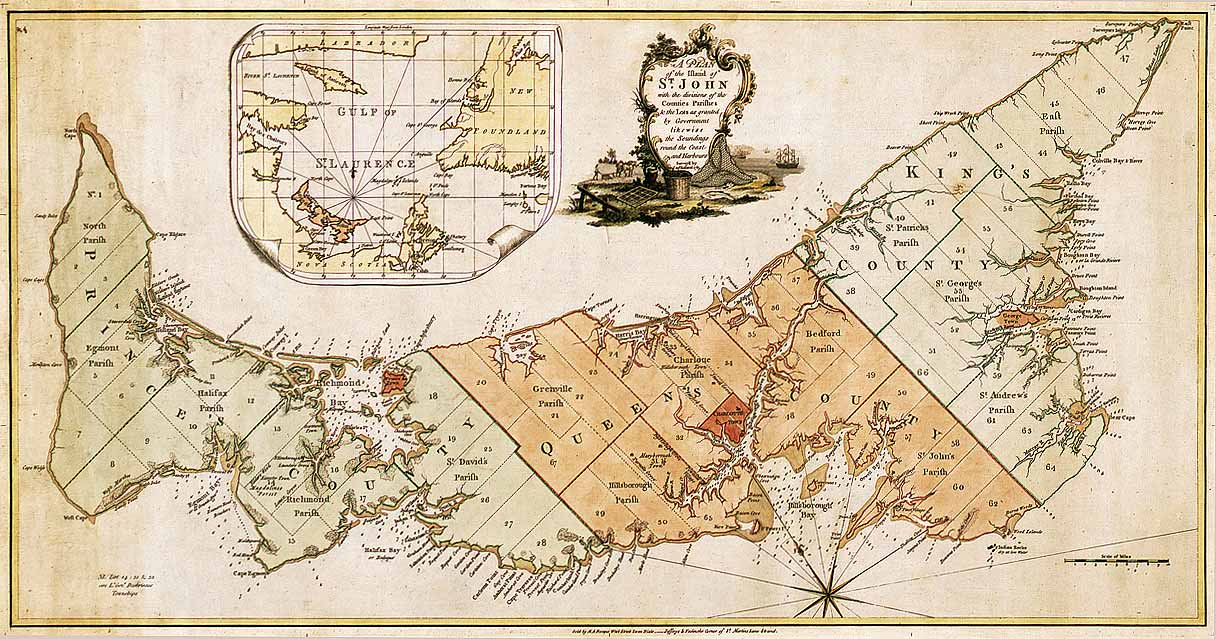
And here’s a list of all the parishes, with locator maps for each. Each parish has a story behind its name – North and East are self-evident, and Wikipedia has the story behind some of the names but it would be nice to see this agglomeration get the documentation it’s due.
G. says that parish boundaries never really came into fashion in bureaucratic use; does anyone have example of situations where they were used (or still are in use)?
About This Blog
 I am Peter Rukavina and this is my blog. I am a writer, letterpress printer, and a curious person.
To learn more about me, read my /now, look at my bio, listen to audio I’ve posted, read presentations and speeches I’ve written, see things I’ve favourited elsewhere, or get in touch (peter@rukavina.net is the quickest way).
I have been writing here since May 1999: you can explore the 25+ years of blog posts in the archive.
![]() You can subscribe to an RSS feed of posts, an RSS feed of comments, an RSS feed of favourites elsewhere, or a podcast RSS feed that just contains audio posts. You can also receive a daily digests of posts by email. I also publish an OPML blogroll.
You can subscribe to an RSS feed of posts, an RSS feed of comments, an RSS feed of favourites elsewhere, or a podcast RSS feed that just contains audio posts. You can also receive a daily digests of posts by email. I also publish an OPML blogroll.
Instagram • YouTube • Vimeo • ORCID • OpenStreetMap • Internet Archive • PEI.art • Drupal • Github.
Add new comment