
The Mount Herbert Loop

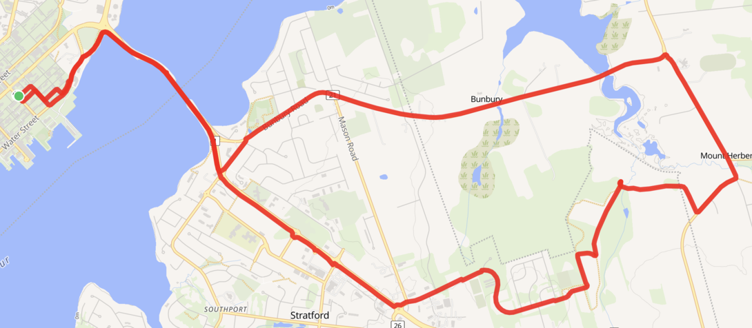
A map showing a cycle route from Charlottetown to Stratford, Mount Herbert, and back to Charlottetown through Bunbury.

We started Sunday with an almost-20 km cycle over to Stratford, through Fullerton’s Marsh, Mount Herbert, and back home via Bunbury.

It was exposure, yet again, of the Town of Stratford’s committment to active transportation: from getting on the cycle path on Water Street near HMCS Queen Charlotte, we were on a separated pathway all the way to the Mount Herbert Road intersection with the Fullerton’s Marsh Trail, 10 km later.

Once we got to Mount Herbert things got (mildly) hilly; a gentle rain made this slightly easier to manage.

An excellent way to spend the morning of my 25th Father’s Day. Kudos to Lisa for being the catalyst.

Peter Rukavina

Add new comment

Plain text

  • Allowed HTML tags: <b> <i> <em> <strong> <blockquote> <code> <ul> <ol> <li>
  • Lines and paragraphs break automatically.

About This Blog

Photo of Peter RukavinaI am . I am a writer, letterpress printer, and a curious person.

To learn more about me, read my /now, look at my bio, listen to audio I’ve posted, read presentations and speeches I’ve written, see things I’ve favourited elsewhere, or get in touch (peter@rukavina.net is the quickest way).

I have been writing here since May 1999: you can explore the 25+ years of blog posts in the archive.

You can subscribe to an RSS feed of posts, an RSS feed of comments, an RSS feed of favourites elsewhere, or a podcast RSS feed that just contains audio posts. You can also receive a daily digests of posts by email. I also publish an OPML blogroll.

InstagramYouTubeVimeoORCIDOpenStreetMapInternet ArchivePEI.artDrupalGithub.