
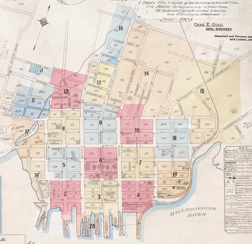
The Charlottetown Fire Insurance Maps are one of the most delightful elements of the Island Imagined collection of digitized images, but the interface for navigating them there doesn’t lend itself to exploration. To help make this easier, I took the index map and converted it to a static JPEG (using the technique I outlined here), and then used this free imagemap-making tool to create a set of clickable links to each map (technical note: I use Image Map Resize to ensure the image map works no matter the size of the image).
Here’s the result; just click on any of the colour-coded areas of the city to jump to the appropriate page in the Island Imagined collection, where you’ll find a slippy map that you can explore in detail.
About This Blog
 I am Peter Rukavina and this is my blog. I am a writer, letterpress printer, and a curious person.
To learn more about me, read my /now, look at my bio, listen to audio I’ve posted, read presentations and speeches I’ve written, see things I’ve favourited elsewhere, or get in touch (peter@rukavina.net is the quickest way).
I have been writing here since May 1999: you can explore the 25+ years of blog posts in the archive.
![]() You can subscribe to an RSS feed of posts, an RSS feed of comments, an RSS feed of favourites elsewhere, or a podcast RSS feed that just contains audio posts. You can also receive a daily digests of posts by email. I also publish an OPML blogroll.
You can subscribe to an RSS feed of posts, an RSS feed of comments, an RSS feed of favourites elsewhere, or a podcast RSS feed that just contains audio posts. You can also receive a daily digests of posts by email. I also publish an OPML blogroll.
Instagram • YouTube • Vimeo • ORCID • OpenStreetMap • Internet Archive • PEI.art • Drupal • Github.
Add new comment