
I went for a long bicycle ride this morning: it was sunny and warm and I needed to clear my head.
Last night, while chatting with an old friend about walking and cycling, I complained that, because Charlottetown is, in essence, a peninsula, there’s not really any where to go if you are averse to walking out and doubling back. I decided to prove myself wrong, and to start collecting ways of cycling around Charlottetown in a great circle, a practice made easier by our ever-improving cycling infrastructure.
So I cycled out to the corner of Riverside Drive and Grafton, to take advantage of the new stretch of multi-use path that runs from there north to Park Street, then continued along the path to the Queen Elizabeth Hospital, turned right and cycled the path along Murchison to Hillsborough Hospital, exited through the back parking lot back to the path, and then, through a little jog and jig, joined the still-under-construction path that runs from Pioneer to St. Peters Road (the first section was still under construction, but had nice hard-packed gravel; the second section was lovely smooth pavement).
Cycle-friendly infrastructure comes to a grinding halt at St. Peters Road, and so to continue the great circle I took the St. Peters roundabout to Oak Drive, and continued along Oak to Mt. Edward Road, and then in the back entrance of the mall to join the Confederation Trail.
I continued down the Confederation Trail to Allen Street, where I stopped for lunch–phoned in from Oak Drive 15 minutes earlier—at Thai Pad, and then continued along the trail to Joe Ghiz park and home.
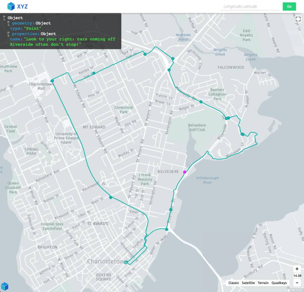
The journey was 14 km from end to end, no doubling back, and a lot of interesting new terrain covered.
I tracked the ride with the my phone, which sends digital breadcrumbs to PhoneTrack. When I got back to the office, I exported from PhoneTrack as a GPX file, then loaded the GPX into GeoJSON.io where I added some annotations, like “This is signed do not enter, but there’s no other way to get to the trail,” and exported as a GeoJSON file, which is a simple, human-readable, Rosetta Stone-like format for passing around map data.
As a result, you can grab a copy for yourself, and load it into your mapping application of choice (HERE XYZ is a good one, as is GeoJSON.io).
I like the idea of GeoJSON Collectibles: digital artifacts that can be shared around like we used to share cassette tapes, with no websites or apps or dependencies on proprietary formats or services required. You can take my GeoJSON, and turn it into your GeoJSON, adding your own route variations and annotations.
About This Blog
 I am Peter Rukavina and this is my blog. I am a writer, letterpress printer, and a curious person.
To learn more about me, read my /now, look at my bio, listen to audio I’ve posted, read presentations and speeches I’ve written, see things I’ve favourited elsewhere, or get in touch (peter@rukavina.net is the quickest way).
I have been writing here since May 1999: you can explore the 25+ years of blog posts in the archive.
![]() You can subscribe to an RSS feed of posts, an RSS feed of comments, an RSS feed of favourites elsewhere, or a podcast RSS feed that just contains audio posts. You can also receive a daily digests of posts by email. I also publish an OPML blogroll.
You can subscribe to an RSS feed of posts, an RSS feed of comments, an RSS feed of favourites elsewhere, or a podcast RSS feed that just contains audio posts. You can also receive a daily digests of posts by email. I also publish an OPML blogroll.
Instagram • YouTube • Vimeo • ORCID • OpenStreetMap • Internet Archive • PEI.art • Drupal • Github.
Add new comment