
L. and I stopped by her Uncle Brian’s house this morning to drop a bouquet of peonies. I’ve known Brian for almost 30 years—we collaborated on a project soon after I moved to the Island—and if you’d told me back then that three decades hence I’d be dating his niece, I’d never have believed you. And yet here we are.
That’s the thing about dating, not unique to PEI, but here in its finest, purest form: as two networks of friends and family join, interesting coincidences are more than likely to abound. Some delightful, some awkward, some remarkable.
Before I met L. I’d already met her brother, and heard her sister perform. Her mother shared office space with a non-profit I chaired. Everyone in Queens County knows her father.
As the social-connection edges join the previously disconnected vertices that surround us, our network becomes stronger, more interesting, more bound together.
L. and I have been cycling a lot this week, taking my new Brompton bicycle for shakedown rides. We were on our bikes when we dropped the peonies to Brian. And, Saturday morning, we were on the outskirts of the city for an inaugural ride on the almost-open extension of the Riverside Drive active transportation path that runs from the St. Peters Road megasection, parallel to the bypass, to Brackley Point Road.
I dropped digital breadcrumbs as we cycled, and dutifully added the path extension to OpenStreetMap.
And as a relationship strengthens a community, a new cycle path joins previously disconnected parts of the city, and strengthens the community in its own way.
Edges joining vertices. It’s powerful.
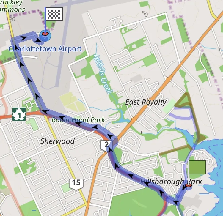
When I use OsmAnd to get a cycle route from École François-Buote to Charlottetown Airport, for example, because the new cycle route is part of OpenStreetMap’s network now, that’s how I get routed: 18 minutes, 6.56 km.
Indeed it’s now possible to ride from Sobeys in Stratford all the way to the airport—and beyond—on a safe, separated, smooth active transportation path.
And when the path is extended next year all the way to Mount Edward Road, and thus the Confederation Trail, the city will grow even more connected.
It’s all rather fantastic. The paths. The uncles.
About This Blog
 I am Peter Rukavina and this is my blog. I am a writer, letterpress printer, and a curious person.
To learn more about me, read my /now, look at my bio, listen to audio I’ve posted, read presentations and speeches I’ve written, see things I’ve favourited elsewhere, or get in touch (peter@rukavina.net is the quickest way).
I have been writing here since May 1999: you can explore the 25+ years of blog posts in the archive.
![]() You can subscribe to an RSS feed of posts, an RSS feed of comments, an RSS feed of favourites elsewhere, or a podcast RSS feed that just contains audio posts. You can also receive a daily digests of posts by email. I also publish an OPML blogroll.
You can subscribe to an RSS feed of posts, an RSS feed of comments, an RSS feed of favourites elsewhere, or a podcast RSS feed that just contains audio posts. You can also receive a daily digests of posts by email. I also publish an OPML blogroll.
Instagram • YouTube • Vimeo • ORCID • OpenStreetMap • Internet Archive • PEI.art • Drupal • Github.
Comments
Beautiful post, Peter. Roots
Beautiful post, Peter. Roots (and routes) and branches.
Well said, Peter. I'm glad
Well said, Peter. I'm glad we still share that love of maps and OSM in particular.
Add new comment