
I’m posting this so that I can refer to it later, as I’m always finding myself looking for these numbers.
Latitude and Longitude of PEI Places
- Coles Building, Charlottetown (see here): 46.23536, -63.12549
- Charlottetown (City Hall): 46.23527, -63.12958
- Charlottetown (Harbour): 46.2179, -63.1342
- Summerside (City Hall): 46.39287, -63.78989
- My House: 46.23587, -63.12412
- My Office: 46.23361, -63.12738
- Center of Prince Edward Island Bounding Box: 46.50105, -63.2014
Bounding Box surrounding Charlottetown
- lonmin,latmin: -63.1977,46.2268
- lonmax,latmax: -63.0811,46.3065
- bbox=-63.1977,46.2268,-63.0811,46.3065
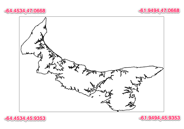
Bounding Box surrounding Prince Edward Island
- lonmin,latmin: -64.4534,45.9353
- lonmax,latmax -61.9494,47.0668
- bbox=-64.4534,45.9353,-61.9494,47.0668
- bounding box for Overpass Turbo: 45.9353,-64.4534,47.0668,-61.9494

Comments