
It figures: after stumbling through the unofficial hack method of using Google Maps earlier in the week, today Google released a Google Maps API. It’s so much easier to implement Google Maps when you have real documentation!
So here’s take two at making Google Maps of my Plazes.
As before, I used XSLT to transform the Plazes “traces” file into a format suitable for Google Maps. There’s a new, much simpler format that’s documented here. On first blush it looks like more of the heavy lifting is left to we the API users: no more automatic pop-ups from data baked into XML. Here’s the result of my first go:
- XML locations file (from Plazes)
- XSLT file (transforms the XML file)
- XML file for Google Maps (in the new ‘markers’ format)
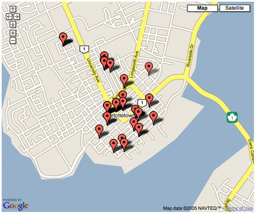
The result of the demo, which you can see live here, looks like this:
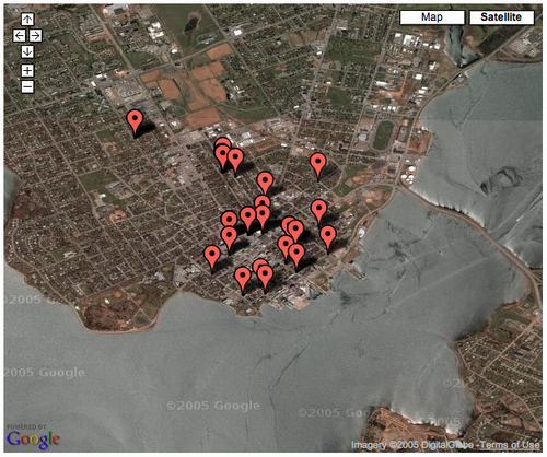
A click of the “Satellite” link and I get this:
The work to be done now — and there’s the API to support this, thank goodness — is to make the Plazes clickable.

Comments